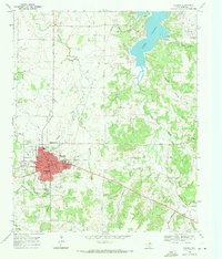
1968 Map of Nocona
USGS Topo · Published 1971About this map
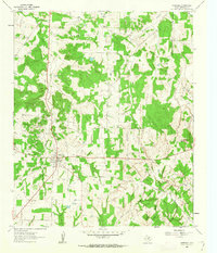
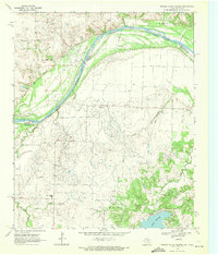
The northern Montague County landscape surrounding Nocona is defined by a transition from the structured town grid to a rugged network of creeks feeding into Lake Nocona. In the late 1960s, the town center is anchored by landmarks like the South Ward School, the Rodeo Ground, and the Drive-in Theatre on its eastern edge, reflecting a community balanced between its industrial roots and local recreation. The surrounding terrain is heavily marked by the petroleum and agricultural industries, with numerous Oil Wells and a Clay Pit scattered across the hills. Numerous family and community cemeteries, including Molsbee Cem, Benton Cem, and Simmons Cem, are situated along the ridgelines near Blue Mound and Benton Hill, providing a detailed record for genealogists. The complex water system is evidenced by the presence of an Aqueduct and Pipeline running toward the reservoir, highlighting the region's mid-century infrastructure developments.
Find a feature on this map
47 named features on this map. Tap any name to fly to it.
Don’t see what you’re looking for? This feature index may not catch every label — zoom into the map to look around manually.
Map Details
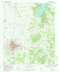
Editions of this 1968 Nocona Map
2 editions found
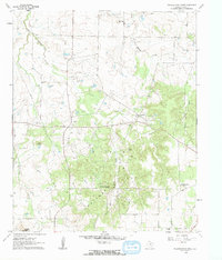
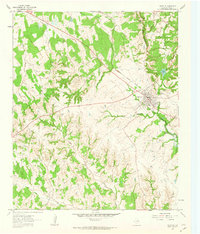
Other maps of this area

1905 · Montague
USGS Topo · 1:125,000

1954 · Sherman
USGS Topo · 1:250,000

1958 · Sherman
USGS Topo · 1:250,000
1960 · Buzzard Roost Knob
USGS Topo · 1:24,000
1961 · Saint Jo
USGS Topo · 1:24,000
1961 · Montague
USGS Topo · 1:24,000
1968 · Bonita
USGS Topo · 1:24,000
1968 · Spanish Fort
USGS Topo · 1:24,000
1968 · Fleetwood
USGS Topo · 1:24,000
1968 · Prairie Valley School
USGS Topo · 1:24,000