2020s Maps of Valley Ranch, Texas
Explore 4 historic maps of Valley Ranch from the 2020s. These maps offer a rare glimpse into what life looked like during the 2020s — showing old roads, neighborhoods, homes, and landmarks that have changed or disappeared over time.
Whether you're researching your family's past, planning a metal detecting trip, or studying how Valley Ranch's landscape evolved across the 2020s, these high-resolution maps are a powerful tool for exploring the history of this region.
- Focus on a specific era: All maps on this page are from the 2020s, giving you a focused view of this time period.
- See what’s changed: Compare century-old streets, trails, and buildings to today's modern landscape using overlays and satellite layers.
- Research with precision: Use these maps for genealogy, historical research, land use analysis, or educational projects.
- View, download, or print: Maps are fully viewable online in high resolution, and can be downloaded or printed for your own records.
Start exploring Valley Ranch's history through authentic maps from the 2020s. This is your window into the past.
Valley Ranch, TX maps
(4)- 2022 Map of Maedan, 2022 Print
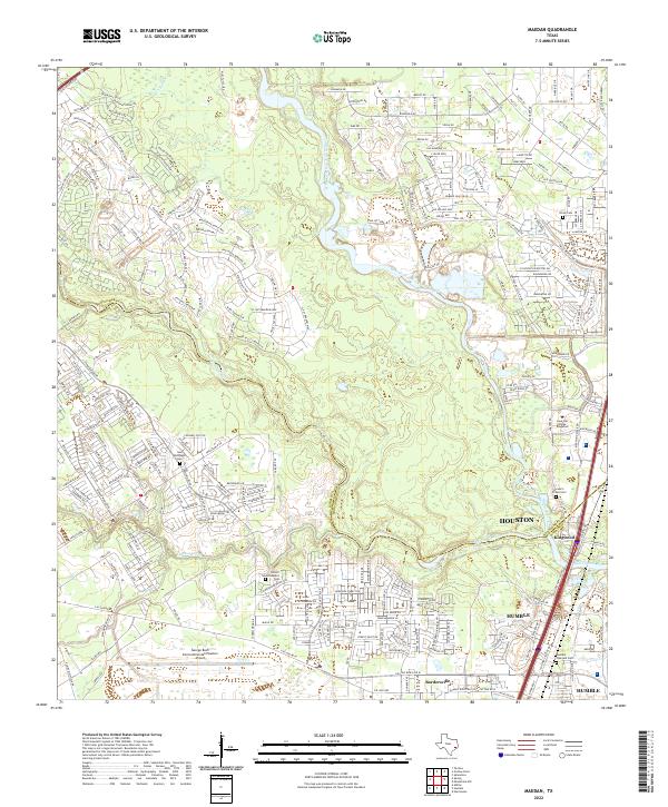 2022 Maedan2022 Print · USGSGreater Houston and Humble appear in the early 2020s, showing the intersection of the San Jacinto River basin with massive suburban growth. Genealogists can locate several local burial sites like Stewart-Prater Cem or the Humble Pipeyard Cem amid modern developments.
 - 2022 Map of Moonshine Hill, 2022 Print
 2022 Moonshine Hill2022 Print · USGSThe northeastern outskirts of Houston are captured here in the early 2020s, showing the dense suburban development surrounding the San Jacinto River. Genealogists and historians can trace family locations near Moonshine Hill, Porter, and the White Oak Cem.
 - 2022 Map of Outlaw Pond, 2022 Print
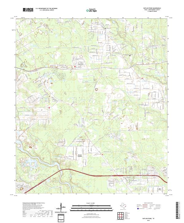 2022 Outlaw Pond2022 Print · USGSMontgomery County's landscape near Porter Heights shows a transition from rural family homesteads to modern development. Genealogists and local historians can trace legacy sites like Freeman Cem, Vick Cem, and water landmarks like Outlaw Pond.
 - 2022 Map of Splendora, 2022 Print
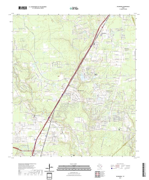 2022 Splendora2022 Print · USGSSoutheast Texas at the turn of the 21st century shows a dense network of creek-side settlements and family burial grounds. Genealogists and local historians can trace legacy sites like Mizell Cem, Turner Family Cem, and the historic rail corridor along Splendora.
End of results
Showing maps 1-4 of 4
Top cities near Valley Ranch
- Houston historical maps
- The Woodlands historical maps
- Conroe historical maps
- Atascocita historical maps
- Kingwood historical maps
- Spring historical maps
See more
Top neighborhoods of Valley Ranch
- Azalea District historical maps
- Forest Colony historical maps
- Valley Ranch historical maps
- Valley Ranch Town Center historical maps
Frequently asked questions
- What are the different types of historical maps available for Valley Ranch?
- What is the oldest map of Valley Ranch?
- Where can I purchase historical maps of Valley Ranch for my home or office?
- Where can I download high-res historical maps of Valley Ranch?
- Are there historical topographic maps available for Valley Ranch?
- Is there historical aerial imagery available for Valley Ranch?
- Where are historical maps of Valley Ranch sourced from?