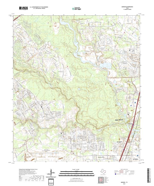
2022 Map of Maedan
USGS Topo · Published 2022About this map
West Fork San Jacinto River and Spring Creek converge in this densely populated corridor along the boundary of Montgomery and Harris counties. The landscape is defined by the rapid suburban expansion of Houston, notably within the master-planned community of Kingwood and the historic area of Humble. This contemporary record shows a complex suburban geography where modern developments like Lone Star College - Kingwood sit adjacent to older cultural sites, including Bordersville and several small burial grounds such as Seal McDougle Cem and Tetters Homesteaders Cem. Transportation infrastructure is dominant, with the Eastex Fwy cutting through the eastern portion of the map and the northern reaches of the George Bush Intercontinental/Houston Airport occupying the southwest corner. The contrast between preserved riparian corridors like Cypress Creek and the intricate grid of residential subdivisions illustrates the modern transformation of the Texas Gulf Coast region.
Find a feature on this map
27 named features on this map. Tap any name to fly to it.
Don’t see what you’re looking for? This feature index may not catch every label — zoom into the map to look around manually.
Map Details
Editions of this 2022 Maedan Map
This is the sole edition of this map. No revisions or reprints were ever made.
Other maps of this area

1916 · Aldine
USGS Topo · 1:24,000

1916 · Harmaston
USGS Topo · 1:24,000

1916 · Moonshine Hill
USGS Topo · 1:24,000

1916 · Humble
USGS Topo · 1:24,000

1916 · Spring
USGS Topo · 1:24,000

1919 · Aldine
USGS Topo · 1:31,680

1919 · Humble
USGS Topo · 1:31,680

1919 · Weeden
USGS Topo · 1:31,680

1920 · Spring
USGS Topo · 1:31,680

1920 · Harmaston
USGS Topo · 1:31,680