
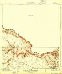
1919 Map of Weeden
USGS Topo · Published 1919About this map
Spring Creek forms the winding boundary between Harris and Montgomery counties in this 1916 survey, a landscape defined by its riparian lowlands and early industrial infrastructure. The settlement of Humble serves as a focal point near the San Jacinto River, where the Houston East and West Texas Railway and the Bender Tramroad converge, suggesting a local economy driven by timber and transit.
Find a feature on this map
16 named features on this map. Tap any name to fly to it.
Don’t see what you’re looking for? This feature index may not catch every label — zoom into the map to look around manually.
Map Details
Editions of this 1919 Weeden Map
2 editions found
Other maps of this area

1916 · Aldine
USGS Topo · 1:24,000

1916 · Harmaston
USGS Topo · 1:24,000

1916 · Moonshine Hill
USGS Topo · 1:24,000

1916 · Humble
USGS Topo · 1:24,000

1916 · Spring
USGS Topo · 1:24,000

1919 · Aldine
USGS Topo · 1:31,680

1919 · Humble
USGS Topo · 1:31,680

1920 · Spring
USGS Topo · 1:31,680

1920 · Harmaston
USGS Topo · 1:31,680

1920 · Moonshine Hill
USGS Topo · 1:31,680