Old Maps of Cactus, Texas for Academic Research
Study the evolution of Cactus with 10 high-resolution historic maps. Whether you're teaching, researching, or modeling changes in land use, these maps provide essential visual documentation of urban, environmental, and geographic change.
- Analyze long-term change: Track patterns in development, transportation, and natural features.
- Ideal for environmental or urban studies: Support academic projects with primary historical map data.
- Use in the classroom or lab: Educators and researchers rely on these maps to bring historical context to life.
These maps are a powerful tool for teaching, research, and visualizing how Cactus has changed over the decades.
Cactus, TX maps
(10)- 1954 Map of Perryton, 1966 Print
 1954 Perryton1966 Print · USGSThe High Plains of the Texas and Oklahoma panhandles are shown during a period of steady growth in the mid-1950s. Genealogists and researchers can trace rail history and local landmarks like Panhandle A & M College, Spurlock Chapel, and the isolated Lord Station.3 unique versions available
 - 1954 Map of Dalhart, 1967 Print
 1954 Dalhart1967 Print · USGSThe High Plains at the junction of four states come alive in the mid-fifties, showing a landscape of rail-hub towns and cattle country. Trace the Old Santa Fe Trail or locate mid-century industrial sites like the Dry ice plant and Carbon Dioxide Works.2 unique versions available
 - 1958 Map of Perryton
 1958 Perryton1958 Print · USGSThe Oklahoma Panhandle and Texas borderlands come alive in this mid-century survey, showing the vital rail-and-ranch economy of the High Plains. Researchers can trace historic stops along the Chicago Rock Island and Pacific and locate rural landmarks like Bethel Church and Spurlock Chapel.
 - 1958 Map of Dalhart
 1958 Dalhart1958 Print · USGSThe High Plains of the tri-state border region come alive in this mid-century survey of the ranching and rail territory around the Texas Panhandle. Genealogists and historians can trace the paths of the Atchison Topeka & Santa Fe Ry, military outposts like Dalhart Air Force No 1, and early settlements such as Pasamonte and Texline.2 unique versions available
 - 1962 Map of Dalhart
 1962 Dalhart1962 Print · USGSThe High Plains and volcanic peaks of the tri-state area are shown in detail during the early sixties. Genealogists and historians can trace the rail corridors of the Fort Worth and Denver and find industrial sites like the Cactus Ordnance Works or the Beaver Meade & Englewood Grain Elevator.
 - 1963 Map of Cactus East, 1966 Print
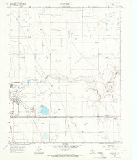 1963 Cactus East1966 Print · USGSThe High Plains industry of the early sixties comes into focus at the intersection of Sherman and Moore counties. Trace the rail-and-oil economy through the Sunray Gas and Oil Field, the Etter settlement, and Sheerin Junction.
 - 1965 Map of Cactus West, 1966 Print
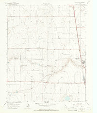 1965 Cactus West1966 Print · USGSThe Texas Panhandle comes alive in the mid-sixties at the industrial junction of Cactus and Etter. Trace the intersection of the Atchison Topeka and Santa Fe railroad with early energy infrastructure like Gas Wells and the North Palo Duro Creek drainage.
 - 1986 Map of Spearman, 1988 Print
 1986 Spearman1988 Print · USGSThe northern Texas Panhandle and Oklahoma border are seen here in the mid-1980s as a landscape of energy production and ranching. Trace local genealogy and land use across the oil and gas field or through settlements like Spearman, Texhoma, and Gruver.
 - 2022 Map of Cactus East, 2022 Print
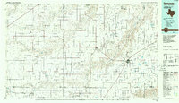
 2022 Cactus East2022 Print · USGSThe northern Panhandle comes into focus in this recent survey of the Sherman and Moore County line. Researchers can trace the industrial and rural development of Cactus, Etter, and Sheerin Junction along the banks of N Palo Duro Cr.
 - 2022 Map of Cactus West, 2022 Print
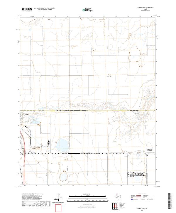
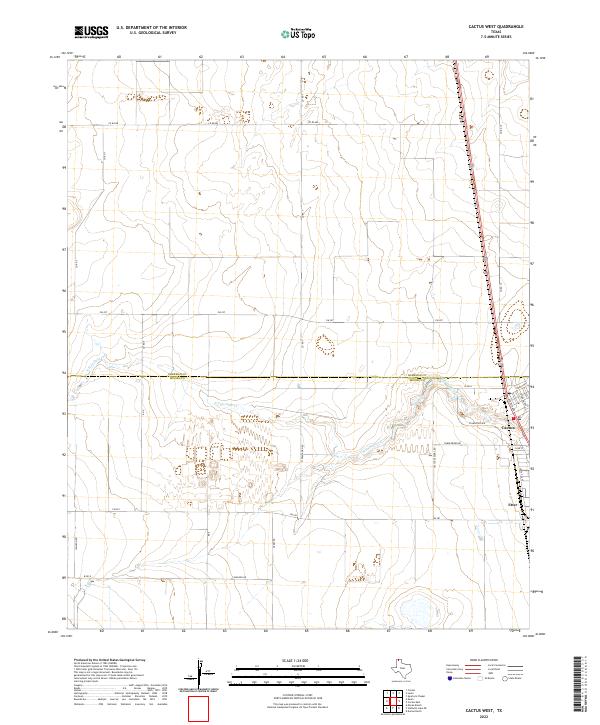 2022 Cactus West2022 Print · USGSThe Texas Panhandle at the junction of Moore and Sherman Counties reveals a landscape of industrial agriculture. Trace the residential growth in Cactus and the rural network surrounding Etter and the drainage of N Palo Duro Cr.
End of results
Showing maps 1-10 of 10
Top cities near Cactus
Frequently asked questions
- What are the different types of historical maps available for Cactus?
- What is the oldest map of Cactus?
- Where can I purchase historical maps of Cactus for my home or office?
- Where can I download high-res historical maps of Cactus?
- Are there historical topographic maps available for Cactus?
- Is there historical aerial imagery available for Cactus?
- Where are historical maps of Cactus sourced from?