1980s Maps of Newton County, Texas
Explore 31 historic maps of Newton County from the 1980s. These maps offer a rare glimpse into what life looked like during the 1980s — showing old roads, neighborhoods, homes, and landmarks that have changed or disappeared over time.
Whether you're researching your family's past, planning a metal detecting trip, or studying how Newton County's landscape evolved across the 1980s, these high-resolution maps are a powerful tool for exploring the history of this region.
- Focus on a specific era: All maps on this page are from the 1980s, giving you a focused view of this time period.
- See what’s changed: Compare century-old streets, trails, and buildings to today's modern landscape using overlays and satellite layers.
- Research with precision: Use these maps for genealogy, historical research, land use analysis, or educational projects.
- View, download, or print: Maps are fully viewable online in high resolution, and can be downloaded or printed for your own records.
Start exploring Newton County's history through authentic maps from the 1980s. This is your window into the past.
Newton County, TX maps
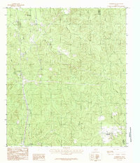
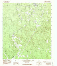
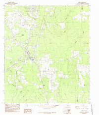
(31)- 1982 Map of Starks, 1983 Print
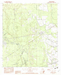 1982 Starks1983 Print · USGSThe Sabine River bottomlands at the Texas-Louisiana border are captured here in the early eighties as a vital rail and river corridor. Genealogists and local historians can trace family burial sites like Doyle Cem and Miller Cem or locate the junctions of the Southern Pacific and Kansas City Southern railroads.
 - 1982 Map of Bancroft, 1983 Print
 1982 Bancroft1983 Print · USGSThe Louisiana-Texas borderlands along the SABINE RIVER are captured here in the early eighties. Genealogists and local historians can locate Spikes Cem and rural congregations at Morning Star Ch and Brushy Creek Ch.
 - 1982 Map of Bon Wier, 1983 Print
 1982 Bon Wier1983 Print · USGSThe Sabine River bottomlands on the Texas-Louisiana border are captured here in the early 1980s, showcasing a landscape of winding sloughs and rail lines. You can trace the path of the Atchison Topeka and Santa Fe through Bon Wier or locate local landmarks like Belgrade Cem and Liveoak Ch.
 - 1982 Map of Merryville South, 1983 Print
 1982 Merryville South1983 Print · USGSThe Sabine River bottomlands in the early 1980s show a landscape shaped by shifting waters and rural settlement. Genealogists and local historians can trace legacy sites like Stark Cemetery, Lone Pine Church, and the community of Bivens.2 unique versions available
 - 1982 Map of Shoats Creek, 1983 Print
 1982 Shoats Creek1983 Print · USGSThe Sabine River bottomlands on the Louisiana-Texas border appear here in the early 1980s, revealing a landscape defined by oxbow lakes and rural outposts. Genealogists and local historians can trace family sites at Clark Cem, Carter Cem, and the river landing at Nicks Landing.
 - 1984 Map of Harrisburg
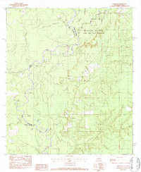
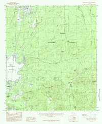
 1984 Harrisburg1984 Print · USGSJasper and Newton counties are captured here in the mid-1980s, showing a landscape of timber lookouts and creek-side settlements. Genealogists and locals can trace family roots around Harrisburg and Browndell or locate the rural Cem and Hardy Bridge.
 - 1984 Map of Pineland South
 1984 Pineland South1984 Print · USGSThe timbered hills of East Texas are captured here in the mid-1980s, bordered by the vast Sam Rayburn Reservoir. Genealogists and historians can trace old community lines in Pineland, Brookeland, and the localized settlement of Stringtown.
 - 1984 Map of Hurricane Creek
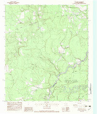
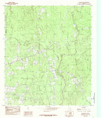
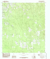
 1984 Hurricane Creek1984 Print · USGSSabine and Newton counties are shown deep in the East Texas piney woods in the early eighties. Local researchers can trace the roads around Clarktown and Scrapping Valley or follow the intricate drainage of Hurricane Creek and Sixmile Creek.
 - 1984 Map of Weeks Settlement
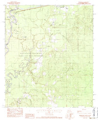
 1984 Weeks Settlement1984 Print · USGSNewton County's rural timber and creek lands are captured here in the mid-1980s, documenting a landscape defined by its waterways. Researchers can locate the Weeks Settlement and trace local landmarks like the Lookout Tower and Indian Hills.
 - 1984 Map of Shankleville, 1985 Print
 1984 Shankleville1985 Print · USGSNewton County in the late twentieth century reveals a landscape of dispersed timber-country settlements and winding creek bottoms. Researchers can trace family sites near Shankleville, locate the Burkeville Lookout Tower, and map the reaches of Little Cow Creek.
 - 1984 Map of Call Junction, 1985 Print
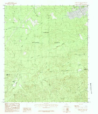
 1984 Call Junction1985 Print · USGSJasper and Newton Counties in the mid-1980s reveal a landscape of creek-fed timberlands and rural junctions. Genealogists and local historians can trace family-named sites and small settlements like Call Junction, Le Verte, and Stamps along the banks of Cypress Creek.
 - 1984 Map of Jamestown, 1985 Print
 1984 Jamestown1985 Print · USGSThe wooded borderlands of Jasper and Newton counties are captured here in the mid-1980s, centered on the Jamestown area. Researchers can trace the path of an Old Railroad Grade and locate family landmarks like local Cemeteries and the settlement of Farrsville.
 - 1984 Map of Evans, 1985 Print
 1984 Evans1985 Print · USGSThe Sabine River borderlands in the mid-1980s reveal a landscape shaped by shifting waters and rural settlements. Researchers can trace the oxbows of Evans Old River or locate local landmarks like Stringtown, Almadane, and the Cem near Evans.
 - 1984 Map of Bleakwood, 1985 Print
 1984 Bleakwood1985 Print · USGSThe wooded landscapes of Newton County are documented here in the late 1970s and early 1980s, centered on the community of Bleakwood. Researchers can trace the borders of the E O Siecke State Forest and locate specific local landmarks like Log Town Pond and Donahoe Marsh.
 - 1984 Map of Jasper East, 1985 Print
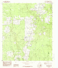
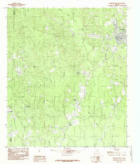
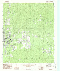 1984 Jasper East1985 Print · USGSThe city of Jasper during the mid-eighties shows its growth and its relationship with the surrounding piney woods landscape. Genealogists and local historians can trace family locations near Holly Springs, Huff, and the banks of Big Walnut Run.
 - 1984 Map of Buna, 1985 Print
 1984 Buna1985 Print · USGSBuna and the surrounding Jasper County timberlands are documented here as they appeared in the late seventies and early eighties. Researchers can locate family homesites and trace the drainages of Strawther Branch, Bessmay, and the high ground at Bunker Hill.
 - 1984 Map of Sudduth Bluff, 1985 Print
 1984 Sudduth Bluff1985 Print · USGSThe Texas-Louisiana borderlands come into focus in the mid-1980s, centered on the winding Sabine River and its dense network of bottomland sloughs. Researchers can trace the unique hydrology of Newton County through landmarks like Sudduth Bluff, Wildcat Lake, and the winding Devils Pocket Slough.
 - 1984 Map of Newton West, 1985 Print
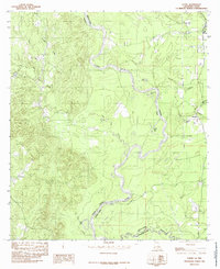
 1984 Newton West1985 Print · USGSNewton and the surrounding piney woods come to life in this mid-1980s survey of the Big Cow Creek basin. Local historians can trace family locations near Friendship Ch, the Friendship Cem, and the community of Pine Grove.
 - 1984 Map of Gist, 1985 Print
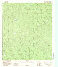
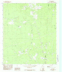 1984 Gist1985 Print · USGSJasper and Newton counties are captured here in the mid-seventies, showing a landscape of prairies and marshland. Genealogists and historians can trace the old RR grade near Robertson or locate the local Oil Field and High Prairie.
 - 1984 Map of Kirbyville, 1985 Print
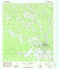 1984 Kirbyville1985 Print · USGSKirbyville and the pine-covered borders of Jasper and Newton counties come into focus during the mid-eighties. Genealogists and local historians can trace the town grid and nearby rural landmarks like Bon Ami, Kirbyville Airport, and the winding Trout Creek.
 - 1984 Map of Hartburg, 1985 Print
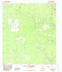 1984 Hartburg1985 Print · USGSThe Texas-Louisiana borderlands along the Sabine River are captured here in the mid-1980s, showcasing a landscape of dense river bottom marshes and emerging industry. Researchers can trace family history through local sites like Hartburg, Deweyville, and the Oil Field near Blacks Prairie.
 - 1984 Map of Newton East, 1985 Print
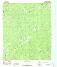
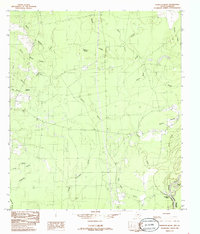
 1984 Newton East1985 Print · USGSNewton County in the mid-eighties shows a landscape of timbered ridges and winding creek bottoms. Genealogists and local historians can trace rural landmarks from the community of Buckhorn to the heights of the Lookout Tower and local Cem.
 - 1984 Map of Merryville North, 1985 Print
 1984 Merryville North1985 Print · USGSThe Sabine River bottomlands in the early eighties were a network of oxbow lakes and railroad corridors along the Texas border. Researchers can trace the path of the K. C. S. Ry. through Merryville and locate river features like Steamboat Bend and Horseshoe Lake.
 - 1984 Map of Trout Creek, 1985 Print
 1984 Trout Creek1985 Print · USGSDeep in the East Texas timberlands during the late seventies, this survey captures the rural character of Newton County. Researchers can trace family-named watercourses and small settlements like Call, Old Salem, and the E O Siecke State Forest.
 - 1985 Map of Fairmount
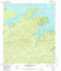 1985 Fairmount1985 Print · USGSThe Sabine River valley in the mid-1980s reveals a landscape transformed by the Toledo Bend Reservoir and protected forest lands. Researchers can locate family landmarks like Mt Sinai Cem, Weaver Cem, and the community at Fairmount.
Showing maps 1-25 of 31
Top cities of Newton County
Frequently asked questions
- What are the different types of historical maps available for Newton County?
- What is the oldest map of Newton County?
- Where can I purchase historical maps of Newton County for my home or office?
- Where can I download high-res historical maps of Newton County?
- Are there historical topographic maps available for Newton County?
- Is there historical aerial imagery available for Newton County?
- Where are historical maps of Newton County sourced from?