Old Maps of Newton County, Texas for Hiking & Exploration
Hike through history with 241 historic maps of Newton County. Explore old trails, ghost towns, and forgotten backroads — perfect for outdoor adventurers and local explorers.
- Rediscover forgotten places: Map out old mining camps, roads, and footpaths that no longer exist on modern maps.
- Layer with modern tools: Combine with LiDAR or satellite views to plan hikes through historical terrain.
- Made for exploration: Popular among hikers, overlanders, and local history lovers.
Use these maps to find adventure and explore the hidden past of Newton County.
Newton County, TX maps
(241)- 1926 Map of Texla
 1926 Texla1926 Print · USGSCoastal Texas in the mid-1920s is defined by its winding waterways and expanding rail lines. Genealogists and industrial historians can trace the Kansas City Southern route past the Linscomb Cem and the settlement at Texla.
 - 1926 Map of Mauriceville
 1926 Mauriceville1926 Print · USGSSoutheast Texas at the height of the mid-twenties rail era shows a landscape of timber-driven settlements and winding waterways. Genealogists and researchers can locate early schools and junctions like Little Cypress School, Lemonville, and Hartburg.
 - 1932 Map of Orange
 1932 Orange1932 Print · USGSSoutheastern Texas at the dawn of the 1930s is defined by the bustling riverfront of Orange and the intricate bends of the Sabine River. Researchers can trace the early street plan of the city, the Southern Pacific rail lines, and river landmarks like Morgan Bluff.2 unique versions available
 - 1935 Map of Wilson Lake, 1954 Print
 1935 Wilson Lake1954 Print · USGSThe Louisiana and Texas borderlands come to life in this mid-1930s survey of the Sabine River bottoms. Genealogists and historians can trace the original river channels and oxbows like Wilson Lake, Old River, and the curiously named Bugger Branch.2 unique versions available
 - 1943 Map of Mauriceville, 1953 Print
 1943 Mauriceville1953 Print · USGSSoutheast Texas at the dawn of the 1940s reveals a rural landscape defined by logging railroads and bayou drainage. Genealogists and historians can trace family locations near Wilkinson Cem, the Little Cypress Sch, and the junction at Mauriceville.
 - 1943 Map of Texla, 1953 Print
 1943 Texla1953 Print · USGSSoutheast Texas at the height of the Second World War shows a landscape defined by the intersection of new rail lines and older timber mill roads. Genealogists can locate family sites like Singleton Cem and Linscomb Cem near the banks of Cow Bayou.
 - 1944 Map of Wiergate
 1944 Wiergate1944 Print · USGSNewton County and the Sabine River borderlands are captured here in the mid-1940s during the peak of the local timber era. Genealogists and researchers can trace family landmarks like Toledo Cem, the Gulf Northern rail line, and the rural Mayflower Sch.2 unique versions available
 - 1946 Map of Merryville
 1946 Merryville1946 Print · USGSMerryville and the Sabine River basin are shown here during the mid-forties, capturing the intersection of river transport and the timber industry. Genealogists can locate family landmarks like Hennigan Cem, Bethlehem Ch, and the site of Clines Ferry.
 - 1947 Map of Starks
 1947 Starks1947 Print · USGSCoastal Louisiana meets the Texas border in the mid-1930s, where the winding Sabine River and extensive timber tracks define the land. Trace old family sites at Fountain Cem, the timber-era Old Logging Railroad Grade, and the ferry landing at Deweyville.
 - 1947 Map of Toomey
 1947 Toomey1947 Print · USGSCalcasieu Parish at the Texas border is seen here in the late 1940s, where the winding river bottoms meet the railroad corridor. Researchers can trace family sites like Comier Cemetery and the settlement at Toomey along the Southern Pacific line.
 - 1947 Map of Carter Creek
 1947 Carter Creek1947 Print · USGSThe Louisiana-Texas borderlands along the Sabine River are documented here in the mid-1940s, showing a landscape shaped by river bends and logging. Researchers can trace the Old Logging Railroad Grade and locate family landmarks like Duetts Ch and Clarks Cem.
 - 1947 Map of Wilson Lake
 1947 Wilson Lake1947 Print · USGSThe Sabine River bottomlands at the Texas-Louisiana border are captured here during the mid-1930s, revealing a shifting landscape of river channels and marsh. Researchers can trace the complex meanders of Old River, Middle River, and the banks of Wilson Lake.
 - 1947 Map of Bivens
 1947 Bivens1947 Print · USGSWestern Louisiana near the Texas border is captured here during the mid-century, showing the timber-driven landscape of Beauregard Parish. Researchers can trace defunct transport routes like the Old Logging Railroad Grade and find family-history landmarks such as Green Oak Ch and the settlement of Bivens.
 - 1948 Map of Wiergate, 1954 Print
 1948 Wiergate1954 Print · USGSThe Sabine River bottomlands and the timbered hills of Newton County are mapped here in the late 1940s. Genealogists and historians can trace rural life through landmarks like Anthonys Ferry, Scott Cem, and the old Sycamore Sch in the heart of the Sabine National Forest.
 - 1949 Map of Bancroft
 1949 Bancroft1949 Print · USGSThe Louisiana-Texas borderlands are captured here in the late 1940s, showing the rural communities and timber infrastructure along the Sabine River. Genealogists and historians can trace local landmarks like Friendship Ch, the Salem Ferry crossing, and an extensive Old Logging Railroad Grade.
 - 1949 Map of Evans
 1949 Evans1949 Print · USGSThe Sabine River bottomlands of Vernon Parish come to life in this late-1940s survey of the Texas-Louisiana border. Genealogists and local historians can trace family locations near Evans, Almadane, and community landmarks like Mt Olive Ch and Oak Grove Sch.
 - 1952 Map of Lake Charles
 1952 Lake Charles1952 Print · USGSSouthwest Louisiana is captured here in the mid-fifties, showing a landscape defined by the rise of the petrochemical industry and deep-water navigation. Researchers can trace family roots through numerous small-town settlements and oil developments like Nibletts Bluff, the Lockport Oil Field, and Starks.
 - 1953 Map of Alexandria, 1963 Print
 1953 Alexandria1963 Print · USGSCentral Louisiana during the early fifties is mapped here at the intersection of the piney woods and the Red River valley. Genealogists and historians can trace the rail-and-river network connecting towns like Alexandria, Natchitoches, and the grounds of Camp Beauregard.3 unique versions available
 - 1954 Map of Toomey
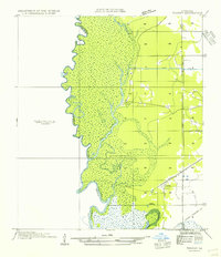 1954 Toomey1954 Print · USGSThe Louisiana-Texas borderlands in the mid-fifties are defined here by the winding Sabine River and the marshes of Calcasieu Parish. Researchers can locate Nibletts Bluff on the riverbank or trace family names at the Comier Cemetery near Toomey.
 - 1954 Map of Merryville
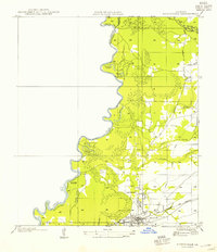 1954 Merryville1954 Print · USGSMerryville and the Sabine River borderlands are shown here in the mid-1950s, during an era defined by timber and rail transit. Genealogists and local historians can trace family-named sites like Hennican Cem, the path of an old Logging Railroad, and the location of Clines Ferry (Abandoned).
 - 1954 Map of Bivens
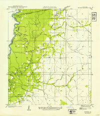 1954 Bivens1954 Print · USGSThe Sabine River bottomlands of Beauregard Parish were still defined by rail and river trade during the mid-twentieth century. Genealogists and local historians can trace the foundations of Merryville and Bivens, or locate the Green Oak Ch and old logging railroad grades.
 - 1954 Map of Wiergate, 1958 Print
 1954 Wiergate1958 Print · USGSNewton County in the mid-fifties shows a rural landscape transitioning after the peak of the timber era. Genealogists and local historians can trace the route of a Dismantled railroad and locate family sites like Maddox Cemetery, Survey School, and Mayflower.2 unique versions available
 - 1954 Map of Wiergate SE, 1958 Print
 1954 Wiergate SE1958 Print · USGSThe Sabine River bottomlands on the Texas-Louisiana border are captured here in the mid-fifties, showing a shifting landscape of oxbows and brakes. Genealogists and local historians can locate Burr Cemetery, Sycamore Church, and trace the path of a dismantled railroad.3 unique versions available
 - 1954 Map of Fairdale, 1958 Print
 1954 Fairdale1958 Print · USGSThe deep timberlands of East Texas are captured here in the mid-1950s as the Sabine National Forest reclaimed the landscape. Researchers can trace the path of a dismantled railroad and locate family burial sites at Fairmount Cemetery or Mt Sinai Cemetery.2 unique versions available
 - 1954 Map of Wiergate, 1958 Print
 1954 Wiergate1958 Print · USGSThe Sabine River bottomlands and the pine forests of Newton County are shown here in the mid-1950s. Genealogists and local historians can trace family locations through sites like Anthonys Ferry, Fairmount Cemetery, and the Survey School.3 unique versions available
Showing maps 1-25 of 241
Top cities of Newton County
Frequently asked questions
- What are the different types of historical maps available for Newton County?
- What is the oldest map of Newton County?
- Where can I purchase historical maps of Newton County for my home or office?
- Where can I download high-res historical maps of Newton County?
- Are there historical topographic maps available for Newton County?
- Is there historical aerial imagery available for Newton County?
- Where are historical maps of Newton County sourced from?