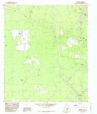
1984 Map of Hartburg
USGS Topo · Published 1985About this map
The Sabine River marks the eastern boundary of this mid-1980s survey, separating Texas from Louisiana where Foster Bluff overlooks the winding waterway. Low-lying wetlands dominate the landscape, characterized by numerous marshes including Negro Marsh, Stanton Marsh, and Nips Marsh. These watery expanses are fed by the intricate systems of Cypress Creek and Little Cypress Creek, creating a complex network of sloughs and coves like Bull Cove and Black Marsh Slough.
Find a feature on this map
19 named features on this map. Tap any name to fly to it.
Don’t see what you’re looking for? This feature index may not catch every label — zoom into the map to look around manually.
Map Details
Editions of this 1984 Hartburg Map
This is the sole edition of this map. No revisions or reprints were ever made.
Other maps of this area

1926 · Texla
USGS Topo · 1:24,000

1926 · Mauriceville
USGS Topo · 1:24,000

1932 · Orange
USGS Topo · 1:62,500

1943 · Mauriceville
USGS Topo · 1:24,000

1943 · Texla
USGS Topo · 1:24,000

1947 · Starks
USGS Topo · 1:31,680

1947 · Toomey
USGS Topo · 1:31,680

1947 · Carter Creek
USGS Topo · 1:31,680

1952 · Lake Charles
USGS Topo · 1:250,000
1954 · Toomey
USGS Topo · 1:31,680