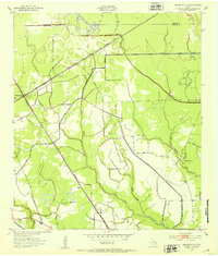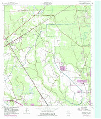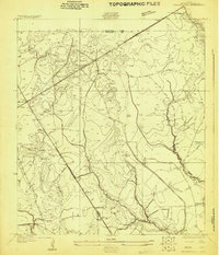
1926 Map of Mauriceville
USGS Topo · Published 1926About this map
Mauriceville and Lemonville anchor this 1926 survey of East Texas, where the landscape is defined by the intersection of major rail lines and slow-moving bayous. The Kansas City Southern RR and the Orange and Northwestern RR cross the terrain, illustrating the importance of timber and freight transport in Orange County during this era. This advance sheet, compiled in part from early aerial photography by the Army Air Corps, provides a high-resolution look at rural infrastructure before modern expansion.
Find a feature on this map
13 named features on this map. Tap any name to fly to it.
Don’t see what you’re looking for? This feature index may not catch every label — zoom into the map to look around manually.
Map Details
Editions of this 1926 Mauriceville Map
This is the sole edition of this map. No revisions or reprints were ever made.
Historical Maps of Orange Through Time
8 maps found