Old Maps of Howards, Texas for Genealogy
Trace your family roots with 10 historic maps of Howards. These high-res maps reveal old neighborhoods, homesites, landmarks, and streets — helping you uncover where your ancestors lived and how the area evolved over time.
- Explore historic neighborhoods: Identify where your relatives may have lived in the 1800s or 1900s.
- Compare maps over time: Trace the changes in streets, buildings, and landmarks for multi-generational research.
- Perfect for genealogy & ancestry research: Used by family historians and researchers to map out lineage and migration.
These maps are an incredible resource for exploring your personal connection to Howards's past.
Howards, TX maps
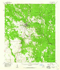
(10)- 1952 Map of Lake Charles
 1952 Lake Charles1952 Print · USGSSouthwest Louisiana is captured here in the mid-fifties, showing a landscape defined by the rise of the petrochemical industry and deep-water navigation. Researchers can trace family roots through numerous small-town settlements and oil developments like Nibletts Bluff, the Lockport Oil Field, and Starks.
 - 1954 Map of Lake Charles, 1964 Print
 1954 Lake Charles1964 Print · USGSSouthwest Louisiana in the mid-fifties is defined by its massive petroleum industry and its complex network of bayous and rail lines. Researchers can trace the development of the Sulphur Mines Oil Field or locate historic settlements like Longville and De Quincy.3 unique versions available
 - 1958 Map of Kirbyville, 1960 Print
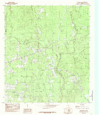
 1958 Kirbyville1960 Print · USGSJasper and Newton counties in the late fifties show a landscape of timber-driven growth and rural community centers. Genealogists can trace family landmarks like Wilson Cem, Lewis Chapel, and several local schools from Bon Ami to Salem.2 unique versions available
 - 1984 Map of Bleakwood, 1985 Print
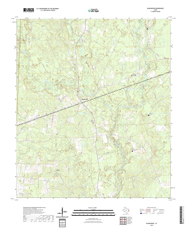
 1984 Bleakwood1985 Print · USGSThe wooded landscapes of Newton County are documented here in the late 1970s and early 1980s, centered on the community of Bleakwood. Researchers can trace the borders of the E O Siecke State Forest and locate specific local landmarks like Log Town Pond and Donahoe Marsh.
 - 1986 Map of DeRidder
 1986 DeRidder1986 Print · USGSThe Louisiana-Texas borderlands come to life in the mid-eighties, showcasing the timber country and rail corridors of the Sabine River valley. Researchers can trace the legacy of small communities and transit lines through Merryville, Holly Springs, and the Missouri Pacific railroad.2 unique versions available
 - 2010 Map of Bleakwood, 2010 Print
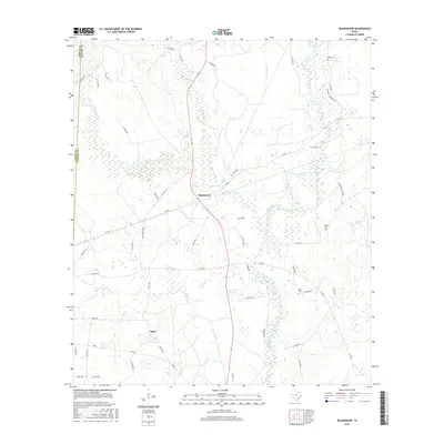
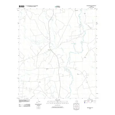 2010 Bleakwood2010 Print · USGSCovers Howards, including Adsul, Harrells, and other nearby areas
 - 2012 Map of Bleakwood, 2012 Print
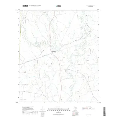
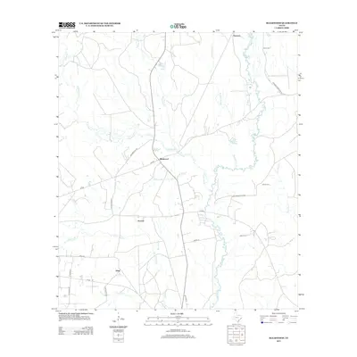 2012 Bleakwood2012 Print · USGSCovers Howards, including Adsul, Harrells, and other nearby areas
 - 2016 Map of Bleakwood, 2016 Print
 2016 Bleakwood2016 Print · USGSCovers Howards, including Adsul, Harrells, and other nearby areas
 - 2019 Map of Bleakwood, 2019 Print
 2019 Bleakwood2019 Print · USGSCovers Howards, including Adsul, Harrells, and other nearby areas
 - 2022 Map of Bleakwood, 2022 Print
 2022 Bleakwood2022 Print · USGSNewton County's marshy timberlands are documented here in the early 21st century. Researchers can trace rural lineages through numerous local landmarks, from Bleakwood Cem and Watson Chapel Cem to the old Adsul community site.
End of results
Showing maps 1-10 of 10
Top cities near Howards
Frequently asked questions
- What are the different types of historical maps available for Howards?
- What is the oldest map of Howards?
- Where can I purchase historical maps of Howards for my home or office?
- Where can I download high-res historical maps of Howards?
- Are there historical topographic maps available for Howards?
- Is there historical aerial imagery available for Howards?
- Where are historical maps of Howards sourced from?