Old Maps of Nolan County, Texas for Academic Research
Study the evolution of Nolan County with 158 high-resolution historic maps. Whether you're teaching, researching, or modeling changes in land use, these maps provide essential visual documentation of urban, environmental, and geographic change.
- Analyze long-term change: Track patterns in development, transportation, and natural features.
- Ideal for environmental or urban studies: Support academic projects with primary historical map data.
- Use in the classroom or lab: Educators and researchers rely on these maps to bring historical context to life.
These maps are a powerful tool for teaching, research, and visualizing how Nolan County has changed over the decades.
Nolan County, TX maps
(158)- 1893 Map of Roby
 1893 Roby1893 Print · USGSFisher and Jones Counties come alive in the 1890s as early ranching settlements and rail sidings begin to dot the West Texas plains. Researchers can trace the early layout of Roby and locate lost community sites like Swedonia, Taopi, or the Winters Chapel congregation.4 unique versions available
 - 1893 Map of Sweetwater
 1893 Sweetwater1893 Print · USGSNolan and Taylor counties come alive in the 1890s as the railroad fuels the growth of frontier cattle towns. Genealogists and historians can trace the early streets of Sweetwater and Merkel or locate the historic site of Fort Chadbourne near Church Mountain.4 unique versions available
 - 1954 Map of Big Spring, 1965 Print
 1954 Big Spring1965 Print · USGSWest Texas in the mid-1950s shows a landscape of growing oil towns and vital rail links along the Texas and Pacific RR. Researchers can trace the development of Big Spring, find smaller settlements like Knott and Lomax, or locate landmarks such as Boyds Chapel and Signal Mountain.4 unique versions available
 - 1957 Map of Merkel, 1958 Print
 1957 Merkel1958 Print · USGSThe West Texas plains near the Taylor and Nolan county line appear here in the mid-fifties, dominated by the oil industry and the rail corridor. Researchers can locate early schools and burial sites like Merkel High Sch, Dora Cem, and Butman Camp.2 unique versions available
 - 1957 Map of Noodle, 1958 Print
 1957 Noodle1958 Print · USGSJones and Fisher Counties appear here during a mid-century period of active oil exploration and railroad transport. Researchers can trace the rural infrastructure of Noodle and Sylvester, alongside landmarks like Newman Ch and the Raven Oil Field.
 - 1958 Map of Big Spring
 1958 Big Spring1958 Print · USGSThe West Texas oil boom was in full swing during the late fifties, transforming the landscape around Howard and Mitchell counties. Genealogists and historians can trace the growth of Big Spring and Snyder alongside industrial landmarks like the Kelly-Snyder Oil Field and the Santa Fe rail lines.
 - 1959 Map of Dam Draw, 1960 Print
 1959 Dam Draw1960 Print · USGSMitchell County energy and ranching are captured here in the late fifties. Researchers can trace the McCabe Oil Field and Panhandle and Santa Fe rail line past landmarks like Wimberley and Six Tank.3 unique versions available
 - 1959 Map of Silver, 1960 Print
 1959 Silver1960 Print · USGSMid-century Coke County is defined here by the booming Jameson Strawn Oil Field and the community of Silver. Genealogists and researchers can trace local family landmarks like McKenzie Cem and the Panhandle and Santa Fe rail line.3 unique versions available
 - 1962 Map of Sanco, 1964 Print
 1962 Sanco1964 Print · USGSCoke County in the early 1960s was a landscape of rugged peaks and growing petroleum infrastructure. This survey allows researchers to trace the I A B Oil Field and landmarks like Sanco, Panther Gap, and Horse Mountain.2 unique versions available
 - 1967 Map of Hylton, 1969 Print
 1967 Hylton1969 Print · USGSThe rural landscape of Nolan and Taylor Counties comes alive in the late sixties, centered on the ranching and resource economy of Hylton. Genealogy researchers can locate family sites at Campbell Cem or Hylton Cem among the bends of Valley Creek.
 - 1967 Map of Church Peak, 1969 Print
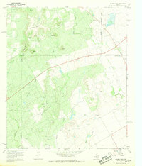 1967 Church Peak1969 Print · USGSWest Texas ranching and oil production meet at the borders of Runnels and Coke counties during the late sixties. Genealogists and historians can locate the Fort Chadbourne (Site) and trace industrial activity at Fort Chadbourne Field and the Refinery.2 unique versions available
 - 1969 Map of Baumann School, 1972 Print
 1969 Baumann School1972 Print · USGSMitchell and Nolan County ranch lands are captured here in the late sixties, showing a landscape defined by seasonal creek beds and rural infrastructure. Researchers can locate the Baumann School, trace the path of a major PIPELINE, and follow the winding South Fork Champion Creek.2 unique versions available
 - 1969 Map of Busby, 1972 Print
 1969 Busby1972 Print · USGSThe Texas rail-and-ranching landscape of the late 1960s comes into focus along the Atchison Topeka and Santa Fe line. Researchers can trace the small sidings of Capitola and Gannon or locate family landmarks near Ray Jones Spring and Wasp Peak.
 - 1969 Map of Bench Mountain, 1972 Print
 1969 Bench Mountain1972 Print · USGSWest Texas ranching and petroleum interests converge in the late 1960s near the settlement of Champion. Local historians can trace family homesteads along Althoff Road and Jarratt Norris Road or locate the Champion Cem and Highland Sch.
 - 1969 Map of Loraine, 1972 Print
 1969 Loraine1972 Print · USGSMitchell County ranching and rail infrastructure are captured here in the late sixties as the Texas and Pacific railroad serves the community of Loraine. Researchers can trace rural lineages at Union Chapel Cem and find landmarks like Lone Wolf Mountain or the Drive-in Theater.
 - 1969 Map of Blackwell NE, 1972 Print
 1969 Blackwell NE1972 Print · USGSNolan County ranchlands and oil fields are captured here in the late sixties. Genealogists and historians can trace the Santa Fe rail line, locate the Decker Cem, and explore the high country of The Divide.2 unique versions available
 - 1969 Map of Bernecker, 1972 Print
 1969 Bernecker1972 Print · USGSFisher and Nolan Counties in the late sixties reveal a landscape shaped by ranching and rail. Genealogists and historians can trace the Round Mtn Cem, the settlement of Claytonville, and the path of the Atchison Topeka and Santa Fe railroad.
 - 1969 Map of Maryneal, 1972 Print
 1969 Maryneal1972 Print · USGSMaryneal and the surrounding Nolan County ranchlands are captured here in the late sixties as the local oil and gravel industries expanded. Genealogists and historians can locate the Maryneal Cem, trace the Atchison Topeka and Santa Fe rail line, and find the John Adams Landing Area.
 - 1969 Map of Dew Drop Creek, 1972 Print
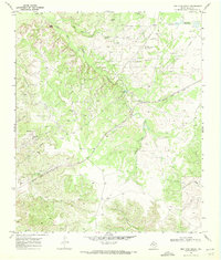 1969 Dew Drop Creek1972 Print · USGSThe West Texas oil country of the late sixties is captured here, centered on the intensive operations of the Nena Lucia Oil Field. Researchers can trace the path of the Atchison Topeka and Santa Fe railroad past the settlements of Maddox and Adair.2 unique versions available
 - 1969 Map of Blackwell SW, 1972 Print
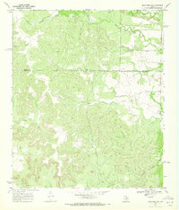 1969 Blackwell SW1972 Print · USGSThe West Texas ranchlands of Coke and Nolan counties are captured here in the late sixties as industrial infrastructure began to mark the landscape. Genealogists and land historians can locate White Hat Ranch, Whiteside Ranch, and the small settlement of Henry.2 unique versions available
 - 1969 Map of Roscoe, 1972 Print
 1969 Roscoe1972 Print · USGSRoscoe and the surrounding Nolan County plains appear in the late 1960s as a hub of rail traffic and energy production. Genealogists can trace family-named routes like Althof Road or locate the Roscoe Cem Cemetery and local High Sch.2 unique versions available
 - 1969 Map of Blackwell, 1972 Print
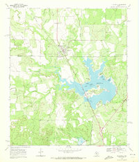 1969 Blackwell1972 Print · USGSThe West Texas borderlands of Nolan and Coke Counties appear here in the late sixties, centered on the growing importance of water management and energy production. Genealogists and local historians can trace the Atchison Topeka and Santa Fe rail line, Blackwell Cem, and the complex shoreline of the Oak Creek Reservoir.2 unique versions available
 - 1969 Map of Eskota, 1972 Print
 1969 Eskota1972 Print · USGSFisher County ranchlands and rail corridors are captured here in the late sixties as the region's transport network matured. Genealogists and historians can trace the small settlement at Palava, its local Cem, and the busy rail lines of the Texas Pacific.2 unique versions available
 - 1969 Map of Sweetwater, 1973 Print
 1969 Sweetwater1973 Print · USGSSweetwater thrived as a Texas rail and petroleum center during the late sixties, where the high plains meet industrial growth. Trace the development of Avenger Village near the Municipal Airport or locate the numerous derricks within the Rowan Hope Oil Field.2 unique versions available
 - 1969 Map of Holder Creek, 1973 Print
 1969 Holder Creek1973 Print · USGSNolan County ranch lands and the rugged ridge known as the Divide are captured here in the late sixties. Researchers can trace family-named landmarks and rural infrastructure from the Nolan Cem and Double Heart Ranch to the remote Landing Strip.
Showing maps 1-25 of 158
Top cities of Nolan County
Frequently asked questions
- What are the different types of historical maps available for Nolan County?
- What is the oldest map of Nolan County?
- Where can I purchase historical maps of Nolan County for my home or office?
- Where can I download high-res historical maps of Nolan County?
- Are there historical topographic maps available for Nolan County?
- Is there historical aerial imagery available for Nolan County?
- Where are historical maps of Nolan County sourced from?