1900s (20th Century) Maps of Maple Crest Acres, Vidor
Explore 7 historic maps of Maple Crest Acres from the 1900s (20th Century). These maps offer a rare glimpse into what life looked like during the 1900s — showing old roads, neighborhoods, homes, and landmarks that have changed or disappeared over time.
Whether you're researching your family's past, planning a metal detecting trip, or studying how Maple Crest Acres's landscape evolved across the 1900s, these high-resolution maps are a powerful tool for exploring the history of this region.
- Focus on a specific era: All maps on this page are from the 1900s, giving you a focused view of this time period.
- See what’s changed: Compare century-old streets, trails, and buildings to today's modern landscape using overlays and satellite layers.
- Research with precision: Use these maps for genealogy, historical research, land use analysis, or educational projects.
- View, download, or print: Maps are fully viewable online in high resolution, and can be downloaded or printed for your own records.
Start exploring Maple Crest Acres's history through authentic maps from the 1900s. This is your window into the past.
Maple Crest Acres, Vidor maps
(7)- 1926 Map of Texla
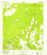
 1926 Texla1926 Print · USGSCoastal Texas in the mid-1920s is defined by its winding waterways and expanding rail lines. Genealogists and industrial historians can trace the Kansas City Southern route past the Linscomb Cem and the settlement at Texla.
 - 1943 Map of Texla, 1953 Print
 1943 Texla1953 Print · USGSSoutheast Texas at the height of the Second World War shows a landscape defined by the intersection of new rail lines and older timber mill roads. Genealogists can locate family sites like Singleton Cem and Linscomb Cem near the banks of Cow Bayou.
 - 1952 Map of Lake Charles
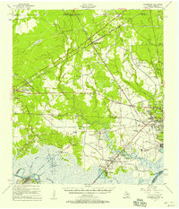
 1952 Lake Charles1952 Print · USGSSouthwest Louisiana is captured here in the mid-fifties, showing a landscape defined by the rise of the petrochemical industry and deep-water navigation. Researchers can trace family roots through numerous small-town settlements and oil developments like Nibletts Bluff, the Lockport Oil Field, and Starks.
 - 1954 Map of Lake Charles, 1964 Print
 1954 Lake Charles1964 Print · USGSSouthwest Louisiana in the mid-fifties is defined by its massive petroleum industry and its complex network of bayous and rail lines. Researchers can trace the development of the Sulphur Mines Oil Field or locate historic settlements like Longville and De Quincy.3 unique versions available
 - 1957 Map of Texla, 1958 Print
 1957 Texla1958 Print · USGSOrange County's transition from timber and rail to mid-century residential growth is captured here in the late fifties. Genealogists and local historians can trace family sites like Singleton Cem and the Log Cabin Tabernacle near the old Texla townsite.3 unique versions available
 - 1957 Map of Orangefield, 1958 Print
 1957 Orangefield1958 Print · USGSSoutheast Texas at the peak of the mid-century oil boom is detailed here, showing the intricate intersection of rail lines and bayous. Genealogists can locate family landmarks such as Linscomb Cem, Winfree Ch, and the settlement of Mauriceville.2 unique versions available
 - 1986 Map of Lake Charles
 1986 Lake Charles1986 Print · USGSThe Louisiana-Texas borderlands are captured here in the mid-1980s, showcasing the industrial growth of the Lake Charles region and its rail-linked satellite towns. Trace the evolution of coastal settlements and family landmarks from Sulphur to the Highland Cem.2 unique versions available
End of results
Showing maps 1-7 of 7
Frequently asked questions
- What are the different types of historical maps available for Maple Crest Acres?
- What is the oldest map of Maple Crest Acres?
- Where can I purchase historical maps of Maple Crest Acres for my home or office?
- Where can I download high-res historical maps of Maple Crest Acres?
- Are there historical topographic maps available for Maple Crest Acres?
- Is there historical aerial imagery available for Maple Crest Acres?
- Where are historical maps of Maple Crest Acres sourced from?