1950s Maps of Panola County, Texas
Explore 9 historic maps of Panola County from the 1950s. These maps offer a rare glimpse into what life looked like during the 1950s — showing old roads, neighborhoods, homes, and landmarks that have changed or disappeared over time.
Whether you're researching your family's past, planning a metal detecting trip, or studying how Panola County's landscape evolved across the 1950s, these high-resolution maps are a powerful tool for exploring the history of this region.
- Focus on a specific era: All maps on this page are from the 1950s, giving you a focused view of this time period.
- See what’s changed: Compare century-old streets, trails, and buildings to today's modern landscape using overlays and satellite layers.
- Research with precision: Use these maps for genealogy, historical research, land use analysis, or educational projects.
- View, download, or print: Maps are fully viewable online in high resolution, and can be downloaded or printed for your own records.
Start exploring Panola County's history through authentic maps from the 1950s. This is your window into the past.
Panola County, TX maps
(9)- 1953 Map of Palestine, 1964 Print
 1953 Palestine1964 Print · USGSEast Texas was defined by its deep pine forests and burgeoning energy sector in the mid-1950s. Genealogists and historians can trace the rail-and-river economy through settlements like Tennessee Colony and Pollok or explore the early footprints of the Cayuga Oil Field and Davy Crockett National Forest.2 unique versions available
 - 1956 Map of Tyler
 1956 Tyler1956 Print · USGSEast Texas was a powerhouse of oil production and rail transport during the mid-fifties, centered on the sprawling East Texas Oil Field. Researchers can trace the heritage of industrial hubs like Kilgore, military sites such as the Longhorn Ordnance Works, and many rural landmarks like Mount Enterprise.5 unique versions available
 - 1956 Map of Deadwood, 1957 Print
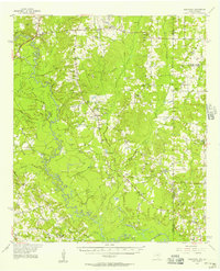 1956 Deadwood1957 Print · USGSThe Texas-Louisiana borderlands along the Sabine River are shown here in the mid-fifties as the Carthage Gas Field reshaped the local landscape. Genealogists can trace family roots through numerous rural landmarks, including the Centennial Cem, Shiloh Baptist Ch, and the settlement at Deadwood.4 unique versions available
 - 1957 Map of Palestine
 1957 Palestine1957 Print · USGSEast Texas in the mid-fifties reveals a landscape of deep pine forests and winding river valleys before the era of massive reservoir construction. Researchers can trace the legacy of the timber and rail industries through labels for the Missouri Pacific RR, Davy Crockett National Forest, and Nacogdoches.
 - 1958 Map of Center, 1959 Print
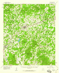
 1958 Center1959 Print · USGSShelby County in the late fifties remains a landscape of timbered hills and rail-connected crossroads. Researchers can trace family roots through numerous rural sites like Newhope Ch, Union Cem, and the small community of Shelbyville near the Sabine River.3 unique versions available
 - 1958 Map of Timpson, 1959 Print
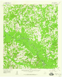
 1958 Timpson1959 Print · USGSShelby and Nacogdoches counties appear here during the late fifties, defined by a landscape of small timber-and-oil settlements and diverging rail lines. Genealogists can locate family landmarks such as Todd Spring Ch, Huber Sch, and Lake Timpson.2 unique versions available
 - 1958 Map of Darco, 1960 Print
 1958 Darco1960 Print · USGSThe Sabine River bottomlands of East Texas are captured here in the late fifties, showing a landscape defined by gas fields and lignite mining. Genealogists can locate family landmarks like the Rosenwald Vocational and Agriculture Sch, Harris Chapel, and the historical Boards Ferry.2 unique versions available
 - 1958 Map of Carthage, 1960 Print
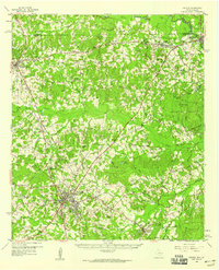
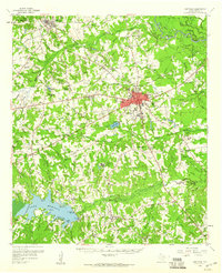 1958 Carthage1960 Print · USGSMid-century Panola County comes to life as the city of Carthage grows and the waters of Lake Murvaul fill the southern valleys. Genealogists and historians can trace dozens of rural landmarks, from Liberty Chapel Cem to the AT & SF RR rail stops at Gary and Beckville.2 unique versions available
 - 1958 Map of Tatum, 1960 Print
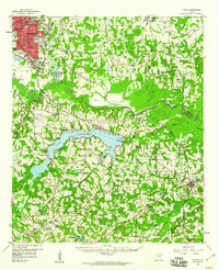 1958 Tatum1960 Print · USGSEast Texas in the late fifties is captured here as the industrial reach of Longview meets the rural landscapes of Rusk and Harrison counties. Genealogists and historians can trace the foundations of local communities at Lake Cherokee, Sweet Home Ch, and the Tatum Gas Field.4 unique versions available
End of results
Showing maps 1-9 of 9
Top cities of Panola County
Frequently asked questions
- What are the different types of historical maps available for Panola County?
- What is the oldest map of Panola County?
- Where can I purchase historical maps of Panola County for my home or office?
- Where can I download high-res historical maps of Panola County?
- Are there historical topographic maps available for Panola County?
- Is there historical aerial imagery available for Panola County?
- Where are historical maps of Panola County sourced from?