1960s Maps of Panola County, Texas
Explore 6 historic maps of Panola County from the 1960s. These maps offer a rare glimpse into what life looked like during the 1960s — showing old roads, neighborhoods, homes, and landmarks that have changed or disappeared over time.
Whether you're researching your family's past, planning a metal detecting trip, or studying how Panola County's landscape evolved across the 1960s, these high-resolution maps are a powerful tool for exploring the history of this region.
- Focus on a specific era: All maps on this page are from the 1960s, giving you a focused view of this time period.
- See what’s changed: Compare century-old streets, trails, and buildings to today's modern landscape using overlays and satellite layers.
- Research with precision: Use these maps for genealogy, historical research, land use analysis, or educational projects.
- View, download, or print: Maps are fully viewable online in high resolution, and can be downloaded or printed for your own records.
Start exploring Panola County's history through authentic maps from the 1960s. This is your window into the past.
Panola County, TX maps
(6)- 1960 Map of Minden, 1962 Print
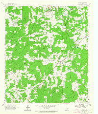
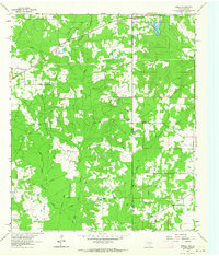
 1960 Minden1962 Print · USGSRusk and Panola counties are shown at the start of the sixties, capturing the intricate network of country roads and family burial grounds. Researchers can find old rural schoolhouses like Willow Springs Sch and trace landmarks from Minden to Fair Play.
 - 1960 Map of Mount Enterprise, 1962 Print
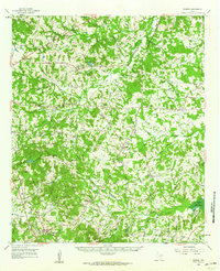
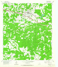
 1960 Mount Enterprise1962 Print · USGSMount Enterprise and the surrounding Piney Woods of East Texas are captured here at the dawn of the 1960s. Genealogists and historians can trace family locations through numerous rural landmarks like Isabell Chapel, Caledonia, and the Helpenstell Cemetery.2 unique versions available
 - 1962 Map of Stricklin Springs, 1964 Print
 1962 Stricklin Springs1964 Print · USGSEast Texas energy and rural life converge in the early sixties as the Elysian Gas Field expands through Harrison County. Genealogists and local historians can trace community roots at the Elysian Fields Sch, Granbury Cem, and Stricklin Springs.2 unique versions available
 - 1962 Map of De Berry, 1964 Print
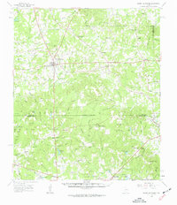
 1962 De Berry1964 Print · USGSPanola and Harrison counties at the dawn of the 1960s reveal a landscape of rural congregations and a growing energy sector. Genealogists can trace family sites at Evergreen Cem and Woodley Cem or locate the old Mims Chapel and Wayside Ch.
 - 1962 Map of Panola, 1964 Print
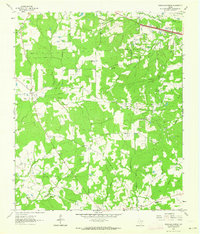
 1962 Panola1964 Print · USGSThe borderlands of Panola County and Caddo Parish are captured here in the early sixties as rural life met the growing energy industry. Genealogists and local historians can trace family sites like Jernigan Cem, Mt Zion Ch, and the De Berry Sch along the Old Railroad Grade.3 unique versions available
 - 1962 Map of Waskom, 1964 Print
 1962 Waskom1964 Print · USGSThe borderlands of East Texas and Western Louisiana were a hub of railroad and petroleum activity in the early sixties. Genealogists and historians can trace the foundations of Waskom through local landmarks like Union Chapel and the Abney High Sch.4 unique versions available
End of results
Showing maps 1-6 of 6
Top cities of Panola County
Frequently asked questions
- What are the different types of historical maps available for Panola County?
- What is the oldest map of Panola County?
- Where can I purchase historical maps of Panola County for my home or office?
- Where can I download high-res historical maps of Panola County?
- Are there historical topographic maps available for Panola County?
- Is there historical aerial imagery available for Panola County?
- Where are historical maps of Panola County sourced from?