Old Maps of Gentry, Texas for Genealogy
Trace your family roots with 11 historic maps of Gentry. These high-res maps reveal old neighborhoods, homesites, landmarks, and streets — helping you uncover where your ancestors lived and how the area evolved over time.
- Explore historic neighborhoods: Identify where your relatives may have lived in the 1800s or 1900s.
- Compare maps over time: Trace the changes in streets, buildings, and landmarks for multi-generational research.
- Perfect for genealogy & ancestry research: Used by family historians and researchers to map out lineage and migration.
These maps are an incredible resource for exploring your personal connection to Gentry's past.
Gentry, TX maps
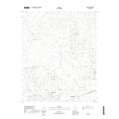
(11)- 1934 Map of Cliffside, 1959 Print
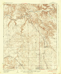
 1934 Cliffside1959 Print · USGSPotter County ranching and rail infrastructure are captured here in the mid-1930s. Genealogists and local historians can trace legacy holdings like Fuqua Ranch and Bivins Ranch alongside rural landmarks like Pleasant Valley Sch.
 - 1936 Map of Cliffside
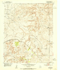
 1936 Cliffside1936 Print · USGSPotter County ranching and rail infrastructure are captured here in the mid-1930s as the Panhandle modernized. Researchers can trace family-named landmarks like Fuqua Ranch and Bivins Ranch or locate early rural education sites at River Road Sch.2 unique versions available
 - 1953 Map of Cliffside, 1954 Print
 1953 Cliffside1954 Print · USGSPotter County’s gas fields and cattle country are captured here in the mid-twentieth century. Family historians and researchers can trace the Fort Worth and Denver (Burlington) rail line past Cliffside, Townsend Cemetery, and the Cliffside Gas Field Camp.3 unique versions available
 - 1954 Map of Amarillo, 1966 Print
 1954 Amarillo1966 Print · USGSThe Texas Panhandle in the mid-1960s shows a landscape of rising industrial power and deep-rooted ranching tradition. Local historians can trace the paths of the Panhandle and Santa Fe railroad or locate sites like the Pantex Ordnance Plant and Mobeetie.2 unique versions available
 - 1958 Map of Amarillo
 1958 Amarillo1958 Print · USGSThe Texas Panhandle in the mid-1950s reveals a landscape of expanding military installations and oil-rich rail towns. Local historians can trace the development of Amarillo Air Force Base or locate smaller settlements like Magic City and New Mobeetie.
 - 1986 Map of Amarillo
 1986 Amarillo1986 Print · USGSAmarillo and the surrounding Texas Panhandle are captured here in the mid-eighties as a hub of energy, agriculture, and transport. Researchers can trace the sprawling Pantex Plant, the rail-side growth of Panhandle, and the deep cuts of Palo Duro Canyon.2 unique versions available
 - 2010 Map of Cliffside, 2010 Print
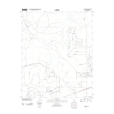
 2010 Cliffside2010 Print · USGSCovers Gentry, including Amarillo, Bishop Hills, and other nearby areas
 - 2012 Map of Cliffside, 2012 Print
 2012 Cliffside2012 Print · USGSCovers Gentry, including Amarillo, Bishop Hills, and other nearby areas
 - 2016 Map of Cliffside, 2016 Print
 2016 Cliffside2016 Print · USGSCovers Gentry, including Amarillo, Bishop Hills, and other nearby areas
 - 2019 Map of Cliffside, 2019 Print
 2019 Cliffside2019 Print · USGSCovers Gentry, including Amarillo, Bishop Hills, and other nearby areas
 - 2022 Map of Cliffside, 2022 Print
 2022 Cliffside2022 Print · USGSThe High Plains meet the canyon breaks northwest of Amarillo in the 2020s, showing a mix of established ranchlands and modern residential expansion. Researchers can find Townsend Cem and trace the paths of West Amarillo Creek and Brickplant Rd.
End of results
Showing maps 1-11 of 11
Top cities near Gentry
- Amarillo historical maps
- Lake Tanglewood historical maps
- Wildorado historical maps
- Bishop Hills historical maps
Frequently asked questions
- What are the different types of historical maps available for Gentry?
- What is the oldest map of Gentry?
- Where can I purchase historical maps of Gentry for my home or office?
- Where can I download high-res historical maps of Gentry?
- Are there historical topographic maps available for Gentry?
- Is there historical aerial imagery available for Gentry?
- Where are historical maps of Gentry sourced from?