Old Maps of Rains County, Texas for Metal Detecting
Plan your next treasure hunt with 48 historic maps of Rains County. Find old homesites, ghost towns, trails, and gathering spots that may be lost to time — perfect for identifying promising metal detecting locations.
- Locate forgotten sites: Uncover places like long-lost settlements, abandoned rail lines, or gathering spots.
- Plan better hunts: Use map overlays combined with LiDAR or satellite views to narrow in on historically rich areas.
- Made for detectorists: Thousands of hobbyists use these maps to discover relics, coins, and hidden history.
Use these historic maps to boost your research and find new opportunities beneath the surface of Rains County.
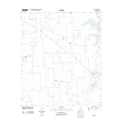
Rains County, TX maps
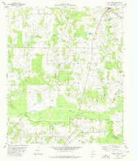
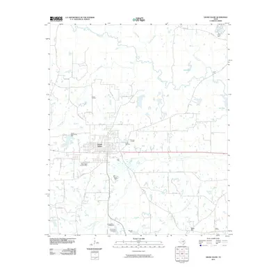
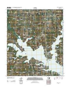
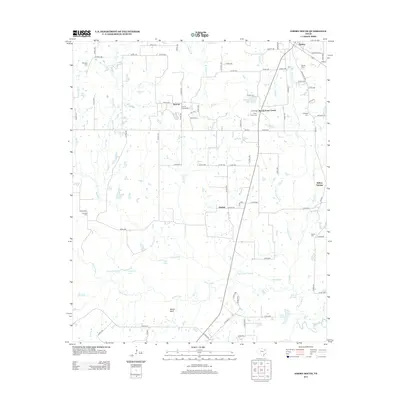
(48)- 1956 Map of Tyler
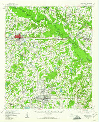
 1956 Tyler1956 Print · USGSEast Texas was a powerhouse of oil production and rail transport during the mid-fifties, centered on the sprawling East Texas Oil Field. Researchers can trace the heritage of industrial hubs like Kilgore, military sites such as the Longhorn Ordnance Works, and many rural landmarks like Mount Enterprise.5 unique versions available
 - 1956 Map of Emory, 1957 Print
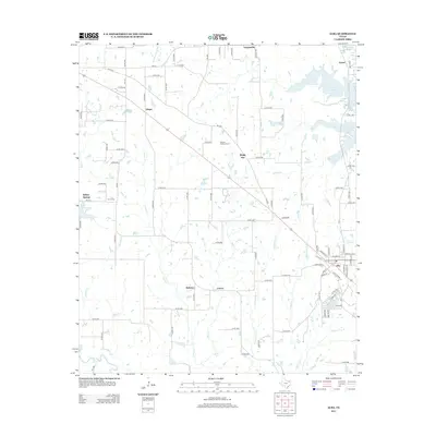
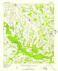 1956 Emory1957 Print · USGSRains County and its neighbors are shown here in the mid-fifties, just as the Sabine River valley prepared for the construction of the Iron Bridge Damsite. Genealogists can trace family roots through numerous small landmarks like Bright Star Ch, Cody Sch, and Parks Cem.3 unique versions available
 - 1958 Map of Arbala, 1960 Print
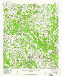
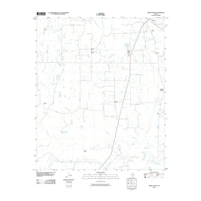
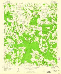 1958 Arbala1960 Print · USGSEast Texas rural life in the late fifties is captured here through the quiet settlements and family cemeteries of Rains and Hopkins counties. Genealogists can trace local roots at Arbala, Bonanza, and the Ishmael Cem along the banks of Lake Fork Creek.4 unique versions available
 - 1958 Map of Alba, 1960 Print
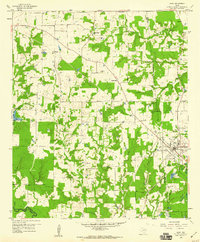 1958 Alba1960 Print · USGSWood County at the close of the fifties reveals a landscape defined by old lignite pits and oil wells. Genealogists can trace family landmarks like McCord Cem and Pilgrim Rest Ch, while historians can follow the Old Railroad Grade through Alba.3 unique versions available
 - 1959 Map of Grand Saline, 1960 Print
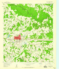 1959 Grand Saline1960 Print · USGSGrand Saline and the Sabine River bottomlands are shown in the late fifties, showcasing a landscape shaped by salt mining and rail transport. Researchers can trace rural life through the Morton Mine, Collins Ferry, and community sites like Friendship School.3 unique versions available
 - 1959 Map of Grand Saline, 1961 Print
 1959 Grand Saline1961 Print · USGSEast Texas in the late fifties reveals a landscape shaped by the oil industry and the railroad. Researchers can trace family-named sites and vanished landmarks like Collins Ferry, Van Oil Field, and the Union Chapel.2 unique versions available
 - 1959 Map of Alba, 1961 Print
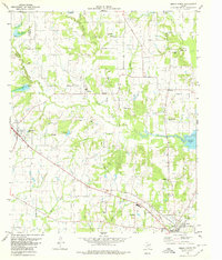
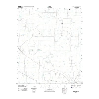
 1959 Alba1961 Print · USGSNortheast Texas at the dawn of the 1960s reveals a landscape of oil fields, family cemeteries, and rural rail stops. Genealogists and local historians can locate early sites like Sandifer Sch, Shady Grove, and the Bucks Yandell Cem scattered near the Elm Fork.2 unique versions available
 - 1980 Map of Emory North
 1980 Emory North1980 Print · USGSEast Texas at the turn of the 1980s reveals a landscape defined by its waterways and tight-knit rural communities. Genealogists can trace family heritage through numerous landmarks like Hill-Pippin Cem, County Line Ch, and the growing Lake Fork Reservoir.
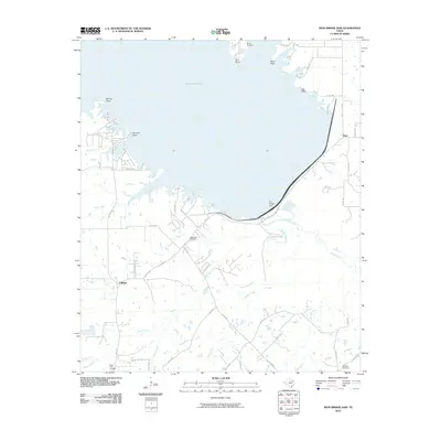
 - 1980 Map of Iron Bridge Dam
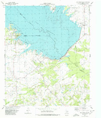 1980 Iron Bridge Dam1980 Print · USGSThe shorelines of Van Zandt and Hunt Counties are captured here as they appeared in the early eighties, centered on the massive Iron Bridge Dam. Genealogists and local historians can locate Bright Star Ch, Shook Cem, and the old settlement of Flats.
 - 1980 Map of Emory South
 1980 Emory South1980 Print · USGSThe Rains County countryside in the late seventies is defined by its deep connection to the winding Sabine River and its myriad sloughs. Researchers can trace ancestral locations from Emory down to Willow Springs, finding rural landmarks like Dunbar Union Ch and Trumble Grave.
 - 1984 Map of Tyler
 1984 Tyler1984 Print · USGSEast Texas at the peak of its reservoir-building era shows a landscape defined by new lakes and established rail corridors. Trace the path of the St Louis Southwestern RR or locate industrial sites like the Longhorn Ordnance Works.3 unique versions available
 - 1985 Map of Mineola
 1985 Mineola1985 Print · USGSUpper East Texas in the mid-eighties shows a region shaped by the Sabine River and large-scale water projects. Researchers can trace the rail heritage of the Missouri Pacific RR and locate rural landmarks like Ambassador College Res or the Oil Field.
 - 1991 Map of Mineola
 1991 Mineola1991 Print · USGSEast Texas in the early nineties reveals a landscape shaped by large-scale water reservoirs and the enduring footprint of the oil industry. Genealogists and historians can trace rail-town development in Mineola or explore smaller settlements like Bright Star and Garden Valley.
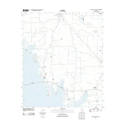
 - 2010 Map of Iron Bridge Dam, 2010 Print
 2010 Iron Bridge Dam2010 Print · USGSCovers Rains County, including Flats, Clifton, and other nearby areas
 - 2010 Map of Emory North, 2010 Print
 2010 Emory North2010 Print · USGSCovers Rains County, including Emory, Point, and other nearby areas
 - 2010 Map of Emory South, 2010 Print
 2010 Emory South2010 Print · USGSCovers Rains County, including Emory, Rocky Point Center, and other nearby areas
 - 2010 Map of Grand Saline, 2010 Print
 2010 Grand Saline2010 Print · USGSCovers Rains County, including Grand Saline, Sand Flat, and other nearby areas
 - 2011 Map of Alba, 2011 Print
 2011 Alba2011 Print · USGSCovers Rains County, including Emory, Alba, and other nearby areas
 - 2011 Map of Arbala, 2011 Print
 2011 Arbala2011 Print · USGSCovers Rains County, including Poole, Shady Grove, and other nearby areas
 - 2011 Map of Lone Oak South, 2011 Print
 2011 Lone Oak South2011 Print · USGSCovers Rains County, including West Tawakoni, East Tawakoni, and other nearby areas
 - 2012 Map of Arbala, 2012 Print
 2012 Arbala2012 Print · USGSCovers Rains County, including Poole, Shady Grove, and other nearby areas
 - 2012 Map of Alba, 2012 Print
 2012 Alba2012 Print · USGSCovers Rains County, including Emory, Alba, and other nearby areas
 - 2012 Map of Grand Saline, 2012 Print
 2012 Grand Saline2012 Print · USGSCovers Rains County, including Grand Saline, Sand Flat, and other nearby areas
 - 2012 Map of Lone Oak South, 2012 Print
 2012 Lone Oak South2012 Print · USGSCovers Rains County, including West Tawakoni, East Tawakoni, and other nearby areas
 - 2012 Map of Emory South, 2012 Print
 2012 Emory South2012 Print · USGSCovers Rains County, including Emory, Rocky Point Center, and other nearby areas
Showing maps 1-25 of 48
Top cities of Rains County
Frequently asked questions
- What are the different types of historical maps available for Rains County?
- What is the oldest map of Rains County?
- Where can I purchase historical maps of Rains County for my home or office?
- Where can I download high-res historical maps of Rains County?
- Are there historical topographic maps available for Rains County?
- Is there historical aerial imagery available for Rains County?
- Where are historical maps of Rains County sourced from?