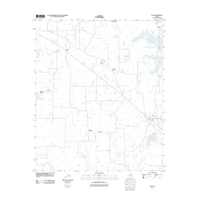
2011 Map of Alba
USGS Topo · Published 2011About this map
Alba serves as the primary hub of this East Texas landscape, where the convergence of several county roads and the proximity to the Lake Fork Reservoir define the local geography. The map documents a patchwork of small communities and rural intersections, including the namesake settlements of Ginger, Bright Star, and Hogansville. The terrain is deeply inscribed by a dense network of waterways, with Franks Creek, Big Creek, and Leatherman Creek draining southward toward the Sabine River. For those tracing local heritage, the inclusion of the Magee - McCord Cemetery and Turner Cemetery provides specific points of interest. The area’s character is shaped by its transition from wooded creek bottoms and private lakes like Woods Lake to the expansive waters of the reservoir in the northeast, illustrating the post-war development of water management and recreation in the region.
Find a feature on this map
65 named features on this map. Tap any name to fly to it.
Don’t see what you’re looking for? This feature index may not catch every label — zoom into the map to look around manually.
Map Details
Editions of this 2011 Alba Map
This is the sole edition of this map. No revisions or reprints were ever made.
Other maps of this area

1956 · Tyler
USGS Topo · 1:250,000

1956 · Emory
USGS Topo · 1:62,500

1958 · Arbala
USGS Topo · 1:24,000

1958 · Alba
USGS Topo · 1:24,000

1959 · Calvary
USGS Topo · 1:24,000

1959 · Golden
USGS Topo · 1:24,000

1959 · Grand Saline
USGS Topo · 1:24,000

1959 · Yantis
USGS Topo · 1:24,000

1959 · Grand Saline
USGS Topo · 1:62,500

1959 · Alba
USGS Topo · 1:62,500