Old Maps of Gozar, Texas for Hiking & Exploration
Hike through history with 10 historic maps of Gozar. Explore old trails, ghost towns, and forgotten backroads — perfect for outdoor adventurers and local explorers.
- Rediscover forgotten places: Map out old mining camps, roads, and footpaths that no longer exist on modern maps.
- Layer with modern tools: Combine with LiDAR or satellite views to plan hikes through historical terrain.
- Made for exploration: Popular among hikers, overlanders, and local history lovers.
Use these maps to find adventure and explore the hidden past of Gozar.
Gozar, TX maps
(10)- 1921 Map of Toyah
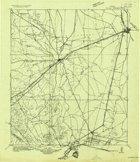 1921 Toyah1921 Print · USGSReeves County at the dawn of the highway era is documented here, showing the junction of major rail lines and early transcontinental motor routes. Researchers can trace family ranching history and railroad development through Toyah, Saragosa, and the VR Ranch.
 - 1954 Map of Pecos, 1964 Print
 1954 Pecos1964 Print · USGSMid-century West Texas reveals a landscape of expanding oil fields and cattle ranching along the winding Pecos River. Local historians can trace family ranch lands like Goodrich Ranch, follow the Texas and Pacific rails, or locate the historic Horsehead Crossing.3 unique versions available
 - 1957 Map of Pecos
 1957 Pecos1957 Print · USGSWest Texas in the mid-fifties is a landscape of desert oil fields and vital rail corridors. Researchers can trace the sprawling Pyote Air Force Base, the historic Horsehead Crossing, and the rail stops at Mentone and Saragosa.
 - 1970 Map of Gozar, 1973 Print
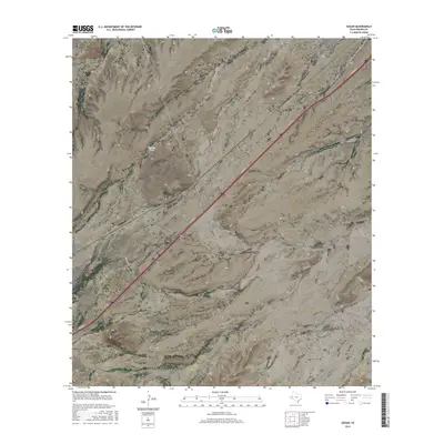
 1970 Gozar1973 Print · USGSReeves County, Texas, was a land of iron rails and ephemeral water during the early seventies. Trace the path of the Texas and Pacific railroad past ranching landmarks like the Three Inch Windmill and the settlement of Gozar.
 - 1986 Map of Pecos
 1986 Pecos1986 Print · USGSWest Texas in the mid-eighties reveals a landscape of desert draws and growing energy infrastructure centered on the Pecos River. Researchers can trace old rail lines, family burials at Mount Evergreen Cem, and rural outposts like Toyah or Saragosa.2 unique versions available
 - 2010 Map of Gozar, 2010 Print
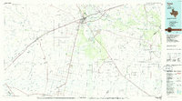
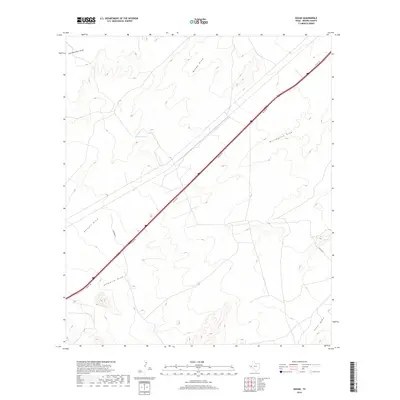
 2010 Gozar2010 Print · USGSCovers Gozar, including Old House Place, Reeves County, and other nearby areas
 - 2013 Map of Gozar, 2013 Print
 2013 Gozar2013 Print · USGSCovers Gozar, including Old House Place, Reeves County, and other nearby areas
 - 2016 Map of Gozar, 2016 Print
 2016 Gozar2016 Print · USGSCovers Gozar, including Old House Place, Reeves County, and other nearby areas
 - 2019 Map of Gozar, 2019 Print
 2019 Gozar2019 Print · USGSCovers Gozar, including Old House Place, Reeves County, and other nearby areas
 - 2022 Map of Gozar, 2022 Print
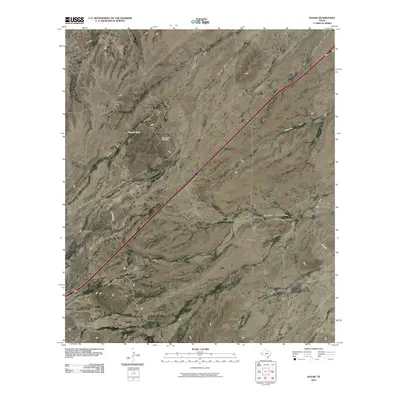
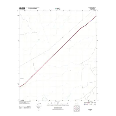
 2022 Gozar2022 Print · USGSReeves County in the early twenty-first century remains a landscape of ranching heritage and arid water systems. Trace the drainage patterns of family-named landmarks like Ramsey Tank, Billingslea Draw, and the expansive Ninemile Draw.
End of results
Showing maps 1-10 of 10
Top cities near Gozar
Frequently asked questions
- What are the different types of historical maps available for Gozar?
- What is the oldest map of Gozar?
- Where can I purchase historical maps of Gozar for my home or office?
- Where can I download high-res historical maps of Gozar?
- Are there historical topographic maps available for Gozar?
- Is there historical aerial imagery available for Gozar?
- Where are historical maps of Gozar sourced from?