1960s Maps of San Patricio County, Texas
Explore 12 historic maps of San Patricio County from the 1960s. These maps offer a rare glimpse into what life looked like during the 1960s — showing old roads, neighborhoods, homes, and landmarks that have changed or disappeared over time.
Whether you're researching your family's past, planning a metal detecting trip, or studying how San Patricio County's landscape evolved across the 1960s, these high-resolution maps are a powerful tool for exploring the history of this region.
- Focus on a specific era: All maps on this page are from the 1960s, giving you a focused view of this time period.
- See what’s changed: Compare century-old streets, trails, and buildings to today's modern landscape using overlays and satellite layers.
- Research with precision: Use these maps for genealogy, historical research, land use analysis, or educational projects.
- View, download, or print: Maps are fully viewable online in high resolution, and can be downloaded or printed for your own records.
Start exploring San Patricio County's history through authentic maps from the 1960s. This is your window into the past.
San Patricio County, TX maps
(12)- 1960 Map of Beeville
 1960 Beeville1960 Print · USGSCoastal Texas in the mid-fifties reveals a landscape of growing towns and vital military outposts like Foster AFB. Researchers can trace old rail lines including the Missouri Pacific and explore the vast Aransas National Wildlife Refuge.
 - 1960 Map of Corpus Christi
 1960 Corpus Christi1960 Print · USGSCoastal South Texas and the Nueces County hinterlands are detailed in this mid-century survey. Genealogists and historians can trace early settlement patterns and rural landmarks like Casa Blanca during a period of steady regional growth.
 - 1966 Map of Corpus Christi
 1966 Corpus Christi1966 Print · USGSThe Texas Coastal Bend in the mid-1960s reveals a landscape where massive cattle empires and strategic military bases meet the Gulf. Trace the vast reaches of King Ranch or locate aviation history at the Corpus Christi Air Station and Kingsville Air Station.
 - 1968 Map of Portland, 1971 Print
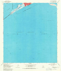 1968 Portland1971 Print · USGSCoastal Texas in the late sixties shows a landscape defined by the energy industry and maritime navigation. Trace the infrastructure of the bay, from the Causeway at Indian Point to the Gas Wells scattered near Alta Vista Reef.2 unique versions available
 - 1968 Map of Corpus Christi, 1971 Print
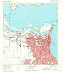 1968 Corpus Christi1971 Print · USGSCorpus Christi emerged as a major industrial and maritime center in the late sixties. Genealogists and historians can trace the development of local neighborhoods through dozens of schools, Old Bayview Cem, and the Del Mar Technical Institute.2 unique versions available
 - 1968 Map of Port Ingleside, 1971 Print
 1968 Port Ingleside1971 Print · USGSThe industrial and maritime growth of San Patricio County is captured here in the late sixties as the energy sector reshaped the coast. Genealogists and historians can trace the footprint of Ingleside, the waterfront at Port Ingleside, and the many offshore oil wells.2 unique versions available
 - 1969 Map of Taft, 1972 Print
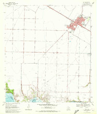 1969 Taft1972 Print · USGSCoastal Texas industry and civic life intersect in the late sixties as oil production expands around Taft. Trace local genealogy and infrastructure through the Bellevue Cem, Worsham Airfield, and the sprawling White Point Oil Field.2 unique versions available
 - 1969 Map of Annaville, 1972 Print
 1969 Annaville1972 Print · USGSCoastal Texas near the Nueces River undergoes a mid-century industrial transformation as suburban growth reaches the edge of the bay. Researchers can find old landmarks like the County Cem, the Saxet Oil Field, and the Mt Tabor Convent.3 unique versions available
 - 1969 Map of Odem, 1972 Print
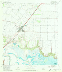 1969 Odem1972 Print · USGSCoastal Texas in the late sixties shows a landscape defined by petroleum and rail at the edge of the Gulf. Researchers can trace family history at Evergreen Cem or San Pedro Cem while mapping the reach of the Odem Oil Field.2 unique versions available
 - 1969 Map of Gregory, 1972 Print
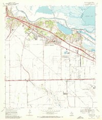
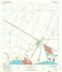 1969 Gregory1972 Print · USGSSan Patricio County’s shoreline in the late sixties shows the rise of industrial and suburban development along the bays. Genealogists and historians can trace the early layouts of Portland and Gregory, finding landmarks like Hunt Airport and Austin Sch.4 unique versions available
 - 1969 Map of Robstown, 1972 Print
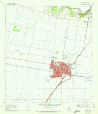 1969 Robstown1972 Print · USGSRobstown and the surrounding Nueces County coastal plains are captured here in the late sixties as a thriving rail and oil hub. Genealogists and historians can trace family-named landmarks and essential community sites like Robstown Memorial Park, Wilma Magee Sch, and the Robstown Labor Camp.3 unique versions available
 - 1969 Map of Edroy, 1972 Print
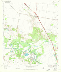 1969 Edroy1972 Print · USGSIn the late 1960s, this San Patricio County landscape was defined by the winding Nueces River and a busy energy economy. Researchers can trace family sites in Edroy, locate the Guadalupe Ch, and map the extensive Riverside Oil Field.2 unique versions available
End of results
Showing maps 1-12 of 12
Top cities of San Patricio County
- Ingleside historical maps
- Sinton historical maps
- Mathis historical maps
- Taft historical maps
- Odem historical maps
- Gregory historical maps
See more
Frequently asked questions
- What are the different types of historical maps available for San Patricio County?
- What is the oldest map of San Patricio County?
- Where can I purchase historical maps of San Patricio County for my home or office?
- Where can I download high-res historical maps of San Patricio County?
- Are there historical topographic maps available for San Patricio County?
- Is there historical aerial imagery available for San Patricio County?
- Where are historical maps of San Patricio County sourced from?