Old Maps of Tulia, Texas for Academic Research
Study the evolution of Tulia with 7 high-resolution historic maps. Whether you're teaching, researching, or modeling changes in land use, these maps provide essential visual documentation of urban, environmental, and geographic change.
- Analyze long-term change: Track patterns in development, transportation, and natural features.
- Ideal for environmental or urban studies: Support academic projects with primary historical map data.
- Use in the classroom or lab: Educators and researchers rely on these maps to bring historical context to life.
These maps are a powerful tool for teaching, research, and visualizing how Tulia has changed over the decades.
Tulia, TX maps
(7)- 1954 Map of Plainview, 1966 Print
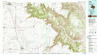
 1954 Plainview1966 Print · USGSThe Texas Panhandle and the rugged Caprock Escarpment appear in detail as the region's agricultural and rail networks reached their mid-century peak. Trace family roots and old land patterns through the canyons and plains near Plainview, Palo Duro State Park, and Childress.3 unique versions available
 - 1958 Map of Plainview
 1958 Plainview1958 Print · USGSThe High Plains and Caprock Escarpment meet in the late fifties, showcasing the ranching and rail networks of the Texas Panhandle. Trace family roots and vanished stops along the Panhandle and Santa Fe railroad through Plainview, Silverton, and Matador.
 - 1965 Map of Tulia, 1968 Print
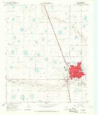 1965 Tulia1968 Print · USGSTulia is shown during a period of steady mid-century growth, anchored by its position along the Atchison Topeka and Santa Fe railroad. Genealogists and local historians can locate the Rose Hill Cemetery, Calvary Church, and the central Courthouse.2 unique versions available
 - 1968 Map of Tule Lake, 1971 Print
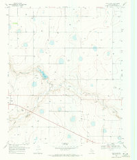 1968 Tule Lake1971 Print · USGSThe Texas Panhandle plains near Tulia come into focus in the late 1960s, a period when groundwater management and local recreation shaped the landscape. Researchers can trace the drainage of Tule Lake and find landmarks like the Rodeo Ground and the settlement of Shafer.
 - 1985 Map of Tulia
 1985 Tulia1985 Print · USGSThe Texas Panhandle in the mid-1980s displays a stark landscape where industrial agriculture meets the deep breaks of Palo Duro Canyon. Genealogists and researchers can trace rural life near Tulia or find old community centers like Vigo Park, Wayside, and Cleta.2 unique versions available
 - 2022 Map of Tule Lake, 2022 Print
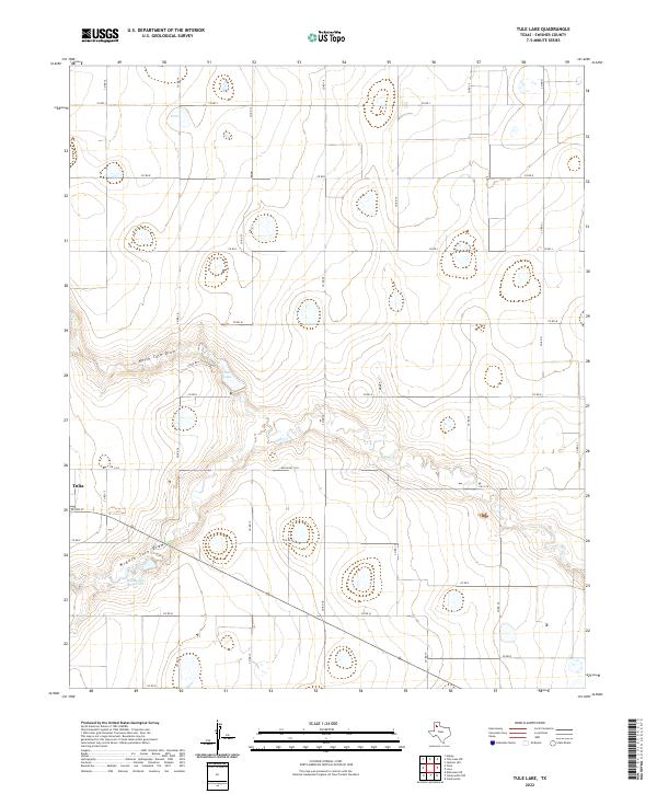 2022 Tule Lake2022 Print · USGSThe eastern outskirts of Tulia meet the expansive draws of the Texas Panhandle in the early twenty-first century. Researchers can trace the hydraulic landscape from North Tule Draw to the Bill Bivens Reservoir and the rural network of Co Rd 15.
 - 2022 Map of Tulia, 2022 Print
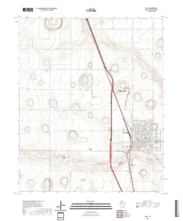 2022 Tulia2022 Print · USGSTulia and the surrounding High Plains are captured here in the early twenty-first century, showing the intersection of agriculture and aviation. Researchers can trace family sites near Rose Hill Cem or locate specific landmarks like the Swisher County Courthouse and Vaughn Farm Airport.
End of results
Showing maps 1-7 of 7
Top cities near Tulia
Frequently asked questions
- What are the different types of historical maps available for Tulia?
- What is the oldest map of Tulia?
- Where can I purchase historical maps of Tulia for my home or office?
- Where can I download high-res historical maps of Tulia?
- Are there historical topographic maps available for Tulia?
- Is there historical aerial imagery available for Tulia?
- Where are historical maps of Tulia sourced from?