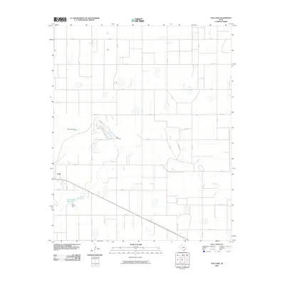
2010 Map of Tule Lake
USGS Topo · Published 2010About this map
Tulia serves as the primary anchor on the western edge of this High Plains landscape, where the town's expansion meets the agricultural grid of Swisher County. The terrain is defined by the sharp incisions of North Tule Draw and Tule Creek, which carve across the otherwise level plateau to feed into Tule Lake and the Bill Bivens Reservoir. These water bodies are managed by significant local infrastructure, including the Tule Lake Dam and Bill Bivens Dam, highlighting the critical role of water storage in this part of the Texas Panhandle. The map reveals a highly structured environment where rural life is organized along a meticulous network of county roads, such as Co RD J and Co RD 15, and the transit corridor provided by Fm 1318. This survey offers a clear view of the balance between municipal growth and the essential water-management systems required for regional ranching and farming.
Find a feature on this map
24 named features on this map. Tap any name to fly to it.
Don’t see what you’re looking for? This feature index may not catch every label — zoom into the map to look around manually.
Map Details
Editions of this 2010 Tule Lake Map
This is the sole edition of this map. No revisions or reprints were ever made.
Other maps of this area

1954 · Plainview
USGS Topo · 1:250,000

1958 · Plainview
USGS Topo · 1:250,000

1965 · Edmonson NE
USGS Topo · 1:24,000

1965 · Tulia
USGS Topo · 1:24,000

1965 · Happy
USGS Topo · 1:24,000

1968 · Tule Lake
USGS Topo · 1:24,000

1969 · Love
USGS Topo · 1:24,000

1969 · Jackson Hill
USGS Topo · 1:24,000

1969 · Claytonville
USGS Topo · 1:24,000

1969 · Tule Lake NW
USGS Topo · 1:24,000