
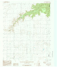
1969 Map of Tule Lake NW
USGS Topo · Published 1971About this map
The high plains of the Texas Panhandle are defined here by the seasonal drainage of Happy Draw, which cuts across the landscape near the northern border of Swisher Co. In 1969, this area remained primarily agricultural, as evidenced by the numerous water wells and Storage Bins scattered across the survey. The topography is marked by distinct depressions and playas, characteristic of this region's drainage patterns. Red dashed lines throughout the map indicate selected fence lines, providing a detailed record of land use and property boundaries during the late 1960s. The intersection of Randall Co and Armstrong Co along the northern edge shows the jurisdictional boundaries of this rural agricultural expanse.
Find a feature on this map
6 named features on this map. Tap any name to fly to it.
Don’t see what you’re looking for? This feature index may not catch every label — zoom into the map to look around manually.
Map Details
Editions of this 1969 Tule Lake NW Map
This is the sole edition of this map. No revisions or reprints were ever made.
Other maps of this area

1954 · Plainview
USGS Topo · 1:250,000

1958 · Plainview
USGS Topo · 1:250,000

1960 · Canyon
USGS Topo · 1:62,500

1960 · Wayside
USGS Topo · 1:62,500

1965 · Tulia
USGS Topo · 1:24,000

1965 · Happy
USGS Topo · 1:24,000

1968 · Tule Lake
USGS Topo · 1:24,000

1969 · Love
USGS Topo · 1:24,000

1969 · Jackson Hill
USGS Topo · 1:24,000
1984 · Wesley Point
USGS Topo · 1:24,000