1980s Maps of Tom Green County, Texas
Explore 22 historic maps of Tom Green County from the 1980s. These maps offer a rare glimpse into what life looked like during the 1980s — showing old roads, neighborhoods, homes, and landmarks that have changed or disappeared over time.
Whether you're researching your family's past, planning a metal detecting trip, or studying how Tom Green County's landscape evolved across the 1980s, these high-resolution maps are a powerful tool for exploring the history of this region.
- Focus on a specific era: All maps on this page are from the 1980s, giving you a focused view of this time period.
- See what’s changed: Compare century-old streets, trails, and buildings to today's modern landscape using overlays and satellite layers.
- Research with precision: Use these maps for genealogy, historical research, land use analysis, or educational projects.
- View, download, or print: Maps are fully viewable online in high resolution, and can be downloaded or printed for your own records.
Start exploring Tom Green County's history through authentic maps from the 1980s. This is your window into the past.
Tom Green County, TX maps
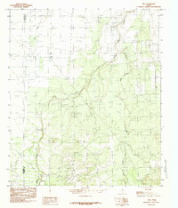
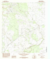
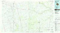
(22)- 1984 Map of Veribest
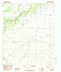 1984 Veribest1984 Print · USGSThe rural community of Veribest and the productive acreage of the Lipan Flat are captured here during the mid-seventies. Local historians can trace the vital irrigation systems of the Main Canal and the natural path of the Concho River.
 - 1984 Map of Wall
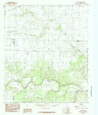
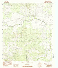
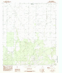 1984 Wall1984 Print · USGSTom Green County in the mid-1980s reveals a landscape defined by the vast Lipan Flat and small rural hubs like Wall. Researchers can trace the winding paths of Dry Lipan Creek and locate local landmarks such as the central Drag Strip.
 - 1984 Map of Vancourt
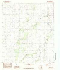
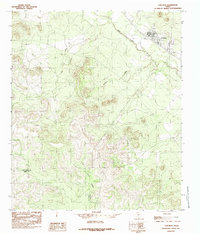
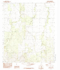 1984 Vancourt1984 Print · USGSTom Green County during the mid-1980s reveals a quiet ranching landscape centered on the rural hub of Vancourt. Genealogists and researchers can trace the seasonal flows of Lipan Creek and Hog Marsh Creek across the broad Lipan Flat.
 - 1984 Map of Knickerbocker NW
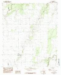
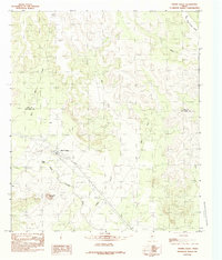
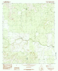 1984 Knickerbocker NW1984 Print · USGSWest Texas ranch land and river valleys are documented here in the mid-seventies, showing the rugged intersection of Irion and Tom Green counties. Genealogists and historians can trace water rights and land use along the Middle Concho River and near the Twin Buttes Reservoir.
 - 1984 Map of Pecan Station
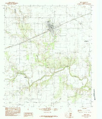
 1984 Pecan Station1984 Print · USGSTom Green County in the mid-1980s shows a landscape shaped by river systems and aviation. Genealogists and historians can trace the topography of Lipan Flat, find the local Pecan Station, and locate landmarks like Mathis Field.
 - 1984 Map of Tennyson
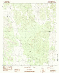
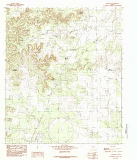 1984 Tennyson1984 Print · USGSThe West Texas ranchlands near the Coke and Tom Green county line are captured here in the early 1980s. Local historians can trace the development of Tennyson and Orient, or locate the curious circular footprint of the Test Facility near Willow Creek.
 - 1984 Map of Pecan Mott
 1984 Pecan Mott1984 Print · USGSThe borderlands of Coke and Tom Green counties are revealed in the early 1980s, centered on the ranching outpost of Pecan Mott. Trace the vital water network of the era through Buffalo Spring, Butterfield Canyon, and the headwaters of Liveoak Creek.
 - 1984 Map of Miles
 1984 Miles1984 Print · USGSRunnels and Tom Green counties are captured here in the late seventies, showing the agricultural and hydraulic development of the West Texas plains. Researchers can locate the community of Miles, trace the Main Canal near Veribest, and find river crossings at Mullins Crossing.
 - 1984 Map of Knickerbocker
 1984 Knickerbocker1984 Print · USGSTom Green County was navigating a period of hydraulic and aerial expansion in the early eighties. Genealogists and historians can trace the Knickerbocker settlement and its Cem alongside landmarks like Mathis Field and Twin Buttes Reservoir.
 - 1984 Map of Miles NW
 1984 Miles NW1984 Print · USGSThe West Texas ranchlands where Coke, Runnels, and Tom Green counties meet are captured here as they appeared in the late 1970s. Researchers can trace the winding course of the Colorado River or locate local landmarks like the UIG Pipeline and Antelope Creek.
 - 1984 Map of Vick
 1984 Vick1984 Print · USGSThe rural borderlands of Tom Green and Concho counties are captured here in the mid-1980s. Researchers can trace the watercourses of Kickapoo Creek and Frog Pond Creek near the small settlement of Vick, or locate local landmarks like Dry Hollow.
 - 1984 Map of Murph Draw
 1984 Murph Draw1984 Print · USGSThe Tom Green and Coke County line area in the mid-eighties shows a landscape of historic transit and deep draws. Researchers can trace the path of the Butterfield Trail and locate local landmarks like Ruby Point and Bean Hill.
 - 1984 Map of Lowake
 1984 Lowake1984 Print · USGSThe tri-county junction of Tom Green, Runnels, and Concho Counties is captured here in the mid-1980s. Researchers can trace the rural landscape of Lowake and find specific landmarks like the Coline Marker, Chandler Lake, and agricultural Storage Bins.
 - 1984 Map of Mereta
 1984 Mereta1984 Print · USGSThe plains of Tom Green County are captured here in the mid-eighties, showing the settlement at Mereta and the vast Lipan Flat. Genealogists and researchers can trace the routes of Ninemile Creek and Hog Marsh Creek or locate the local Main Canal.
 - 1984 Map of Harriet
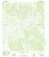
 1984 Harriet1984 Print · USGSThe rural landscape of Tom Green County during the mid-eighties shows a world of ranchland and river drainages. Genealogists and researchers can trace the vicinity of Harriet and landmarks like Rattle Snake Hill, the Test Facility, and the banks of the Concho River.
 - 1984 Map of Tankersley
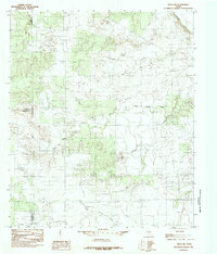
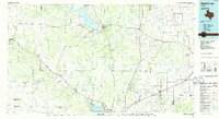
 1984 Tankersley1984 Print · USGSTom Green County in the mid-1980s shows a landscape defined by the intersection of riparian corridors and county boundaries. Researchers can trace the layout of Tankersley and the upper reaches of Twin Buttes Reservoir and Spring Creek.
 - 1984 Map of Carlsbad
 1984 Carlsbad1984 Print · USGSThe West Texas landscape near the Tom Green and Irion county line comes into focus during the mid-1980s. Researchers can trace the river-bound settlement of Carlsbad and locate industrial Gravel Pits along the banks of the North Concho River.
 - 1984 Map of Eola
 1984 Eola1984 Print · USGSConcho County ranching and infrastructure are well-documented in the mid-1970s as the community of Eola serves as a local hub. Genealogists and land researchers can trace property boundaries near Dry Hollow, Lipan Creek, and the county line.
 - 1984 Map of Water Valley
 1984 Water Valley1984 Print · USGSNorth Concho River ranchlands are captured here in the mid-1980s as they bridge the Tom Green and Coke County line. Local historians can trace the settlement at Water Valley, search for family roots at the Cem, and locate landmarks like Mc Laughlin Mountain.
 - 1986 Map of Lacy Creek
 1986 Lacy Creek1986 Print · USGSGlasscock County and its surrounding West Texas neighbors are shown during the mid-1980s oil boom. Local historians can trace the expansive OIL FIELD networks surrounding Garden City and Saint Lawrence or locate landmarks like White Lake and Midkiff.2 unique versions available
 - 1986 Map of San Angelo
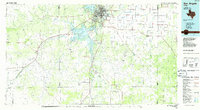 1986 San Angelo1986 Print · USGSSan Angelo and the Concho Valley appear here in the mid-1980s as a landscape shaped by massive reservoirs and a thriving energy industry. Researchers can trace the Atchison Topeka and Santa Fe rail line past Knickerbocker and explore the sprawling Oil and Gas Fields of the western plains.2 unique versions available
 - 1986 Map of Robert Lee
 1986 Robert Lee1986 Print · USGSWest Texas ranching and oil country come into focus in the mid-eighties as the E V Spence Reservoir reshapes the landscape near Robert Lee. Researchers can trace the path of the Atchison Topeka and Santa Fe railroad through Rowena or locate the historic Fort Chadbourne.2 unique versions available
End of results
Showing maps 1-22 of 22
Top cities of Tom Green County
Frequently asked questions
- What are the different types of historical maps available for Tom Green County?
- What is the oldest map of Tom Green County?
- Where can I purchase historical maps of Tom Green County for my home or office?
- Where can I download high-res historical maps of Tom Green County?
- Are there historical topographic maps available for Tom Green County?
- Is there historical aerial imagery available for Tom Green County?
- Where are historical maps of Tom Green County sourced from?