Old Maps of Austin, Texas for Academic Research
Study the evolution of Austin with 131 high-resolution historic maps. Whether you're teaching, researching, or modeling changes in land use, these maps provide essential visual documentation of urban, environmental, and geographic change.
- Analyze long-term change: Track patterns in development, transportation, and natural features.
- Ideal for environmental or urban studies: Support academic projects with primary historical map data.
- Use in the classroom or lab: Educators and researchers rely on these maps to bring historical context to life.
These maps are a powerful tool for teaching, research, and visualizing how Austin has changed over the decades.
Austin, TX maps
(131)- 1893 Map of Georgetown
 1893 Georgetown1893 Print · USGSCentral Texas in the late 1800s was a landscape in flux as rail lines reshaped old frontier settlements. Genealogists can trace the shift from riverside villages like Bagdad and Old Round Rock to new rail hubs such as Leander and Hutto.5 unique versions available
 - 1896 Map of Austin
 1896 Austin1896 Print · USGSAustin and its surrounding counties are shown in the mid-1890s, capturing the transition from frontier river crossings to a rail-centered regional hub. Researchers can trace historic river access points like Cameron Ferry alongside vanished landmarks such as Johnson's Institute and Moore & Berry's Store.
 - 1897 Map of Austin
 1897 Austin1897 Print · USGSTexas in the late 1890s reveals a capital city defined by its river and an expanding railroad network. Genealogists and historians can trace family-named landmarks and early centers of learning like Saint Edward's College, Johnson's Institute, and Anderson Mill.
 - 1910 Map of Austin
 1910 Austin1910 Print · USGSAustin and the surrounding Travis County hill country are captured here at the start of the twentieth century. Genealogists and researchers can locate pioneer landmarks like Anderson Mill, Mc.Kinney Falls, and numerous river crossings including Lohmann Ford.3 unique versions available
 - 1928 Map of Round Rock
 1928 Round Rock1928 Print · USGSWilliamson County in the mid-twenties shows a landscape of developing rail hubs and scattered rural school districts. Genealogists can locate family landmarks like Bell Gin, Old Round Rock, and the Strickland Grove Church.2 unique versions available
 - 1930 Map of Austin-2
 1930 Austin-21930 Print · USGSThe winding loops of the Colorado River dominate this 1930 survey of Travis County before the era of major dams. Researchers can trace early crossings like Stewart Ford and locate local landmarks such as the Jack Sch and Ch.
 - 1932 Map of Mt. Bonnell
 1932 Mt. Bonnell1932 Print · USGSThe meanders of the Texas Hill Country are captured here in the early 1930s, just before the landscape was transformed by dam construction. You can trace early river life through multiple historical crossings like Lohmann Ford and rural sites like Cox Spring Sch.2 unique versions available
 - 1949 Map of Round Rock, 1967 Print
 1949 Round Rock1967 Print · USGSCentral Texas in the late 1940s reveals a landscape defined by cotton ginning and the heavy influence of competing rail lines. Genealogists can locate family landmarks like Palm Valley Ch, the Bell Gin, and rural schools such as Palacky Sch or Bell Sch.2 unique versions available
 - 1951 Map of Round Rock
 1951 Round Rock1951 Print · USGSWilliamson County at mid-century reveals a landscape of thriving rural communities and intersecting rail lines before the era of modern suburban expansion. Local researchers can pinpoint family landmarks like Palm Valley Ch, trace the old settlement at Old Round Rock, or locate the Bell Gin.
 - 1954 Map of Austin East, 1956 Print
 1954 Austin East1956 Print · USGSMid-century Austin is captured here during a time of significant institutional and residential growth. Genealogists and researchers can trace family landmarks like Oakwood Cemetery, the Fiskville Cemetery, and old schools like Anderson High Sch.
 - 1954 Map of Austin West, 1956 Print
 1954 Austin West1956 Print · USGSMid-century Austin is captured here as the city expanded westward toward the hills and the winding Colorado River. Researchers can trace the layout of Camp Mabry, the historic Texas Confederate Home, and the original footprint of Zilker Park near Barton Springs.
 - 1954 Map of Austin, 1964 Print
 1954 Austin1964 Print · USGSCentral Texas is captured during a period of steady growth as the capital city and its neighboring farm towns began to modernize. Researchers can trace historic rail corridors like the Southern Pacific RR or locate landmarks such as Bergstrom Air Force Base and Pilot Knob.4 unique versions available
 - 1955 Map of Montopolis, 1956 Print
 1955 Montopolis1956 Print · USGSSoutheast Travis County shows its rural roots in the mid-fifties as the capital begins to expand toward the Colorado River. Genealogy researchers can locate family landmarks like Moores Crossing, Pilot Knob Sch, and the historic Salem Ch.2 unique versions available
 - 1955 Map of Oak Hill, 1956 Print
 1955 Oak Hill1956 Print · USGSSouthwest of Austin in the mid-fifties, this area shows a landscape of rural schoolhouses and family farms before the suburban boom. Genealogists can locate family landmarks like the Oak Hill Cem, the St Elmo Sch (Aband), and the Kenchion settlement.
 - 1955 Map of Montopolis, 1956 Print
 1955 Montopolis1956 Print · USGSThe area southeast of Austin in the mid-fifties reveals a transition from river-bottom farming to active resource extraction. Researchers can locate family landmarks such as Assumption Cemetery, the Elroy Oil Field, and rural centers like Moores Crossing.2 unique versions available
 - 1955 Map of Austin, 1956 Print
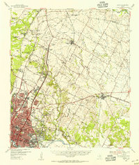 1955 Austin1956 Print · USGSAustin and its northern Travis County neighbors appear here in the mid-1950s, just as suburban growth began to reach toward the Williamson County line. Researchers can trace historic family locations and vanished institutions like the Travis County Tuberculosis Sanitarium, McNeil, and New Sweden.
 - 1958 Map of Buda, 1960 Print
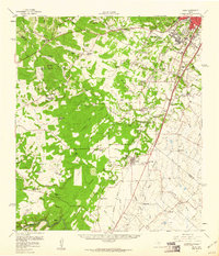 1958 Buda1960 Print · USGSBuda and the southern reaches of Travis and Hays Counties are seen here in the late fifties during a period of steady ranching and early suburban growth. Genealogists and local historians can trace family ranch lands and historic sites like Science Hall, Goforth, and the Old San Antonio Road.2 unique versions available
 - 1959 Map of Lake Travis, 1960 Print
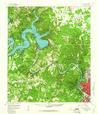 1959 Lake Travis1960 Print · USGSThe Texas Hill Country and the Highland Lakes are captured here during a period of steady growth and ranching. Genealogists can trace early landmarks and family sites like Pond Springs Cem, the Trading Post near Bee Cave, and Schulze Ranch.5 unique versions available
 - 1962 Map of Leander, 1966 Print
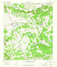 1962 Leander1966 Print · USGSCentral Texas settlements and Hill Country ranch land thrive along the rail line during the early sixties. Genealogists can trace family names at Bagdad Cem and White Stone, or locate the Independent Sch near the Southern Pacific tracks.4 unique versions available
 - 1966 Map of Oak Hill, 1969 Print
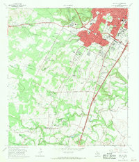 1966 Oak Hill1969 Print · USGSSouthwest Austin was undergoing a transformation in the late sixties as suburban development reached into Travis County. Researchers can trace early family sites and rural landmarks like Kineheonville, Manchaca, and Williamson Creek Cem.2 unique versions available
 - 1966 Map of Austin East, 1969 Print
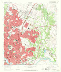 1966 Austin East1969 Print · USGSMid-century Austin is captured here during a season of significant urban growth and institutional expansion. Local researchers can trace the historic grounds of the University of Texas, the former Robert Mueller Municipal Airport, and the French Embassy.3 unique versions available
 - 1966 Map of Austin West, 1969 Print
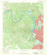 1966 Austin West1969 Print · USGSThe hills west of the capital come alive in the mid-sixties as West Lake Hills and Rollingwood develop along the Colorado River. Trace the path of the Missouri Pacific railroad or locate historic sites like Treaty Oak and Breece Cem.4 unique versions available
 - 1966 Map of Montopolis, 1970 Print
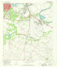 1966 Montopolis1970 Print · USGSSoutheast Austin and the Colorado River corridor are captured here during the mid-sixties as the city began to edge toward the surrounding farmland. Genealogists and local historians can locate early landmarks such as Burdett Prairie Cem, Moores Crossing, and the sprawling Bergstrom Air Force Base.
 - 1968 Map of Signal Hill, 1971 Print
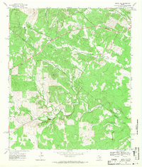 1968 Signal Hill1971 Print · USGSTexas ranching life and early suburban development converge on the Travis and Hays county line during the late sixties. Researchers can trace family landmarks like Cedar Valley, Oliver Cem, and legacy properties such as Signal Hill Ranch.3 unique versions available
 - 1968 Map of Mansfield Dam, 1971 Print
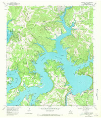 1968 Mansfield Dam1971 Print · USGSThe Travis County hill country is captured here in the late sixties as recreational growth transforms the landscape around Lake Travis. Researchers can trace local heritage at Simpson Cem or explore the development of Jonestown, Volente, and Hudson Bend.3 unique versions available
Showing maps 1-25 of 131
Top cities near Austin
- Round Rock historical maps
- Pflugerville historical maps
- Cedar Park historical maps
- Hutto historical maps
- Leander historical maps
- Lakeway historical maps
See more
Top neighborhoods of Austin
- Sprinkle Corner historical maps
- Jollyville historical maps
- Avery Ranch historical maps
- Windsor Park historical maps
- Bouldin historical maps
- Broadacres historical maps
See more
Frequently asked questions
- What are the different types of historical maps available for Austin?
- What is the oldest map of Austin?
- Where can I purchase historical maps of Austin for my home or office?
- Where can I download high-res historical maps of Austin?
- Are there historical topographic maps available for Austin?
- Is there historical aerial imagery available for Austin?
- Where are historical maps of Austin sourced from?