Old Maps of Allandale, Austin for Academic Research
Study the evolution of Allandale with 24 high-resolution historic maps. Whether you're teaching, researching, or modeling changes in land use, these maps provide essential visual documentation of urban, environmental, and geographic change.
- Analyze long-term change: Track patterns in development, transportation, and natural features.
- Ideal for environmental or urban studies: Support academic projects with primary historical map data.
- Use in the classroom or lab: Educators and researchers rely on these maps to bring historical context to life.
These maps are a powerful tool for teaching, research, and visualizing how Allandale has changed over the decades.
Allandale, Austin maps
(24)- 1896 Map of Austin
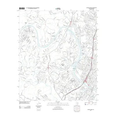
 1896 Austin1896 Print · USGSAustin and its surrounding counties are shown in the mid-1890s, capturing the transition from frontier river crossings to a rail-centered regional hub. Researchers can trace historic river access points like Cameron Ferry alongside vanished landmarks such as Johnson's Institute and Moore & Berry's Store.
 - 1897 Map of Austin
 1897 Austin1897 Print · USGSTexas in the late 1890s reveals a capital city defined by its river and an expanding railroad network. Genealogists and historians can trace family-named landmarks and early centers of learning like Saint Edward's College, Johnson's Institute, and Anderson Mill.
 - 1910 Map of Austin
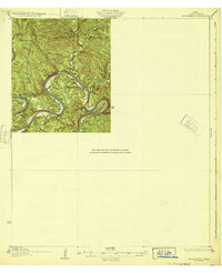
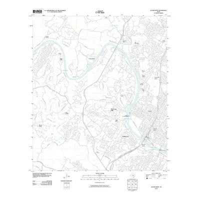
 1910 Austin1910 Print · USGSAustin and the surrounding Travis County hill country are captured here at the start of the twentieth century. Genealogists and researchers can locate pioneer landmarks like Anderson Mill, Mc.Kinney Falls, and numerous river crossings including Lohmann Ford.3 unique versions available
 - 1932 Map of Mt. Bonnell
 1932 Mt. Bonnell1932 Print · USGSThe meanders of the Texas Hill Country are captured here in the early 1930s, just before the landscape was transformed by dam construction. You can trace early river life through multiple historical crossings like Lohmann Ford and rural sites like Cox Spring Sch.2 unique versions available
 - 1954 Map of Austin East, 1956 Print
 1954 Austin East1956 Print · USGSMid-century Austin is captured here during a time of significant institutional and residential growth. Genealogists and researchers can trace family landmarks like Oakwood Cemetery, the Fiskville Cemetery, and old schools like Anderson High Sch.
 - 1954 Map of Austin West, 1956 Print
 1954 Austin West1956 Print · USGSMid-century Austin is captured here as the city expanded westward toward the hills and the winding Colorado River. Researchers can trace the layout of Camp Mabry, the historic Texas Confederate Home, and the original footprint of Zilker Park near Barton Springs.
 - 1954 Map of Austin, 1964 Print
 1954 Austin1964 Print · USGSCentral Texas is captured during a period of steady growth as the capital city and its neighboring farm towns began to modernize. Researchers can trace historic rail corridors like the Southern Pacific RR or locate landmarks such as Bergstrom Air Force Base and Pilot Knob.4 unique versions available
 - 1955 Map of Austin, 1956 Print
 1955 Austin1956 Print · USGSAustin and its northern Travis County neighbors appear here in the mid-1950s, just as suburban growth began to reach toward the Williamson County line. Researchers can trace historic family locations and vanished institutions like the Travis County Tuberculosis Sanitarium, McNeil, and New Sweden.
 - 1959 Map of Lake Travis, 1960 Print
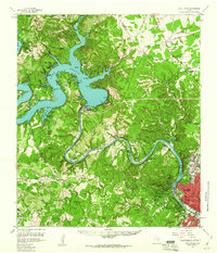 1959 Lake Travis1960 Print · USGSThe Texas Hill Country and the Highland Lakes are captured here during a period of steady growth and ranching. Genealogists can trace early landmarks and family sites like Pond Springs Cem, the Trading Post near Bee Cave, and Schulze Ranch.5 unique versions available
 - 1966 Map of Austin East, 1969 Print
 1966 Austin East1969 Print · USGSMid-century Austin is captured here during a season of significant urban growth and institutional expansion. Local researchers can trace the historic grounds of the University of Texas, the former Robert Mueller Municipal Airport, and the French Embassy.3 unique versions available
 - 1966 Map of Austin West, 1969 Print
 1966 Austin West1969 Print · USGSThe hills west of the capital come alive in the mid-sixties as West Lake Hills and Rollingwood develop along the Colorado River. Trace the path of the Missouri Pacific railroad or locate historic sites like Treaty Oak and Breece Cem.4 unique versions available
 - 1985 Map of Austin
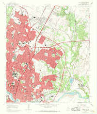
 1985 Austin1985 Print · USGSCentral Texas in the mid-eighties reveals a region in transition, balancing rapid urban growth in Austin with deep-rooted rural landscapes. Genealogists and historians can trace family locations near St Johns Ch, the Science Hall schoolhouse, and long-standing communities like Webberville and Manchaca.3 unique versions available
 - 1988 Map of Austin East
 1988 Austin East1988 Print · USGSAustin and its eastern environs are captured during a period of significant growth in the late eighties. Researchers can trace the layout of Huston-Tillotson College, find family markers in Oakwood Cemetery, or locate the rural crossroads of Sprinkle.2 unique versions available
 - 1988 Map of Austin West
 1988 Austin West1988 Print · USGSWestern Austin and the Colorado River corridor are captured here in the late eighties as suburban growth reshaped the Hill Country. Locate local heritage sites like Preece Cem, the heights of Mount Bonnell, and the sprawling Zilker Park.
 - 2010 Map of Austin East, 2010 Print
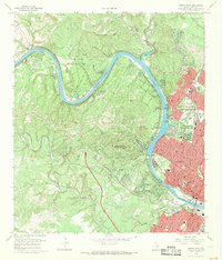
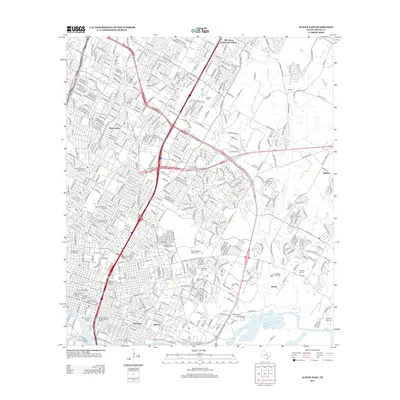
 2010 Austin East2010 Print · USGSCovers Allandale, including Austin, Sprinkle Corner, and other nearby areas
 - 2010 Map of Austin West, 2010 Print
 2010 Austin West2010 Print · USGSCovers Allandale, including Austin, West Lake Hills, and other nearby areas
 - 2013 Map of Austin East, 2013 Print
 2013 Austin East2013 Print · USGSCovers Allandale, including Austin, Sprinkle Corner, and other nearby areas
 - 2013 Map of Austin West, 2013 Print
 2013 Austin West2013 Print · USGSCovers Allandale, including Austin, West Lake Hills, and other nearby areas
 - 2016 Map of Austin East, 2016 Print
 2016 Austin East2016 Print · USGSCovers Allandale, including Austin, Sprinkle Corner, and other nearby areas
 - 2016 Map of Austin West, 2016 Print
 2016 Austin West2016 Print · USGSCovers Allandale, including Austin, West Lake Hills, and other nearby areas
 - 2019 Map of Austin East, 2019 Print
 2019 Austin East2019 Print · USGSCovers Allandale, including Austin, Sprinkle Corner, and other nearby areas
 - 2019 Map of Austin West, 2019 Print
 2019 Austin West2019 Print · USGSCovers Allandale, including Austin, West Lake Hills, and other nearby areas
 - 2022 Map of Austin West, 2022 Print
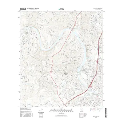
 2022 Austin West2022 Print · USGSThe hill country west of Austin comes into focus in this recent survey of the Colorado River corridor. Genealogists can trace family landmarks at Austin Memorial Park Cem and Brown Cem, or locate historic water sources like Deep Eddy Spring and Barton Springs.
 - 2022 Map of Austin East, 2022 Print
 2022 Austin East2022 Print · USGSEast Austin at the start of the 2020s shows a landscape of deep-rooted neighborhoods and major institutional centers. Researchers can trace historic burial sites like Oakwood Cem and Evergreen Cem or locate the campuses of Huston Tillotson University and The University of Texas at Austin.
End of results
Showing maps 1-24 of 24
Frequently asked questions
- What are the different types of historical maps available for Allandale?
- What is the oldest map of Allandale?
- Where can I purchase historical maps of Allandale for my home or office?
- Where can I download high-res historical maps of Allandale?
- Are there historical topographic maps available for Allandale?
- Is there historical aerial imagery available for Allandale?
- Where are historical maps of Allandale sourced from?