1970s Maps of Upton County, Texas
Explore 20 historic maps of Upton County from the 1970s. These maps offer a rare glimpse into what life looked like during the 1970s — showing old roads, neighborhoods, homes, and landmarks that have changed or disappeared over time.
Whether you're researching your family's past, planning a metal detecting trip, or studying how Upton County's landscape evolved across the 1970s, these high-resolution maps are a powerful tool for exploring the history of this region.
- Focus on a specific era: All maps on this page are from the 1970s, giving you a focused view of this time period.
- See what’s changed: Compare century-old streets, trails, and buildings to today's modern landscape using overlays and satellite layers.
- Research with precision: Use these maps for genealogy, historical research, land use analysis, or educational projects.
- View, download, or print: Maps are fully viewable online in high resolution, and can be downloaded or printed for your own records.
Start exploring Upton County's history through authentic maps from the 1970s. This is your window into the past.
Upton County, TX maps
(20)- 1970 Map of Sevenmile Corner NE, 1972 Print
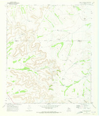
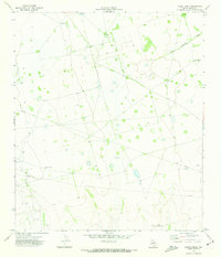
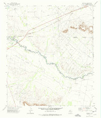
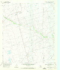 1970 Sevenmile Corner NE1972 Print · USGSThe Upton and Reagan County line comes alive in the 1970s as a hub of energy production. Trace the industrial footprint of the Benedum Oil Field through its network of Oil Wells, Pumping Sta, and the High Lonesome Draw.
 - 1970 Map of Lindsey Ranch, 1972 Print
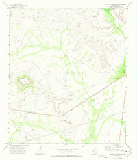
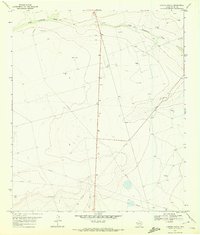 1970 Lindsey Ranch1972 Print · USGSUpton County at the start of the 1970s reveals a West Texas landscape defined by the oil industry and ranching life. Genealogists and industrial historians can trace a PIPELINE network through Lindsey Ranch or locate an Oil Well along High Lonesome Draw.
 - 1970 Map of Sevenmile Corner SE, 1973 Print
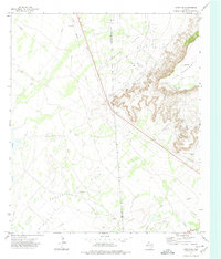
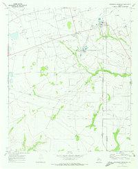 1970 Sevenmile Corner SE1973 Print · USGSUpton and Reagan counties in the early 1970s show the peak of the West Texas petroleum boom. Researchers can trace the industrial footprint of the Benedum Oil Field, including Benedum Camp, a Refinery, and the Atchison Topeka and Santa Fe railroad.
 - 1970 Map of Rankin SE, 1973 Print
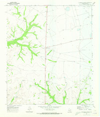
 1970 Rankin SE1973 Print · USGSThe West Texas ranchlands at the start of the 1970s are captured here, centered on the Noelke Ranch and its vital water infrastructure. Researchers can trace family-named landmarks like Schlinke Windmill and remote features like Lost Tank.3 unique versions available
 - 1970 Map of Cedar Canyon, 1973 Print
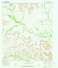
 1970 Cedar Canyon1973 Print · USGSThe West Texas borderlands of Upton and Crockett counties are seen here in the early 1970s, defined by ranching infrastructure and mineral surveys. Trace the landscape of family-named water sources like Munro Windmill and landmarks such as Cedar Hill.
 - 1970 Map of Sevenmile Corner, 1973 Print
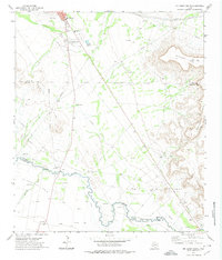
 1970 Sevenmile Corner1973 Print · USGSUpton County ranching and oil exploration intersect in this 1970s survey of the West Texas plains. Genealogists and historians can trace the remnants of Upland or locate family landmarks such as Tippet Ranch and the Joe Bailey Windmill.2 unique versions available
 - 1970 Map of Rankin NE, 1973 Print
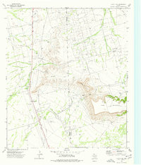
 1970 Rankin NE1973 Print · USGSUpton and Reagan Counties are captured here in the early 1970s during a period of active resource extraction and cattle ranching. Researchers can trace the Flat Rock Oil Field, the Atchison Topeka and Santa Fe rail line, and family-named landmarks like Flat Rock Ranch.
 - 1970 Map of Rankin, 1973 Print
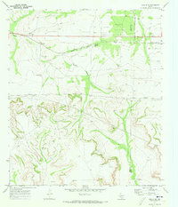
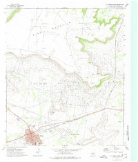
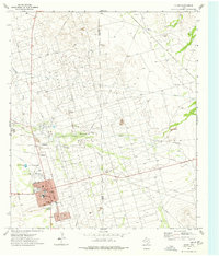
 1970 Rankin1973 Print · USGSRankin at the start of the 1970s was a bustling West Texas rail and oil hub where the Santa Fe line met the Upton County plains. Genealogists and researchers can locate the Rankin Cem, the Duo Day Arena, and remote landmarks like Taylor Windmill.2 unique versions available
 - 1971 Map of Hanks Ranch, 1973 Print
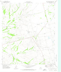
 1971 Hanks Ranch1973 Print · USGSUpton County ranching and oil production are captured here in the early seventies, showing a landscape shaped by resource extraction. Researchers can trace the industrial footprint of the Hazel Oil Field and landmarks like the Middle Underwood Windmill.
 - 1971 Map of McElroy Ranch, 1973 Print
 1971 McElroy Ranch1973 Print · USGSUpton County ranching lands were being reshaped by the energy industry during the early seventies. Researchers can trace the development of the Wilshire Oil Field and the Jack Herbert Oil Field alongside the McElroy Ranch.
 - 1971 Map of Marlboro Canyon SE, 1974 Print
 1971 Marlboro Canyon SE1974 Print · USGSUpton County ranching and oil production meet in the early seventies, where industrial pipelines cross the arid landscape. Genealogists and historians can trace the locations of named landmarks like High Lonesome Windmill, China Draw, and the Amacker Tippett Oil Field.
 - 1971 Map of Marlboro Canyon, 1974 Print
 1971 Marlboro Canyon1974 Print · USGSThe West Texas ranching and oil landscape of Upton County is captured here in the early seventies, centered on the massive King Mountain plateau. Researchers can trace the industrial footprint of the Willrode Oil Field and find specific family-named landmarks like the Eddelman Windmill.
 - 1972 Map of Girvin NE, 1974 Print
 1972 Girvin NE1974 Print · USGSThe Texas Permian Basin is captured here in the early 1970s at the height of its mid-century energy production. Researchers can trace the extensive network of the Roberdeau Oil Field, the AT & SF railroad, and landmarks like Soda Lake.
 - 1972 Map of McCamey South, 1974 Print
 1972 McCamey South1974 Print · USGSThe West Texas oil and cattle country near the Pecos River is captured here in the early 1970s. Researchers can locate family landmarks like the Patton Ranch, trace the historic Old Spanish Ditch, or study the industrial footprint of the Tippett Oil Field.
 - 1972 Map of Table Top Mountain, 1974 Print
 1972 Table Top Mountain1974 Print · USGSCrockett and Upton counties are mapped in the early 1970s, showcasing the high-desert energy economy and ranching life. Genealogists and historians can trace the Kelton Ranch and Tippett sites alongside the extensive workings of the Crockett Oil Field.
 - 1972 Map of McCamey North, 1974 Print
 1972 McCamey North1974 Print · USGSMcCamey and the surrounding oil patches of Upton County are shown in detail during the early 1970s. Researchers can trace the industrial landscape of the Mesa Tank Farm or locate local landmarks like the Drive-in Theater and Garden of Memories (Cemetery).
 - 1972 Map of Girvin SE, 1975 Print
 1972 Girvin SE1975 Print · USGSThe Pecos River valley in the early seventies shows a landscape deeply shaped by the oil industry and ranching. Genealogists and historians can trace family land at Johnson Ranch, find old transit points like Adobe Crossing, and follow the Atchison Topeka and Santa Fe railroad.
 - 1972 Map of Square Top Mountain, 1975 Print
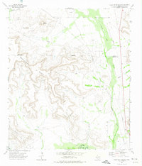
 1972 Square Top Mountain1975 Print · USGSUpton County during the early 1970s shows a landscape defined by the energy industry and rugged landmarks like Square Top Mountain. Researchers can trace the Atchison Topeka and Santa Fe rail line and numerous Oil Wells and pipelines.
 - 1974 Map of Crane, 1977 Print
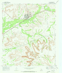
 1974 Crane1977 Print · USGSThe Permian Basin oil economy is on full display in the mid-1970s as the McElroy Oil Field surrounds the town of Crane. Researchers can trace old pipelines, the County Airport, and schools like Crane-Bethune Sch.
 - 1974 Map of Castle Gap, 1977 Print
 1974 Castle Gap1977 Print · USGSThe Permian Basin landscape near the Crane and Upton County border in the mid-seventies is defined by industrial energy and historic passes. Trace the famous Castle Gap near King Mountain and find local landmarks like County South Cem.
End of results
Showing maps 1-20 of 20
Top cities of Upton County
Frequently asked questions
- What are the different types of historical maps available for Upton County?
- What is the oldest map of Upton County?
- Where can I purchase historical maps of Upton County for my home or office?
- Where can I download high-res historical maps of Upton County?
- Are there historical topographic maps available for Upton County?
- Is there historical aerial imagery available for Upton County?
- Where are historical maps of Upton County sourced from?