1960s Maps of Upton County, Texas
Explore 11 historic maps of Upton County from the 1960s. These maps offer a rare glimpse into what life looked like during the 1960s — showing old roads, neighborhoods, homes, and landmarks that have changed or disappeared over time.
Whether you're researching your family's past, planning a metal detecting trip, or studying how Upton County's landscape evolved across the 1960s, these high-resolution maps are a powerful tool for exploring the history of this region.
- Focus on a specific era: All maps on this page are from the 1960s, giving you a focused view of this time period.
- See what’s changed: Compare century-old streets, trails, and buildings to today's modern landscape using overlays and satellite layers.
- Research with precision: Use these maps for genealogy, historical research, land use analysis, or educational projects.
- View, download, or print: Maps are fully viewable online in high resolution, and can be downloaded or printed for your own records.
Start exploring Upton County's history through authentic maps from the 1960s. This is your window into the past.
Upton County, TX maps
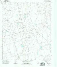
(11)- 1964 Map of Perkins Lake, 1967 Print
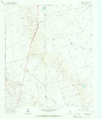 1964 Perkins Lake1967 Print · USGSThe Permian Basin oil and ranching landscape of the 1960s is meticulously detailed at the Crane and Upton county line. Researchers can trace historic ranch properties like the Glass and Everitt Ranch and dozens of family-named landmarks including Denson Windmills and Pee Wee Windmill.
 - 1965 Map of San Angelo
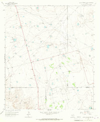
 1965 San Angelo1965 Print · USGSWest Texas in the mid-sixties reveals a landscape shaped by the petroleum industry and strategic water management. Genealogists and historians can trace the rail corridor through Texon and Big Lake, or locate military landmarks like Goodfellow AFB and Broome Air Force Auxiliary Airfield.
 - 1965 Map of South Cowden Ranch, 1967 Print
 1965 South Cowden Ranch1967 Print · USGSThe West Texas range meets the mid-century oil boom in the mid-1960s, where vast energy fields intersect with historic cattle operations. Genealogists and historians can trace ranch boundaries and water sources like South Cowden Ranch, Hillbilly Windmill, and Railway Ranch.2 unique versions available
 - 1967 Map of Midkiff, 1970 Print
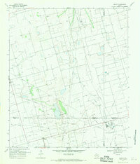 1967 Midkiff1970 Print · USGSMidland and Upton counties are shown during a peak of mid-century industrial growth. Local historians can trace energy development through the Midkiff settlement, the Midkiff Gas Plant, and a sprawling network of Oil Wells.2 unique versions available
 - 1968 Map of Benge Corner SE, 1970 Print
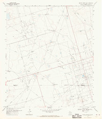
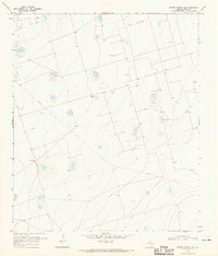 1968 Benge Corner SE1970 Print · USGSThe Permian Basin oil boom is on full display in this late 1960s survey of Upton County. Genealogists and industrial historians can trace ranching and energy operations through the Cross L Ranch, the Pegasus Oil Field, and the Tree Windmill.
 - 1968 Map of Benge Corner NW, 1970 Print
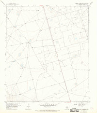
 1968 Benge Corner NW1970 Print · USGSMidland and Upton counties are shown during the late 1960s as a high-density network of oil production and pipelines began to transform the ranching landscape. Trace the industrial footprint of the Pegasus Oil Field and Sweetie Peck Plant alongside family landmarks like Hatley Windmill.
 - 1968 Map of Midkiff NW, 1970 Print
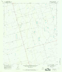
 1968 Midkiff NW1970 Print · USGSThe Permian Basin oil fields on the Midland County and Upton County border appear in the late sixties as a dense network of energy infrastructure. Trace the early industrial footprint of Midkiff Camp, Oil Wells, and the Johnson Draw drainage.
 - 1968 Map of Benge Corner SW, 1970 Print
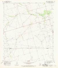
 1968 Benge Corner SW1970 Print · USGSUpton County was deep in the mid-century petroleum boom when this survey was conducted. You can trace the complex infrastructure of the Pegasus Oil Field and Davis Oil Field or locate ranching landmarks like Barr Ranch.
 - 1968 Map of Midkiff SW, 1970 Print
 1968 Midkiff SW1970 Print · USGSUpton County during the late sixties presents a landscape of industrial extraction and wide-open West Texas ranch land. Researchers can trace the proliferation of the petroleum industry through numerous Oil Wells, industrial Gravel Pits, and the isolated Roadside Park.2 unique versions available
 - 1968 Map of Benge Corner, 1970 Print
 1968 Benge Corner1970 Print · USGSThe West Texas plains at the edge of the Permian Basin are captured here during the late 1960s oil boom. Genealogists and industrial historians can trace the intersection of Benge Corner, the extensive Pegasus Oil Field, and the Johnson Draw drainage.
 - 1968 Map of Midkiff SE, 1970 Print
 1968 Midkiff SE1970 Print · USGSThe West Texas oil boom and ranching traditions meet in the late sixties along the Upton and Reagan County line. Researchers can trace the industrial footprint of the Oil Field and find family-named landmarks like the Barrett Ranch.
End of results
Showing maps 1-11 of 11
Top cities of Upton County
Frequently asked questions
- What are the different types of historical maps available for Upton County?
- What is the oldest map of Upton County?
- Where can I purchase historical maps of Upton County for my home or office?
- Where can I download high-res historical maps of Upton County?
- Are there historical topographic maps available for Upton County?
- Is there historical aerial imagery available for Upton County?
- Where are historical maps of Upton County sourced from?