Old Maps of Corner Windmill, Texas for Hiking & Exploration
Hike through history with 10 historic maps of Corner Windmill. Explore old trails, ghost towns, and forgotten backroads — perfect for outdoor adventurers and local explorers.
- Rediscover forgotten places: Map out old mining camps, roads, and footpaths that no longer exist on modern maps.
- Layer with modern tools: Combine with LiDAR or satellite views to plan hikes through historical terrain.
- Made for exploration: Popular among hikers, overlanders, and local history lovers.
Use these maps to find adventure and explore the hidden past of Corner Windmill.
Corner Windmill, TX maps
(10)- 1954 Map of Sonora, 1965 Print
 1954 Sonora1965 Print · USGSThe Edwards Plateau and West Texas ranching country come alive in this mid-century survey of the canyons and plateaus. Genealogists and historians can trace the remote settlements of Pandale and Loma Alta or follow the path of the Panhandle and Santa Fe RR.2 unique versions available
 - 1958 Map of Sonora
 1958 Sonora1958 Print · USGSThe Edwards Plateau and Trans-Pecos region come alive in the late fifties, showing a landscape of remote ranchlands and historic frontier outposts. Trace the legacy of Fort Lancaster Ruins, the limestone depths of Devils Sinkhole Cavern, and the path of the Pecos River.
 - 1973 Map of White Draw NW, 1975 Print
 1973 White Draw NW1975 Print · USGSVal Verde County's high-desert ranch lands are documented here in the early seventies, centered on the Devils River corridor. Researchers can trace remote family operations like Drydale Ranch and map the vital water network of Boone Windmill and Divide Well.
 - 1985 Map of Rocksprings, 1986 Print
 1985 Rocksprings1986 Print · USGSThe Edwards Plateau in the mid-1980s is captured here at the junction of four counties, centered on the settlement of Rocksprings. Geologists and local historians can trace the network of drainage draws and subterranean features like Felton Cave, Word Cave, and the path of the Devils River.
 - 1993 Map of Rocksprings
 1993 Rocksprings1993 Print · USGSThe Edwards Plateau ranching country is captured here in the early nineties, centered on the high-elevation hub of Rocksprings. Genealogists and local historians can trace the paths of the Old Spanish Road and the intricate draws like Tenmile Draw or Dragoo Hollow.
 - 2010 Map of White Draw NW, 2010 Print
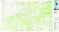
 2010 White Draw NW2010 Print · USGSCovers Corner Windmill, including Val Verde County, United States, and other nearby areas
 - 2012 Map of White Draw NW, 2012 Print
 2012 White Draw NW2012 Print · USGSCovers Corner Windmill, including Val Verde County, United States, and other nearby areas
 - 2016 Map of White Draw NW, 2016 Print
 2016 White Draw NW2016 Print · USGSCovers Corner Windmill, including Val Verde County, United States, and other nearby areas
 - 2019 Map of White Draw NW, 2019 Print
 2019 White Draw NW2019 Print · USGSCovers Corner Windmill, including Val Verde County, United States, and other nearby areas
 - 2022 Map of White Draw NW, 2022 Print
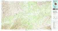
 2022 White Draw NW2022 Print · USGSVal Verde County ranchlands are captured here in the early twenty-first century, showing a landscape shaped by intermittent watercourses. Researchers can trace the path of Devils River and follow rural transit along Ranch Rd 189 and Buckley Draw.
End of results
Showing maps 1-10 of 10
Frequently asked questions
- What are the different types of historical maps available for Corner Windmill?
- What is the oldest map of Corner Windmill?
- Where can I purchase historical maps of Corner Windmill for my home or office?
- Where can I download high-res historical maps of Corner Windmill?
- Are there historical topographic maps available for Corner Windmill?
- Is there historical aerial imagery available for Corner Windmill?
- Where are historical maps of Corner Windmill sourced from?