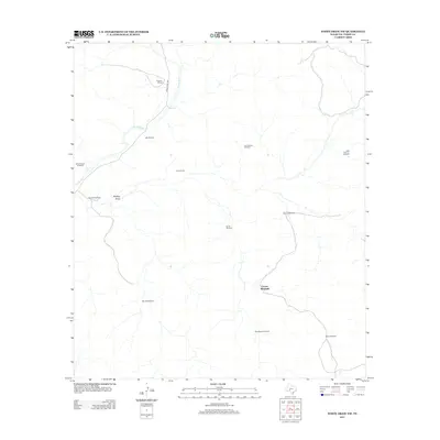
2012 Map of White Draw NW
USGS Topo · Published 2012About this map
Devils River winds through this arid section of Val Verde County, defining the drainage patterns of a landscape marked by intermittent watercourses like Buckley Draw. The distribution of human activity is revealed through a network of water-management infrastructure, essential for sustaining livestock in this environment. Named landmarks such as Corner Windmill and Monroe Windmill serve as critical orientation points across the terrain, while the presence of the Drisdale Ranch and Taylor Ranch indicates the long-standing ranching tradition of the region. Transportation is anchored by Ranch Road 189, which provides the primary access route through this sparsely populated territory, connecting isolated family-named sites like Murrah Windmill and Boone Windmill.
Find a feature on this map
16 named features on this map. Tap any name to fly to it.
Don’t see what you’re looking for? This feature index may not catch every label — zoom into the map to look around manually.
Map Details
Editions of this 2012 White Draw NW Map
This is the sole edition of this map. No revisions or reprints were ever made.
Other maps of this area

1954 · Sonora
USGS Topo · 1:250,000

1958 · Sonora
USGS Topo · 1:250,000

1967 · Flat Rock Draw SE
USGS Topo · 1:24,000

1967 · Flat Rock Draw SW
USGS Topo · 1:24,000

1970 · Juno
USGS Topo · 1:24,000

1970 · Brushy Draw
USGS Topo · 1:24,000

1970 · Deaton Draw
USGS Topo · 1:24,000

1973 · White Draw NW
USGS Topo · 1:24,000

1973 · Robinson Draw
USGS Topo · 1:24,000
1973 · White Draw NE
USGS Topo · 1:24,000