Old Maps of Van Zandt County, Texas for Metal Detecting
Plan your next treasure hunt with 74 historic maps of Van Zandt County. Find old homesites, ghost towns, trails, and gathering spots that may be lost to time — perfect for identifying promising metal detecting locations.
- Locate forgotten sites: Uncover places like long-lost settlements, abandoned rail lines, or gathering spots.
- Plan better hunts: Use map overlays combined with LiDAR or satellite views to narrow in on historically rich areas.
- Made for detectorists: Thousands of hobbyists use these maps to discover relics, coins, and hidden history.
Use these historic maps to boost your research and find new opportunities beneath the surface of Van Zandt County.
Van Zandt County, TX maps
(74)- 1920 Map of Kemp
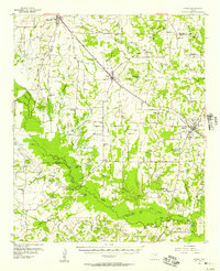
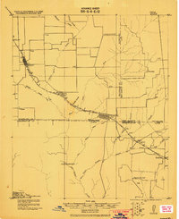 1920 Kemp1920 Print · USGSNortheast Texas at the start of the 1920s reveals a landscape of railroad towns and rural post offices at the junction of three counties. Genealogists can trace early homesteads and schoolhouses near Mabank, Prairieville, and Ansley.
 - 1948 Map of Tyler, 1964 Print
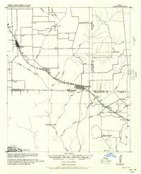
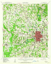 1948 Tyler1964 Print · USGSSmith County and the growing city of Tyler are captured here in the late 1940s, showing a landscape of rail-driven commerce and established rural communities. Local historians can trace family roots through numerous landmarks like Camp Ford, Pounds Field, and Texas College.2 unique versions available
 - 1948 Map of Brownsboro, 1966 Print
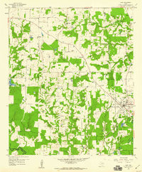
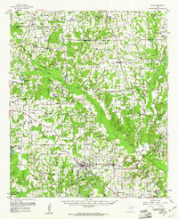
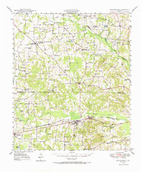 1948 Brownsboro1966 Print · USGSHenderson and Van Zandt counties appear here in the late 1940s as a landscape of rural schoolhouses and family cemeteries along the St Louis Southwestern rails. Genealogists can locate family landmarks like Old Norwegian Cem, Smith Chapel, and Prairie Springs Cem.
 - 1948 Map of Martins Mill, 1974 Print
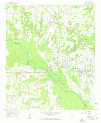
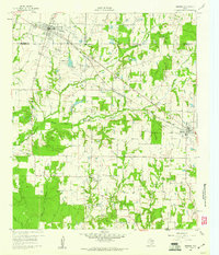
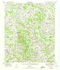 1948 Martins Mill1974 Print · USGSVan Zandt and Henderson counties are shown here in the late 1940s, revealing a landscape of small agricultural settlements and rural school districts. Genealogists can trace family roots through numerous sites like Liberty Cem, Walnut Sch, and the St Louis Southwestern Railroad corridor.
 - 1949 Map of Tyler
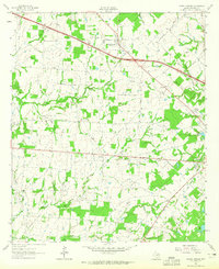
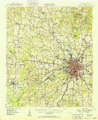 1949 Tyler1949 Print · USGSMid-century Smith County is captured here at a peak of rail and aviation development, centered on the growing hub of Tyler. Genealogists and historians can trace numerous country churches and schools like Lanes Chapel and Young Hill Sch, alongside the sprawling grounds of Camp Ford.
 - 1949 Map of Martins Mill
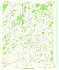
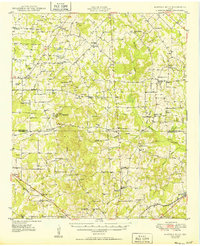 1949 Martins Mill1949 Print · USGSEast Texas rural life is preserved here in the late 1940s as farm-to-market roads linked the communities of Martins Mills and Murchison. Genealogists can trace family names through dozens of landmarks like Cool Springs Ch, Lone Star Sch, and Carter Cem.
 - 1949 Map of Brownsboro
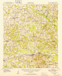 1949 Brownsboro1949 Print · USGSEast Texas at the end of the 1940s reveals a network of railroad towns and oil fields at the Henderson and Smith county line. Genealogy researchers can trace local family roots through sites like Old Norwegian Cem, Sexton Chapel, and Arc Ridge Sch.
 - 1954 Map of Dallas, 1963 Print
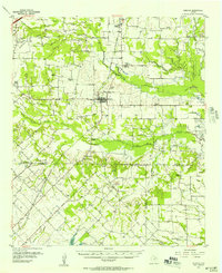
 1954 Dallas1963 Print · USGSNorth Texas in the mid-fifties and early sixties reveals a landscape of rapid urban growth and water management. Genealogists and historians can trace the evolution of the metroplex through landmarks like Hensley Field, Boles Orphan Home, and the Texas & Pacific RR.4 unique versions available
 - 1956 Map of Tyler
 1956 Tyler1956 Print · USGSEast Texas was a powerhouse of oil production and rail transport during the mid-fifties, centered on the sprawling East Texas Oil Field. Researchers can trace the heritage of industrial hubs like Kilgore, military sites such as the Longhorn Ordnance Works, and many rural landmarks like Mount Enterprise.5 unique versions available
 - 1956 Map of Quinlan, 1957 Print
 1956 Quinlan1957 Print · USGSNortheast Texas at the height of the post-war era is depicted here through its network of small crossroads communities and family farms. Researchers can trace rural lineages through local landmarks like Union Valley Sch, the Boys Home (Orphanage), and the Masonic Cem near Quinlan.3 unique versions available
 - 1956 Map of Emory, 1957 Print
 1956 Emory1957 Print · USGSRains County and its neighbors are shown here in the mid-fifties, just as the Sabine River valley prepared for the construction of the Iron Bridge Damsite. Genealogists can trace family roots through numerous small landmarks like Bright Star Ch, Cody Sch, and Parks Cem.3 unique versions available
 - 1957 Map of Kemp
 1957 Kemp1957 Print · USGSThe rural borders of Kaufman and Henderson counties come alive in this early twentieth-century survey of the Texas and New Orleans Railroad corridor. Researchers can trace defunct post offices and local landmarks like Ansley and the remote settlement at Prairieville.
 - 1958 Map of Dallas
 1958 Dallas1958 Print · USGSNorth Texas in the late fifties shows the dramatic expansion of the Metroplex as it absorbs surrounding farm towns. Genealogists and historians can trace old rail lines like the Missouri-Kansas-Texas and locate early lakefront developments at Eagle Mountain Lake and Lake Worth Village.
 - 1958 Map of Alba, 1960 Print
 1958 Alba1960 Print · USGSWood County at the close of the fifties reveals a landscape defined by old lignite pits and oil wells. Genealogists can trace family landmarks like McCord Cem and Pilgrim Rest Ch, while historians can follow the Old Railroad Grade through Alba.3 unique versions available
 - 1959 Map of Golden, 1960 Print
 1959 Golden1960 Print · USGSThe Sabine River bottomlands in the late fifties show a landscape of deep wetlands and evolving industry at the junction of three counties. Genealogists and local historians can trace rural landmarks like Sand Springs Church, the Greenland Ford Cem, and the community of Golden.3 unique versions available
 - 1959 Map of Grand Saline, 1960 Print
 1959 Grand Saline1960 Print · USGSGrand Saline and the Sabine River bottomlands are shown in the late fifties, showcasing a landscape shaped by salt mining and rail transport. Researchers can trace rural life through the Morton Mine, Collins Ferry, and community sites like Friendship School.3 unique versions available
 - 1959 Map of Van, 1960 Print
 1959 Van1960 Print · USGSThe community of Van and its surrounding salt-rich terrain are detailed in this late fifties survey of East Texas. Genealogists and historians can trace local family roots through Marvin Chapel Cem, Pac Cem, and the industry at the large Tank Farm.2 unique versions available
 - 1959 Map of Van Lake, 1960 Print
 1959 Van Lake1960 Print · USGSThe oil-rich landscape of East Texas in the late fifties comes alive on this map, showing the rural crossroads and petroleum fields of Smith and Van Zandt counties. Genealogists can locate family landmarks like Dickerson Cem and churches like Union Chapel and Wisdom Temple.4 unique versions available
 - 1959 Map of Grand Saline, 1961 Print
 1959 Grand Saline1961 Print · USGSEast Texas in the late fifties reveals a landscape shaped by the oil industry and the railroad. Researchers can trace family-named sites and vanished landmarks like Collins Ferry, Van Oil Field, and the Union Chapel.2 unique versions available
 - 1959 Map of Alba, 1961 Print
 1959 Alba1961 Print · USGSNortheast Texas at the dawn of the 1960s reveals a landscape of oil fields, family cemeteries, and rural rail stops. Genealogists and local historians can locate early sites like Sandifer Sch, Shady Grove, and the Bucks Yandell Cem scattered near the Elm Fork.2 unique versions available
 - 1960 Map of Mabank, 1961 Print
 1960 Mabank1961 Print · USGSThe crossroads of Henderson, Kaufman, and Van Zandt counties are captured here in the early sixties, showing a landscape defined by small-town life and the railroad. Genealogists can trace family roots through landmarks like Elam Grove Ch, Mabank Cem, and rural outposts such as Payne Springs.5 unique versions available
 - 1962 Map of Myrtle Springs, 1965 Print
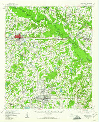
 1962 Myrtle Springs1965 Print · USGSVan Zandt County is captured in the early sixties as rural farmsteads and creek-side communities began to interface with new infrastructure. Genealogists can trace family footprints near Wesley Chapel Cemetery, the Myrtle Springs settlement, and High Cem.3 unique versions available
 - 1962 Map of Prairieville, 1965 Print
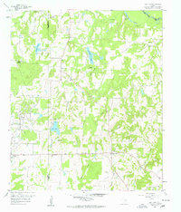
 1962 Prairieville1965 Print · USGSThe Van Zandt County countryside comes into focus in the early sixties, showing the rural crossroads and creek-fed farms of the Texas interior. Trace family landmarks like the Aanonsen Cem, Fourmile Ch, and the small settlement at Prairieville.2 unique versions available
 - 1962 Map of Cedarvale, 1965 Print
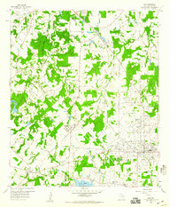
 1962 Cedarvale1965 Print · USGSVan Zandt County was a landscape of small farming communities and emerging oil fields in the early sixties. Researchers can trace family sites near North Bouie Ch, the Fairview Community Center, and the Fair Oil Field.2 unique versions available
 - 1962 Map of Wills Point, 1965 Print
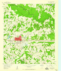
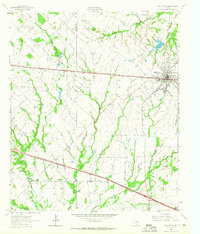 1962 Wills Point1965 Print · USGSWills Point and the surrounding Van Zandt County countryside are shown here in the early 1960s, centered on the Texas and Pacific rail line. Genealogists can trace family landmarks like Union Grove Cem, Allen Cem, and the small settlement of Hiram.2 unique versions available
Showing maps 1-25 of 74
Top cities of Van Zandt County
- Wills Point historical maps
- Canton historical maps
- Canton historical maps
- Grand Saline historical maps
- Van historical maps
- Edgewood historical maps
See more
Frequently asked questions
- What are the different types of historical maps available for Van Zandt County?
- What is the oldest map of Van Zandt County?
- Where can I purchase historical maps of Van Zandt County for my home or office?
- Where can I download high-res historical maps of Van Zandt County?
- Are there historical topographic maps available for Van Zandt County?
- Is there historical aerial imagery available for Van Zandt County?
- Where are historical maps of Van Zandt County sourced from?