
1959 Map of Van Lake
USGS Topo · Published 1960About this map
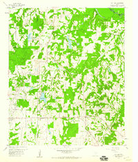
Van Oil Field and the surrounding piney woods of East Texas define this 1959 topographic record, showing the industrial footprint of petroleum extraction alongside long-established rural communities. The map captures the boundary where Van Zandt and Smith counties meet, a landscape crisscrossed by numerous waterways including Village Creek and the Sabine River. Small-scale settlement patterns are evident in the clusters around Garden Valley and Jamestown, where local life centered on rural institutions like Union Chapel and Duck Creek Ch. This era of development is marked by the presence of modern infrastructure, such as the Filtration Plant and spillway at Van Lake, positioned just north of the growing town of Van. Genealogical researchers will find value in the specific locations of family-named landmarks like Dickerson Cem and Bunkley Cem, which anchor the history of these communities to the land.
Find a feature on this map
29 named features on this map. Tap any name to fly to it.
Don’t see what you’re looking for? This feature index may not catch every label — zoom into the map to look around manually.
Map Details
Editions of this 1959 Van Lake Map
4 editions found
Other maps of this area

1948 · Tyler
USGS Topo · 1:62,500

1948 · Brownsboro
USGS Topo · 1:62,500

1949 · Tyler
USGS Topo · 1:62,500

1949 · Brownsboro
USGS Topo · 1:62,500

1956 · Tyler
USGS Topo · 1:250,000

1959 · Golden
USGS Topo · 1:24,000

1959 · Grand Saline
USGS Topo · 1:24,000

1959 · Van
USGS Topo · 1:24,000

1959 · Grand Saline
USGS Topo · 1:62,500

1960 · Lindale
USGS Topo · 1:24,000