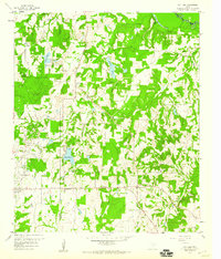
1959 Map of Van Lake
USGS Topo · Published 1960About this map
The Sabine River forms the northern boundary of this 1959 survey, where the border of Smith, Wood, and Van Zandt counties meet. This period in East Texas history is defined by the extensive petroleum infrastructure of the Van Oil Field, which occupies much of the western landscape near the settlement of Van. The map reveals a transition from industrial energy extraction to a rural, water-rich interior characterized by numerous small reservoirs and named creeks.
Find a feature on this map
25 named features on this map. Tap any name to fly to it.
Don’t see what you’re looking for? This feature index may not catch every label — zoom into the map to look around manually.
Map Details
Editions of this 1959 Van Lake Map
4 editions found
Other maps of this area

1948 · Tyler
USGS Topo · 1:62,500

1948 · Brownsboro
USGS Topo · 1:62,500

1949 · Tyler
USGS Topo · 1:62,500

1949 · Brownsboro
USGS Topo · 1:62,500

1956 · Tyler
USGS Topo · 1:250,000

1959 · Golden
USGS Topo · 1:24,000

1959 · Grand Saline
USGS Topo · 1:24,000

1959 · Van
USGS Topo · 1:24,000

1959 · Van Lake
USGS Topo · 1:24,000

1959 · Grand Saline
USGS Topo · 1:62,500