Old Maps of Washington County, Texas for Academic Research
Study the evolution of Washington County with 132 high-resolution historic maps. Whether you're teaching, researching, or modeling changes in land use, these maps provide essential visual documentation of urban, environmental, and geographic change.
- Analyze long-term change: Track patterns in development, transportation, and natural features.
- Ideal for environmental or urban studies: Support academic projects with primary historical map data.
- Use in the classroom or lab: Educators and researchers rely on these maps to bring historical context to life.
These maps are a powerful tool for teaching, research, and visualizing how Washington County has changed over the decades.
Washington County, TX maps
(132)- 1913 Map of Millican
 1913 Millican1913 Print · USGSBrazos County at the beginning of the twentieth century was a critical rail junction defined by large-scale valley farming and the winding river border. Researchers can trace historic riverfront operations and rail stops including Millican, Hidalgo Falls, and the Steele Farm.3 unique versions available
 - 1914 Map of Gay Hill
 1914 Gay Hill1914 Print · USGSThe Brazos River valley in the early twentieth century shows a thriving rail-and-farm economy across three counties. Genealogists can trace family landmarks and rural school sites like Wiedes Store, Old Gay Hill, and the Allseeing Eye School.2 unique versions available
 - 1914 Map of Navasota
 1914 Navasota1914 Print · USGSBefore the modernization of the Brazos valley, this 1910s era survey captures the thriving rail-and-river economy of Grimes and Washington counties. Genealogists can trace early homesteads and community hubs like Wilsons Gin, Prairie Church, and Grange Hall School.2 unique versions available
 - 1919 Map of Giddings
 1919 Giddings1919 Print · USGSGiddings and the surrounding Lee County countryside are documented here at the end of the Great War era, when rail travel dominated the Texas interior. Local historians can trace the foundations of rural life through family-named landmarks like the Willy Branch School and numerous post offices including Northrup P.O. and Ledbetter P.O.
 - 1930 Map of Brenham, 1937 Print
 1930 Brenham1937 Print · USGSBrenham and Chapel Hill appear here during the interwar years as vital rail and agricultural centers for Washington County. Researchers can trace rural life through numerous labeled landmarks like the County Farm, Harrison Spring Church, and Polaski School.
 - 1954 Map of Austin, 1964 Print
 1954 Austin1964 Print · USGSCentral Texas is captured during a period of steady growth as the capital city and its neighboring farm towns began to modernize. Researchers can trace historic rail corridors like the Southern Pacific RR or locate landmarks such as Bergstrom Air Force Base and Pilot Knob.4 unique versions available
 - 1956 Map of Hempstead
 1956 Hempstead1956 Print · USGSSoutheast Texas river country comes alive in this survey of the Brazos valley at the dawn of the motorized age. Genealogists and historians can trace the foundations of local society through schools like Pauls School, post offices at Howth P.O., and the path of the Houston and Texas Central Railroad.
 - 1956 Map of Brenham
 1956 Brenham1956 Print · USGSWashington County during the early twentieth century was a landscape of rail-connected towns and rural parish life. Genealogists can trace family locations near landmarks like Harrison Spring Church, Polaski School, and the County Farm.
 - 1956 Map of Somerville
 1956 Somerville1956 Print · USGSThe rail junctions of Burleson County come into focus in this post-World War I era survey of the Brazos River valley hinterlands. Genealogists can locate family-named landmarks and rural hubs like Frenstat, Charlesville School, and Lyons P.O.
 - 1958 Map of Ledbetter, 1959 Print
 1958 Ledbetter1959 Print · USGSLedbetter and the surrounding cattle-and-rail country of Lee County are shown here in the late fifties. Genealogists and local historians can trace the foundations of Jones Colony, locate the Atkinson Cem, and follow the Texas and New Orleans railroad line.2 unique versions available
 - 1958 Map of Greenvine, 1959 Print
 1958 Greenvine1959 Print · USGSThe rural Texas borderlands of Washington and Austin counties come into focus in the late fifties. Genealogists can trace family heritage through numerous pioneer burial sites and small settlements like Latium, Wesley, and the David Shelby Grave.2 unique versions available
 - 1958 Map of Carmine, 1959 Print
 1958 Carmine1959 Print · USGSThe rail-and-road junction at Carmine anchor this late 1950s survey of the Fayette and Washington County border. Genealogists and local historians can trace family-named sites like Hartstack Cem, La Bahia, and St Matthew Missionary Ch.2 unique versions available
 - 1958 Map of Burton, 1959 Print
 1958 Burton1959 Print · USGSThe Washington County countryside around Burton is shown here in the late fifties as a bustling rail and agricultural corridor. Researchers can trace family history through sites like St Paul Ch, Bethany Cem, and the Carver Sch.2 unique versions available
 - 1958 Map of Round Top, 1959 Print
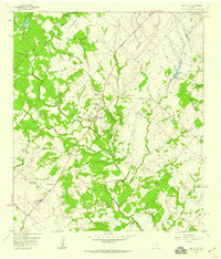 1958 Round Top1959 Print · USGSFayette and Washington Counties are captured here in the late fifties, showing a rural Texas landscape of small farmsteads and creek-side settlements. Researchers can trace ancestral locations near Round Top through numerous burial sites like Weyand Cem and Drawe Cem.2 unique versions available
 - 1958 Map of Washington, 1960 Print
 1958 Washington1960 Print · USGSThe confluence of the Brazos and Navasota rivers defines this part of Texas in the late fifties. Genealogists and historians can locate old rural landmarks like Tennyson Cem, St Matthew Sch, and the riverside settlement of Washington.3 unique versions available
 - 1958 Map of Courtney, 1960 Print
 1958 Courtney1960 Print · USGSThe Brazos River valley in the late fifties was a landscape of prairie farms and intersecting rail lines. Genealogists and historians can trace family-named sites like Sommerford Cem, congregations at Mercy Seat Ch, and the settlement at Courtney.3 unique versions available
 - 1959 Map of Millican, 1960 Print
 1959 Millican1960 Print · USGSThe Brazos Valley in the late fifties was a crossroads of major rail lines and river commerce. Genealogists and historians can trace the development of rail-side settlements like Millican and Allenfarm, or locate rural landmarks such as Brooks Chapel and Hidalgo Falls.4 unique versions available
 - 1959 Map of Flag Pond, 1960 Print
 1959 Flag Pond1960 Print · USGSThe tri-county borderlands of Burleson, Lee, and Washington counties are captured here in the late fifties. Genealogists can trace rural communities through landmarks like Flat Prairie Cem, Post Oak Sch, and St Mary Ch.
 - 1959 Map of Gay Hill, 1960 Print
 1959 Gay Hill1960 Print · USGSWashington and Burleson Counties were shaped by the railroad and the oil patch during the late fifties. Genealogists and historians can trace the foundations of local life at Old Gay Hill Ch, the Clay Creek Oil Field, and the Gulf Colorado and Santa Fe rail line.3 unique versions available
 - 1959 Map of Clay, 1960 Print
 1959 Clay1960 Print · USGSNear the convergence of the Brazos and Yegua, this late-fifties survey reveals a landscape of winding river bends and vital rail junctions. Historians can trace the legacy of local settlements through Betts Ferry Cem, the rail lines of the Missouri Pacific, and the namesake Clay Pit.3 unique versions available
 - 1959 Map of Somerville, 1960 Print
 1959 Somerville1960 Print · USGSSomerville was a bustling railway junction in the late fifties where the Burleson and Washington county lines meet along the river. Researchers can locate family sites like Schoppe Cem, Sweet Home, and the old Somerville Substa rail yard.
 - 1959 Map of Independence, 1960 Print
 1959 Independence1960 Print · USGSTexas history remains etched into the landscape around Independence in the late fifties, from the original Baylor University State Park to the Gov Sam Houston Home. Trace family roots through rural landmarks like Sandy Hill, Union Hill Ch, and the Summers Cem.3 unique versions available
 - 1961 Map of Daniels, 1963 Print
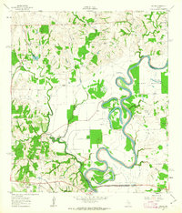 1961 Daniels1963 Print · USGSThe Brazos River meanders through Washington and Waller counties in the early sixties, shaping a landscape of fertile bottomlands and small settlements. Researchers can locate family landmarks like Brown College, Franklin Cem, and the community of Goodwill.2 unique versions available
 - 1961 Map of Howth, 1963 Print
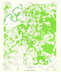 1961 Howth1963 Print · USGSThe rural Brazos River valley comes to life in the early sixties, centered on the railroad town of Howth. Researchers can trace family history through sites like Salem Cem, St Luke Ch, and the small settlement of Rock Island.2 unique versions available
 - 1962 Map of Buckhorn, 1963 Print
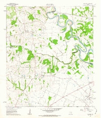 1962 Buckhorn1963 Print · USGSThe Brazos River loop forms the heart of this rural Texas landscape in the early sixties, where oil extraction meets traditional farming. Trace family roots and local industry through the Raccoon Bend Oil Field, Sauney Stand, and the Apperson Cem.2 unique versions available
Showing maps 1-25 of 132
Top cities of Washington County
Frequently asked questions
- What are the different types of historical maps available for Washington County?
- What is the oldest map of Washington County?
- Where can I purchase historical maps of Washington County for my home or office?
- Where can I download high-res historical maps of Washington County?
- Are there historical topographic maps available for Washington County?
- Is there historical aerial imagery available for Washington County?
- Where are historical maps of Washington County sourced from?