1960s Maps of Carbon County, Utah
Explore 18 historic maps of Carbon County from the 1960s. These maps offer a rare glimpse into what life looked like during the 1960s — showing old roads, neighborhoods, homes, and landmarks that have changed or disappeared over time.
Whether you're researching your family's past, planning a metal detecting trip, or studying how Carbon County's landscape evolved across the 1960s, these high-resolution maps are a powerful tool for exploring the history of this region.
- Focus on a specific era: All maps on this page are from the 1960s, giving you a focused view of this time period.
- See what’s changed: Compare century-old streets, trails, and buildings to today's modern landscape using overlays and satellite layers.
- Research with precision: Use these maps for genealogy, historical research, land use analysis, or educational projects.
- View, download, or print: Maps are fully viewable online in high resolution, and can be downloaded or printed for your own records.
Start exploring Carbon County's history through authentic maps from the 1960s. This is your window into the past.
Carbon County, UT maps
(18)- 1960 Map of Price
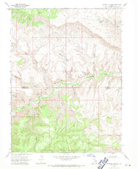
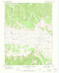
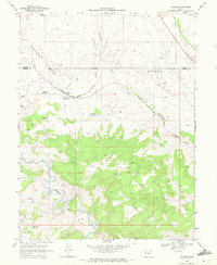
 1960 Price1960 Print · USGSCentral Utah in the late fifties was a landscape of coal-hauling railroads and high plateau settlements. Genealogists and local historians can trace the rail-to-river economy from Price to the mountain mining camps of Hiawatha, Dragerton, and Sunnyside.2 unique versions available
 - 1960 Map of Grand Junction
 1960 Grand Junction1960 Print · USGSThe Grand Junction area at the dawn of the 1960s shows a landscape of river-valley agriculture and high-plateau extraction. Researchers can trace the path of the dismantled railroad and find vanished sites like Watson and Sego.2 unique versions available
 - 1962 Map of Grand Junction
 1962 Grand Junction1962 Print · USGSThe Western Slope of the early sixties comes into focus here, showing the irrigation-driven growth of the valley and the surrounding high desert. Trace the path of the Denver and Rio Grande Western RR or locate old outposts like Atchee and Dragon.
 - 1962 Map of Price
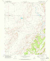
 1962 Price1962 Print · USGSCentral Utah during the early sixties shows a landscape balancing high-mountain forestry with valley agriculture and coal mining. Genealogists and historians can trace the Denver and Rio Grande Western rail lines through industrial hubs like Price or locate formerly active sites like Coal City (abandoned).
 - 1964 Map of Grand Junction
 1964 Grand Junction1964 Print · USGSThe Colorado-Utah borderlands are shown here in the mid-1960s, a period when the river-valley settlements and high-desert rail outposts defined the region. Researchers can trace the legacy of remote camps like Atchee and Dragon or follow the agricultural expansion around Grand Junction and Fruita.
 - 1965 Map of Grand Junction
 1965 Grand Junction1965 Print · USGSWestern Colorado and eastern Utah appear at a mid-century crossroads, where the irrigated orchards of the Grand Valley meet the high desert plateaus. Trace the Denver & Rio Grande Western RR as it connects Grand Junction to early settlements like Westwater and Cisco.2 unique versions available
 - 1968 Map of Wood Canyon, 1971 Print
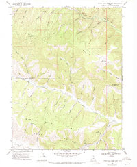
 1968 Wood Canyon1971 Print · USGSHigh canyon country in Duchesne and Carbon Counties during the late sixties reveals a landscape of deep drainages and early boundaries. Researchers can trace the Old Indian Treaty Boundary and explore the winding paths of Nine Mile Creek and Argyle Creek.
 - 1968 Map of Cowboy Bench, 1971 Print
 1968 Cowboy Bench1971 Print · USGSThe high desert canyons of the Duchesne and Carbon County border were undergoing early energy exploration in the late sixties. Trace ancient cultural sites like petroglyphs and The Mummy alongside modern markers like Nutters Corral and the Nine Mile Gas Field.
 - 1968 Map of Pinnacle Canyon, 1971 Print
 1968 Pinnacle Canyon1971 Print · USGSThe high plateaus and deep drainages of the Duchesne and Carbon county line are captured here in the late sixties. Researchers can trace the winding path of Nine Mile Creek and locate remote features like Horse Bench and the isolated Drill Hole.2 unique versions available
 - 1968 Map of Currant Canyon, 1971 Print
 1968 Currant Canyon1971 Print · USGSUpper Duchesne and Carbon counties are shown in the late sixties as a landscape of deep-cut drainage and industrial frontier. Researchers can trace the Old Indian Treaty Boundary or locate the remote Interplanetary Airstrip and Stone Cabin Gas Field.
 - 1969 Map of Kyune, 1971 Print
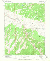 1969 Kyune1971 Print · USGSThe industrial corridor of Carbon County is captured here in the late sixties, where the railroad and river define the landscape. Local historians can trace the Denver and Rio Grande Western line past the settlement of Kyune and locate old Mines and Gravel Pits tucked into the canyons.2 unique versions available
 - 1969 Map of Minnie Maud Creek East, 1971 Print
 1969 Minnie Maud Creek East1971 Print · USGSHigh plateau country in eastern Utah is documented here in the late sixties, where the Duchesne and Carbon county lines meet. Researchers can trace remote landmarks like Sky-high Pond, the Roan Cliffs, and early resource indicators such as a Drill Hole and a Gaging Station.2 unique versions available
 - 1969 Map of Minnie Maud Creek West, 1971 Print
 1969 Minnie Maud Creek West1971 Print · USGSThe high plateau country of eastern Utah is captured here in the late sixties, showcasing the dramatic transition from Argyle Ridge to the Roan Cliffs. Trace old high-country routes like the Warren Trail and locate family-named sites such as Orson Bedground.2 unique versions available
 - 1969 Map of Matts Summit, 1971 Print
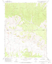
 1969 Matts Summit1971 Print · USGSHigh-altitude ranching and forest lands in the late sixties define this portion of the Utah interior. Researchers can locate remote landmarks like the Downard Cabin and Matts Summit or trace the early water systems of Little Boulder Dam.
 - 1969 Map of Olsen Reservoir, 1972 Print
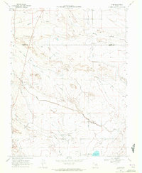
 1969 Olsen Reservoir1972 Print · USGSThe Carbon-Emery county line was a landscape of remote livestock outposts and early rail transport in the late sixties. Researchers can trace the location of the Victor (Site) settlement and its Old Victor Cem near the Denver and Rio Grande Western rail line.2 unique versions available
 - 1969 Map of Elmo, 1972 Print
 1969 Elmo1972 Print · USGSThe high desert of Emery County comes into focus in the late sixties, centered on the settlement of Elmo. Trace the critical irrigation routes of the Cleveland Canal and locate the local Cem or the southern Desert Lake.2 unique versions available
 - 1969 Map of Poison Spring Bench, 1972 Print
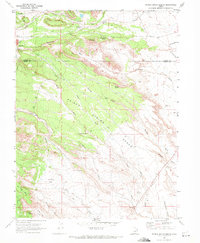 1969 Poison Spring Bench1972 Print · USGSThe borderlands of Carbon and Emery counties are captured here in the late sixties, showing the industrial fringe of Hiawatha. Researchers can trace early infrastructure through the Pipeline and Substa or locate historic water sources like Clawson Spring and Coyote Spring.3 unique versions available
 - 1969 Map of Mounds, 1972 Print
 1969 Mounds1972 Print · USGSEmery and Carbon Counties come into focus during the late sixties as the high desert landscape is mapped in detail. Genealogists and researchers can trace the Denver and Rio Grande Western rail line through Mounds and Verde, or locate remote oil wells and the distinct Balanced Rock.
End of results
Showing maps 1-18 of 18
Top cities of Carbon County
Frequently asked questions
- What are the different types of historical maps available for Carbon County?
- What is the oldest map of Carbon County?
- Where can I purchase historical maps of Carbon County for my home or office?
- Where can I download high-res historical maps of Carbon County?
- Are there historical topographic maps available for Carbon County?
- Is there historical aerial imagery available for Carbon County?
- Where are historical maps of Carbon County sourced from?