Old Maps of Garden City, Utah
Explore 18 old maps of Garden City, spanning from 1912 to today. These high-resolution historic maps reveal how streets, neighborhoods, landmarks, and natural features evolved over time — perfect for genealogy, metal detecting, research, and local history exploration.
What you can do with these maps:
- See how Garden City changed over time: Compare historical maps to modern-day views to trace roads, homesites, rail lines & more.
- View detailed metadata: Each map includes creators, publishers, year, scale, and archive source.
- Overlay maps with satellite & LiDAR: Visualize the past alongside modern tools to explore terrain & human change.
- Trusted historical sources: Maps sourced from the USGS, Library of Congress, and other archives.
- Access maps your way: View online, download high-res files, or order prints for personal or research use.
Start exploring old maps of Garden City to uncover forgotten places, hidden landmarks, and the deep history beneath your feet.
Garden City, UT maps
(18)- 1912 Map of Randolph
 1912 Randolph1912 Print · USGSThe high valley ranching country of the Utah-Wyoming border is captured here in the early twentieth century. Genealogists and historians can trace family land holdings such as Rex Ranch or Sixmile Ranch and find old routes like the Ogden Road.3 unique versions available
 - 1954 Map of Ogden, 1967 Print
 1954 Ogden1967 Print · USGSThe northern Utah corridor and Wyoming borderlands are captured here in the mid-1950s, showing the region's transition from mountain wilderness to settled valleys. Researchers can trace historic institutions like Utah State University or locate vanished points like Church Butte Station and the Trappist Monastery.3 unique versions available
 - 1958 Map of Ogden
 1958 Ogden1958 Print · USGSNorthern Utah and southwestern Wyoming are captured here during a period of steady growth and military expansion. You can trace the Union Pacific rail lines and early road networks connecting Ogden and Logan to Bear Lake and Evanston.
 - 1960 Map of Ogden
 1960 Ogden1960 Print · USGSIn the mid-1950s, this region of the American West balanced military expansion with frontier history along the Union Pacific RR. Genealogists and historians can trace old settlements like Fort Bridger, the residential growth of Washington Terrace, and industrial sites from the Hill AFB complex to the coal mines of Kemmerer.
 - 1969 Map of Bear Lake South, 1973 Print
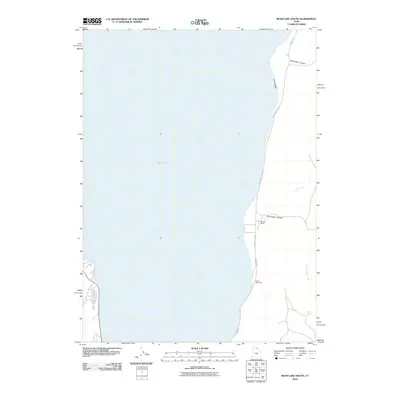
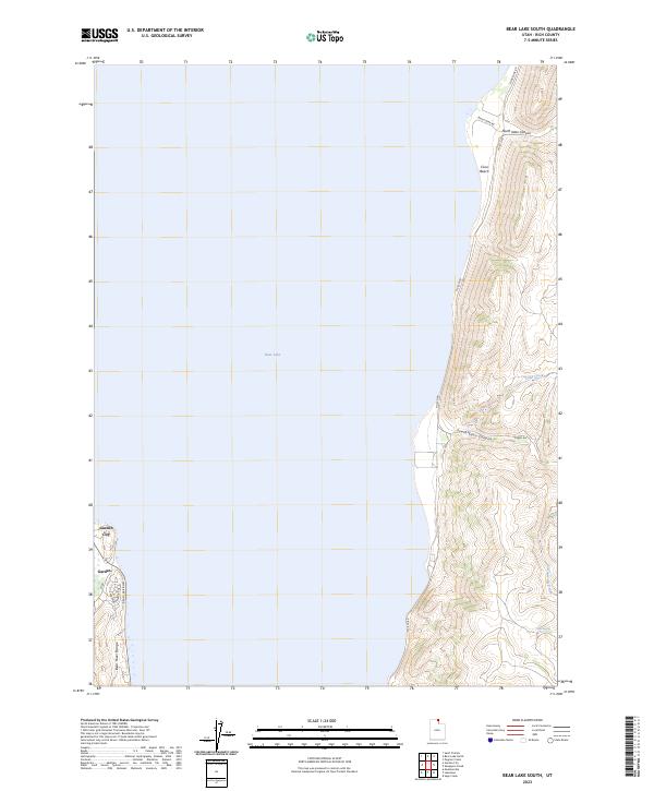
 1969 Bear Lake South1973 Print · USGSBear Lake's eastern shoreline and the canyons of Rich County are captured here in the late sixties. Genealogists and local historians can locate Nebeker Ranch, trace the Jeep Trail through the high country, and find Sigma and Camp Bear Lake.2 unique versions available
 - 1969 Map of Garden City, 1973 Print
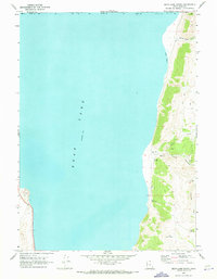
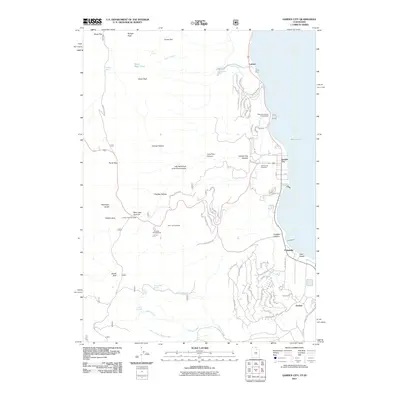
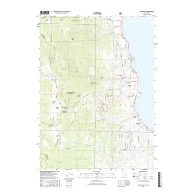
 1969 Garden City1973 Print · USGSThe western shores of Bear Lake are shown in the late sixties as lakeside communities like Garden City and Pickelville expanded. Trace family roots at the Garden City Cem or explore mountain landmarks like the Old Limber Pine and Bear Lake Summit.4 unique versions available
 - 1984 Map of Logan, 1985 Print
 1984 Logan1985 Print · USGSNorthern Utah and its borderlands with Idaho and Wyoming are shown here in the mid-1980s as the Cache Valley communities grew. Researchers can trace the Union Pacific rail lines and find legacy sites like College Ward, Pickleville, and Utah State University.3 unique versions available
 - 1998 Map of Garden City, 2001 Print
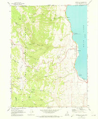
 1998 Garden City2001 Print · USGSThe western shores of Bear Lake in the late 1990s are defined by recreation and rugged mountain terrain. Researchers can trace local landmarks from the Garden City Cemetery to high-elevation points like Bear Lake Summit and Swan Peak.
 - 2010 Map of Bear Lake South, 2010 Print
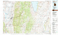
 2010 Bear Lake South2010 Print · USGSCovers Garden City, including Rich County, United States, and other nearby areas
 - 2011 Map of Garden City, 2011 Print
 2011 Garden City2011 Print · USGSCovers Garden City, including Garden, Pickelville, and other nearby areas
 - 2014 Map of Bear Lake South, 2014 Print
 2014 Bear Lake South2014 Print · USGSCovers Garden City, including Rich County, United States, and other nearby areas
 - 2014 Map of Garden City, 2014 Print
 2014 Garden City2014 Print · USGSCovers Garden City, including Garden, Pickelville, and other nearby areas
 - 2017 Map of Bear Lake South, 2017 Print
 2017 Bear Lake South2017 Print · USGSCovers Garden City, including Rich County, United States, and other nearby areas
 - 2017 Map of Garden City, 2017 Print
 2017 Garden City2017 Print · USGSCovers Garden City, including Garden, Pickelville, and other nearby areas
 - 2020 Map of Bear Lake South, 2020 Print
 2020 Bear Lake South2020 Print · USGSCovers Garden City, including Rich County, United States, and other nearby areas
 - 2020 Map of Garden City, 2020 Print
 2020 Garden City2020 Print · USGSCovers Garden City, including Garden, Pickelville, and other nearby areas
 - 2023 Map of Bear Lake South, 2023 Print
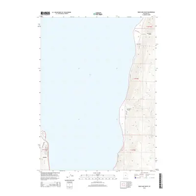
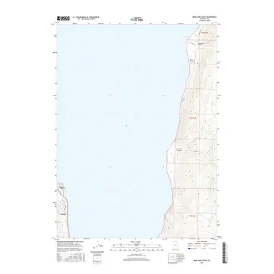
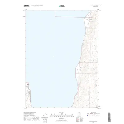
 2023 Bear Lake South2023 Print · USGSThe southern shores of Bear Lake at the turn of the 2020s reveal a landscape of both growing lakeside communities and steep canyon terrain. Trace local landmarks like Garden City and Cisco Beach, or follow the high ridges of North Eden Canyon and the Bear River Range.
 - 2023 Map of Garden City, 2023 Print
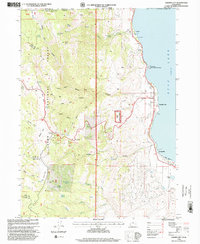
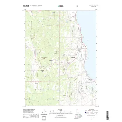
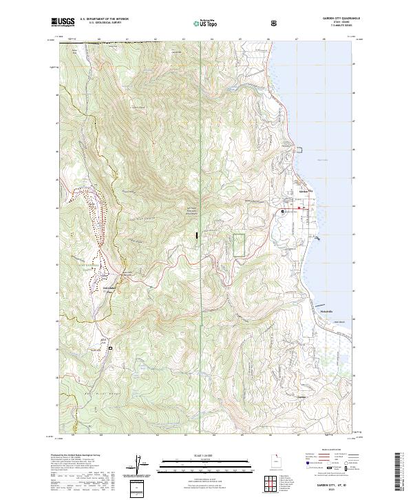 2023 Garden City2023 Print · USGSGarden City and the western shores of Bear Lake are showcased in this modern survey of the Utah-Idaho borderlands. Genealogists and researchers can locate the Garden City Cem and trace the development of lakeside communities like Pickelville and Ideal Beach.
End of results
Showing maps 1-18 of 18
Top cities near Garden City
Top neighborhoods of Garden City
Frequently asked questions
- What are the different types of historical maps available for Garden City?
- What is the oldest map of Garden City?
- Where can I purchase historical maps of Garden City for my home or office?
- Where can I download high-res historical maps of Garden City?
- Are there historical topographic maps available for Garden City?
- Is there historical aerial imagery available for Garden City?
- Where are historical maps of Garden City sourced from?