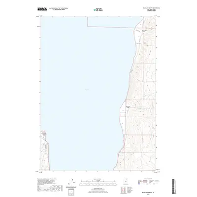
2020 Map of Bear Lake South
USGS Topo · Published 2020About this map
Bear Lake dominates the western half of this area, its shoreline serving as the primary anchor for the settlements and infrastructure in this corner of Rich County. Along the southwestern shore, the grid of Garden City expands near Bear Lake Blvd, while the eastern side of the lake presents a more sparsely developed landscape defined by the steep transitions from the water to the high terrain. These eastern slopes are cut by dramatic geological features such as North Eden Canyon and South Eden Canyon, where drainages like Little Cr and Cottonwood Cr flow toward the lake. This 2020 topographical record highlights the contrast between the concentrated growth in Garden City and the recreational and rural access points along the eastern shore, including Cisco Beach and the network of roads like Shoreline Rd that skirt the water's edge.
Find a feature on this map
16 named features on this map. Tap any name to fly to it.
Don’t see what you’re looking for? This feature index may not catch every label — zoom into the map to look around manually.
Map Details
Editions of this 2020 Bear Lake South Map
This is the sole edition of this map. No revisions or reprints were ever made.
Other maps of this area

1909 · Montpelier
USGS Topo · 1:125,000

1911 · Montpelier
USGS Topo · 1:125,000

1912 · Randolph
USGS Topo · 1:125,000

1954 · Ogden
USGS Topo · 1:250,000

1955 · Preston
USGS Topo · 1:250,000

1958 · Ogden
USGS Topo · 1:250,000

1958 · Preston
USGS Topo · 1:250,000

1960 · Ogden
USGS Topo · 1:250,000

1962 · Preston
USGS Topo · 1:250,000

1969 · Sheeppen Creek
USGS Topo · 1:24,000