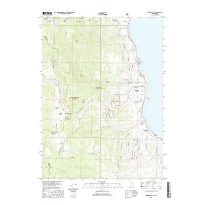
2017 Map of Garden City
USGS Topo · Published 2017About this map
Garden City sits along the western shoreline of Bear Lake, serving as a central hub for this high-elevation landscape in Rich County. The map details the transition from the lakeside settlements of Pickelville and Ideal Beach to the steep, wooded terrain of the Cache National Forest. In the western reaches, the topography rises sharply toward prominent summits like Swan Peak and Bridger Peak, where the network of seasonal routes including the Swan Flat Winter Sports and Garden City Winter Sports trails indicates the area's importance for year-round recreation. Notable landmarks like the Old Limber Pine and numerous water sources such as Swan Creek and Richardson Fork define the rugged interior. For those researching local heritage, the Garden City Cemetery is clearly marked, and the map traces the intricate network of canyon roads like Hodges Canyon Rd and Garden City Canyon that connect the lakeshore to the high flats.
Find a feature on this map
91 named features on this map. Tap any name to fly to it.
Don’t see what you’re looking for? This feature index may not catch every label — zoom into the map to look around manually.
Map Details
Editions of this 2017 Garden City Map
This is the sole edition of this map. No revisions or reprints were ever made.
Other maps of this area

1909 · Montpelier
USGS Topo · 1:125,000

1911 · Montpelier
USGS Topo · 1:125,000

1912 · Randolph
USGS Topo · 1:125,000

1914 · Logan
USGS Topo · 1:125,000

1915 · Preston
USGS Topo · 1:96,000

1916 · Logan
USGS Topo · 1:125,000

1918 · Preston
USGS Topo · 1:125,000

1954 · Ogden
USGS Topo · 1:250,000

1955 · Preston
USGS Topo · 1:250,000

1958 · Ogden
USGS Topo · 1:250,000