1960s Maps of San Juan County, Utah
Explore 23 historic maps of San Juan County from the 1960s. These maps offer a rare glimpse into what life looked like during the 1960s — showing old roads, neighborhoods, homes, and landmarks that have changed or disappeared over time.
Whether you're researching your family's past, planning a metal detecting trip, or studying how San Juan County's landscape evolved across the 1960s, these high-resolution maps are a powerful tool for exploring the history of this region.
- Focus on a specific era: All maps on this page are from the 1960s, giving you a focused view of this time period.
- See what’s changed: Compare century-old streets, trails, and buildings to today's modern landscape using overlays and satellite layers.
- Research with precision: Use these maps for genealogy, historical research, land use analysis, or educational projects.
- View, download, or print: Maps are fully viewable online in high resolution, and can be downloaded or printed for your own records.
Start exploring San Juan County's history through authentic maps from the 1960s. This is your window into the past.
San Juan County, UT maps
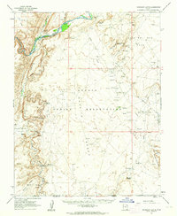
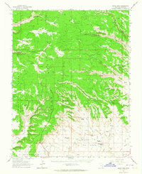
(23)- 1960 Map of Escalante
 1960 Escalante1960 Print · USGSSouthern Utah and northern Arizona appear at a historic turning point in the late fifties as Lake Powell begins to reshape the canyons. Researchers can trace remote sites like Goulding Trading Post, a lonely Uranium Mine, and Coyote Ranches before the reservoir's rise.
 - 1960 Map of Salina
 1960 Salina1960 Print · USGSThe high plateaus and canyonlands of south-central Utah appear in the early sixties as a region of remote ranching towns and developing parklands. Researchers can trace historic settlements like Fruita and Loa or locate the uranium mines and the tracks of the Denver and Rio Grande Western RR.2 unique versions available
 - 1960 Map of Moab
 1960 Moab1960 Print · USGSThe canyonlands and high plateaus of the Utah-Colorado border are shown here during the mid-century uranium boom. Researchers can trace the river-and-rail corridors of the Colorado River and the Denver and Rio Grande Western near Moab and Uravan.3 unique versions available
 - 1961 Map of Marble Canyon
 1961 Marble Canyon1961 Print · USGSThe northern Arizona desert in the early sixties reveals a landscape of tribal lands and canyon crossings. Trace the old river life at Lees Ferry, find the Uranium mill at Tuba City, and locate the iconic Elephant Feet landmarks.
 - 1962 Map of Moab
 1962 Moab1962 Print · USGSThe canyon country of southeastern Utah and western Colorado is captured here in the early sixties, showing the reach of the Denver and Rio Grande Western through the desert. Researchers can trace the layout of mining settlements like Uravan and old railroad stops at Cisco and Sagers Station.
 - 1962 Map of Salina
 1962 Salina1962 Print · USGSSevier County and the surrounding desert wilderness appear here in the early sixties as a network of isolated river valley towns and high-altitude forests. Researchers can locate remote landmarks like Fruita, trace the Denver & Rio Grande Western RR, and find backcountry sites like the Aquarius Ranger Station.
 - 1962 Map of Cortez
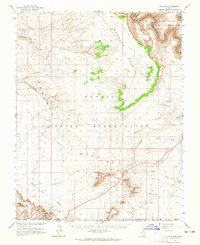
 1962 Cortez1962 Print · USGSThe Four Corners region comes alive in the early sixties, showing a landscape defined by reservation lands and federal forests. Trace the route of the Rio Grande Southern RR or locate the Uranium and vanadium mines near Monticello.
 - 1962 Map of Bluff NW, 1963 Print
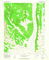 1962 Bluff NW1963 Print · USGSSan Juan County canyon country in the early sixties is a landscape defined by dramatic geology and ancient habitation. Archaeologists and historians can trace the locations of numerous Cliff dwellings and Ruins tucked into Mule Canyon and Comb Ridge.2 unique versions available
 - 1962 Map of Montezuma Creek, 1963 Print
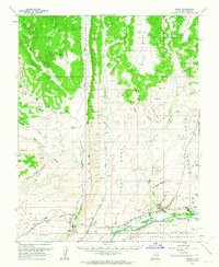
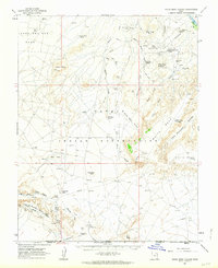
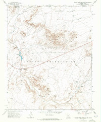
 1962 Montezuma Creek1963 Print · USGSSan Juan County at the height of the early 1960s oil boom shows a landscape of desert mesas and industrial growth along the river. Genealogists and historians can trace the Aneth Oil Field infrastructure, the Montezuma Creek Sch, and the remote settlement of Fiddlers Green.3 unique versions available
 - 1962 Map of Bluff, 1963 Print
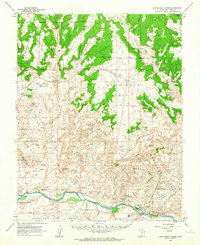
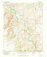
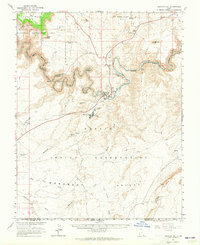
 1962 Bluff1963 Print · USGSThe high desert landscape around the San Juan River comes into focus in the early sixties, showing the settlement of Bluff and the surrounding mesas. Historians can trace the Mormon Road and locate numerous cliff dwellings and the St Christophers Mission.3 unique versions available
 - 1962 Map of Bluff SW, 1963 Print
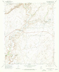
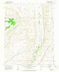 1962 Bluff SW1963 Print · USGSSoutheastern Utah in the early sixties reveals a landscape of deep canyons and ancient habitations. Archaeologists and historians can trace the paths of the Mormon Trail and locate several Cliff Dwellings tucked into the reaches of Road Canyon.3 unique versions available
 - 1962 Map of Boundary Butte, 1964 Print
 1962 Boundary Butte1964 Print · USGSThe high desert of San Juan County during the early 1960s reveals a unique intersection of ancient history and modern industry. Researchers can trace the layout of the Tohonadla Oil Field and locate ancestral sites like Poncho House and various Cliff Dwellings.3 unique versions available
 - 1962 Map of Aneth, 1964 Print
 1962 Aneth1964 Print · USGSThe Four Corners region in the early sixties reveals a landscape where ancient history and modern industry meet along the San Juan River. Genealogists and historians can trace indigenous heritage and early infrastructure through features like the Aneth settlement, Cliff Dwellings, and the Navajo Trail.
 - 1962 Map of White Mesa Village, 1964 Print
 1962 White Mesa Village1964 Print · USGSThe Navajo Nation's high desert meets the industrial energy boom of the early sixties along the San Juan River. Researchers can trace tribal settlements like White Rock Village alongside oil industry outposts such as Aztec Camp, Morans Camp, and the Aneth Oil Field.2 unique versions available
 - 1963 Map of Grand Gulch, 1964 Print
 1963 Grand Gulch1964 Print · USGSThe San Juan River country and Cedar Mesa are shown in the early sixties as Lake Powell began to fill. Researchers can locate ancient Cliff Dwelling sites, Petroglyphs, and remote water sources like Sulphur Spring.4 unique versions available
 - 1963 Map of Cedar Mesa, 1964 Print
 1963 Cedar Mesa1964 Print · USGSCedar Mesa and the spectacular rock formations of the San Juan country are captured here in the early sixties. Archaeologists and historians can trace numerous Cliff Dwellings and Ruins along Grand Gulch or follow the historic Mormon Trail.2 unique versions available
 - 1963 Map of Goulding, 1965 Print
 1963 Goulding1965 Print · USGSThe high desert along the Utah-Arizona border comes to life in the early sixties, showing the remote outposts of the Monument Valley region. Trace the locations of the Goulding Trading Post, the Mission, and geologic icons like Castle Rock and Sentinel Mesa.2 unique versions available
 - 1963 Map of Mexican Hat, 1965 Print
 1963 Mexican Hat1965 Print · USGSSoutheastern Utah and the Navajo Nation meet at the San Juan River during the height of the mid-century uranium era. Genealogists and historians can trace old landmarks like Raplees Stone House (Ruins), the Mexican Hat PO, and early industrial features including the Tailings Ponds.3 unique versions available
 - 1964 Map of Moab
 1964 Moab1964 Print · USGSThe canyonlands of eastern Utah and western Colorado are captured here in the mid-1960s, a time when uranium mining shaped the local economy. Researchers can trace the river-and-rail network through Sinbad Valley and locate mining outposts like Uravan and Vancorum.
 - 1965 Map of Moab
 1965 Moab1965 Print · USGSSoutheast Utah and Western Colorado are mapped here in the mid-sixties, showcasing a landscape of high plateaus and deep river canyons. Genealogists and historians can trace the mining-era towns of Uravan and Paradox or locate remote landmarks like Castleton and Dead Horse Point.
 - 1966 Map of Cortez
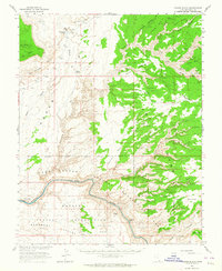
 1966 Cortez1966 Print · USGSThe Four Corners region in the mid-sixties reveals a landscape of high mesas, tribal lands, and archaeological preserves. Researchers can trace the ancient sites at Hovenweep National Monument, follow the Denver & Rio Grande Western Railroad, or locate old settlements like Ginger Hill and Yellow Jacket.
 - 1968 Map of Mexican Water, 1971 Print
 1968 Mexican Water1971 Print · USGSThe Navajo Nation borderlands come into focus in the late 1960s as ancient ruins and modern energy infrastructure meet. Researchers can trace ancestral sites like Floating House Ruins alongside community landmarks including the Mexican Water Chapter House and Mission.2 unique versions available
 - 1968 Map of Walker Creek Reservoir, 1971 Print
 1968 Walker Creek Reservoir1971 Print · USGSThe Navajo Nation borderlands in the late sixties come into focus through this survey of high-desert springs and trading sites. Trace the remote Mexican Water Trading Post, locate a Cliff Dwelling, or follow the waters of Walker Creek Reservoir.
End of results
Showing maps 1-23 of 23
Top cities of San Juan County
- Blanding historical maps
- Oljeto (Moonlight Water) historical maps
- Monticello historical maps
- Bluff historical maps
- Mexican Hat historical maps
Frequently asked questions
- What are the different types of historical maps available for San Juan County?
- What is the oldest map of San Juan County?
- Where can I purchase historical maps of San Juan County for my home or office?
- Where can I download high-res historical maps of San Juan County?
- Are there historical topographic maps available for San Juan County?
- Is there historical aerial imagery available for San Juan County?
- Where are historical maps of San Juan County sourced from?