2000-2009 Maps of San Juan County, Utah
Explore 28 historic maps of San Juan County from 2000-2009. These maps offer a rare glimpse into what life looked like during the 2000s — showing old roads, neighborhoods, homes, and landmarks that have changed or disappeared over time.
Whether you're researching your family's past, planning a metal detecting trip, or studying how San Juan County's landscape evolved across the 2000s, these high-resolution maps are a powerful tool for exploring the history of this region.
- Focus on a specific era: All maps on this page are from the 2000s, giving you a focused view of this time period.
- See what’s changed: Compare century-old streets, trails, and buildings to today's modern landscape using overlays and satellite layers.
- Research with precision: Use these maps for genealogy, historical research, land use analysis, or educational projects.
- View, download, or print: Maps are fully viewable online in high resolution, and can be downloaded or printed for your own records.
Start exploring San Juan County's history through authentic maps from the 2000s. This is your window into the past.
San Juan County, UT maps
(28)- 2001 Map of Dolores Point South, 2004 Print
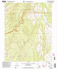
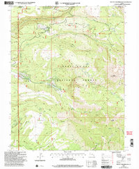
 2001 Dolores Point South2004 Print · USGSThe high plateaus along the Utah-Colorado state line are captured here at the start of the millennium. Local history researchers can trace high-elevation landmarks such as Kirks Basin, Pace Lake, and the remote Fish & Game Cabin.
 - 2001 Map of Kigalia Point, 2004 Print
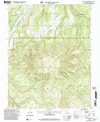
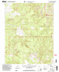
 2001 Kigalia Point2004 Print · USGSSan Juan County at the start of the millennium remains a land of high plateaus and deep sandstone drainages. Trace the primitive 4WD routes across Elk Ridge to find Bears Ears, Keystone Arch, and the isolated Babylon Pasture.
 - 2001 Map of Fable Valley, 2004 Print
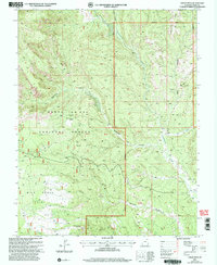
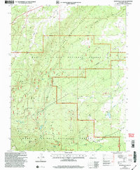
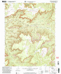
 2001 Fable Valley2004 Print · USGSSan Juan County at the start of the new millennium preserves a landscape of remote canyons and high plateaus. Trace historical water sources and primitive terrain through Beef Basin, Fable Valley, and the dramatic House Park Butte.
 - 2001 Map of Cathedral Butte, 2004 Print
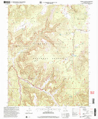
 2001 Cathedral Butte2004 Print · USGSSan Juan County, Utah, at the start of the millennium shows the dramatic convergence of federal lands near the Needles. Researchers can trace historic administrative sites like the North Cottonwood Guard Station and geological landmarks including Wedding Ring Arch and Cathedral Butte.
 - 2001 Map of La Sal West, 2004 Print
 2001 La Sal West2004 Print · USGSSan Juan County at the turn of the millennium shows a landscape defined by ranching, mining, and the high forest. Geologists and local historians can trace industrial footprints at the Lisbon Mine and Hecla Shaft, or locate the Cem near La Sal.
 - 2001 Map of Chippean Rocks, 2004 Print
 2001 Chippean Rocks2004 Print · USGSThe high mesas and deep canyons of San Juan County are documented here as they appeared at the start of the millennium. Trace the remote trails and land features of the Manti-La Sal National Forest, from the Mormon Pasture Landing Strip to the distinctive formation of Chippean Rocks.
 - 2001 Map of La Sal East, 2004 Print
 2001 La Sal East2004 Print · USGSSan Juan County's high-country ranching and mining roots are visible in this late-century survey of the La Sal Mountains. Genealogists and historians can trace the shift from Old La Sal to the newer settlement of La Sal, while locating historic operations like the Snowball Mine and Pandora Mine.
 - 2001 Map of Black Steer Canyon, 2004 Print
 2001 Black Steer Canyon2004 Print · USGSSan Juan County’s canyonlands are preserved here at the turn of the millennium, showing a landscape defined by wilderness protections and deep drainage systems. Researchers can trace the remote topography of Black Steer Canyon, Upper Horse Flats, and Lean-To Point.
 - 2001 Map of Cream Pots, 2004 Print
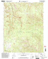
 2001 Cream Pots2004 Print · USGSThe Manti La Sal National Forest is captured here at the turn of the millennium, showing a high-desert landscape of deep canyons and mesas. Genealogists and historians can trace family-named landmarks like Whiskers Draw, local Gravel Pits, and a small Cem.
 - 2001 Map of Mount Peale, 2004 Print
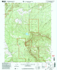
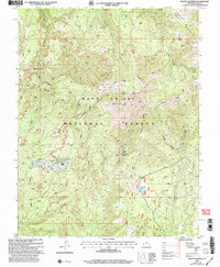
 2001 Mount Peale2004 Print · USGSThe high peaks of the San Juan and Grand County border are captured here during the early 2000s, showcasing the peaks of the southern La Sal range. Map collectors and hikers can trace routes through Geyser Pass, find secluded waters like Blue Lake, and locate the high summit of Mount Peale.
 - 2001 Map of Hotel Rock, 2004 Print
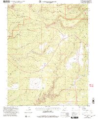
 2001 Hotel Rock2004 Print · USGSSan Juan County at the turn of the millennium reveals a landscape of high mesas and deep canyons before major modern developments. Researchers can trace land use through the Perkins Ranch, the Roadside Park, and distinct terrain like Milk Ranch Point and Cheese and Raisins.
 - 2001 Map of Abajo Peak, 2004 Print
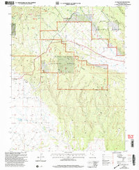
 2001 Abajo Peak2004 Print · USGSThe Abajo Mountains of San Juan County are shown here at the turn of the millennium within the forest service boundaries. Researchers can trace high-altitude water systems like the Camp Jackson Reservoir or locate local landmarks such as Blue Mtn Ranch and the Gold Queen Basin.
 - 2001 Map of Mancos Jim Butte, 2004 Print
 2001 Mancos Jim Butte2004 Print · USGSSan Juan County, Utah, is shown here as it appeared during a 2001 Forest Service revision of this high-desert landscape. Researchers can trace land use through a small Cem, numerous Corral sites, and early mining Prospects near Mancos Jim Butte.
 - 2001 Map of Monticello North, 2004 Print
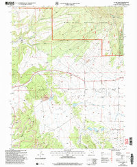
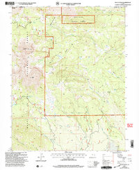
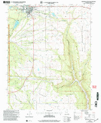
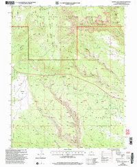
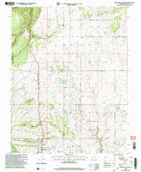 2001 Monticello North2004 Print · USGSMonticello and its northern hinterlands are documented here at the turn of the millennium, showing the intersection of forest lands and high-plateau settlement. You can trace local infrastructure from the San Juan County Airport to the Kelley Reservoir and the Rodeo Ground.
 - 2001 Map of Mount Linnaeus, 2004 Print
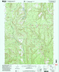
 2001 Mount Linnaeus2004 Print · USGSThe Abajo Mountains in San Juan County were a hub of remote ranching and forest management at the turn of the twenty-first century. Researchers can locate remote outposts like Bayles Ranch and historic shelters such as Bob Park Cabin or the Duckett Cabin.
 - 2001 Map of Kane Gulch, 2004 Print
 2001 Kane Gulch2004 Print · USGSSan Juan County at the turn of the millennium shows a remote landscape where federal monument and forest lands converge. Researchers can trace historic access routes across Grand Flat and Mormon Flat or locate the Kane Gulch Ranger Station and Natural Arch.
 - 2001 Map of Shay Mountain, 2004 Print
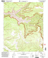
 2001 Shay Mountain2004 Print · USGSSan Juan County at the start of the new millennium shows a landscape defined by the Abajo Mountains and archaeological heritage. Researchers can locate Newspaper Rock National Historic Site, high-country landmarks like Robertson Pasture, and remote Ruins.
 - 2001 Map of Monticello Lake, 2004 Print
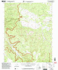
 2001 Monticello Lake2004 Print · USGSSan Juan County at the start of the millennium shows a landscape of managed water and high-country forests. Researchers can trace the path of the Aqueduct and locate mountain landmarks like Monticello Lake and Peters Point.
 - 2001 Map of Monticello South, 2004 Print
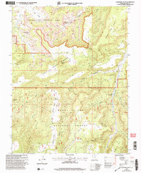
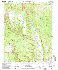
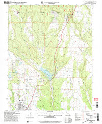
 2001 Monticello South2004 Print · USGSSan Juan County's high-plateau country comes into focus in the early 2000s as the town of Monticello meets the forest edge. Local researchers can trace old ranching features and small settlements like Verdure or map the canyons of Dodge Point.
 - 2001 Map of Blanding North, 2004 Print
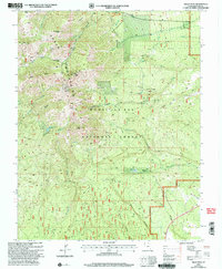
 2001 Blanding North2004 Print · USGSBlanding and the surrounding canyonlands of San Juan County are captured here at the start of the millennium as the town expanded toward the forest boundary. Researchers can trace local infrastructure and landmarks like Recapture Reservoir, Pinenut Knoll, and the Mobile Home Parks near the town center.
 - 2001 Map of Mount Tukuhnikivatz, 2004 Print
 2001 Mount Tukuhnikivatz2004 Print · USGSThe high peaks and deep canyons of the La Sal Mountains are captured here at the turn of the millennium. Researchers can locate historical mining sites like the Yellow Circle Mines or trace high-altitude routes through La Sal Pass and Brumley Ridge.
 - 2001 Map of House Park Butte, 2004 Print
 2001 House Park Butte2004 Print · USGSSan Juan County at the dawn of the new millennium reveals a complex landscape of protected wilderness and ancient sites. Researchers can locate remote features like a Cliff Dwelling and Druid Arch, or trace historic routes along Beef Basin Wash.
 - 2001 Map of Warren Canyon, 2004 Print
 2001 Warren Canyon2004 Print · USGSSan Juan County at the turn of the century is captured here as a remote wilderness landscape of high mesas and deep canyons. Researchers and outdoorsmen can trace primitive cattle-country landmarks like the Corral, find the Natural Arches, and locate secluded water sources like Sweet Alice Spring.
 - 2001 Map of Poison Canyon, 2004 Print
 2001 Poison Canyon2004 Print · USGSSan Juan County’s canyon country is shown in detail at the turn of the millennium, following a USDA Forest Service revision. Researchers can trace historic grazing sites like Redd Pasture and Horse Pasture amidst the protected Dark Canyon Wilderness.
 - 2001 Map of South Long Point, 2004 Print
 2001 South Long Point2004 Print · USGSSan Juan County at the turn of the millennium is a landscape of high plateaus and carved canyon systems. Researchers can trace the relief of South Long Point and locate remote landmarks like Angel Arch, Salvation Knoll, and Texas Flat.
Showing maps 1-25 of 28
Top cities of San Juan County
- Blanding historical maps
- Oljeto (Moonlight Water) historical maps
- Monticello historical maps
- Bluff historical maps
- Mexican Hat historical maps
Frequently asked questions
- What are the different types of historical maps available for San Juan County?
- What is the oldest map of San Juan County?
- Where can I purchase historical maps of San Juan County for my home or office?
- Where can I download high-res historical maps of San Juan County?
- Are there historical topographic maps available for San Juan County?
- Is there historical aerial imagery available for San Juan County?
- Where are historical maps of San Juan County sourced from?