1980s Maps of San Juan County, Utah
Explore 172 historic maps of San Juan County from the 1980s. These maps offer a rare glimpse into what life looked like during the 1980s — showing old roads, neighborhoods, homes, and landmarks that have changed or disappeared over time.
Whether you're researching your family's past, planning a metal detecting trip, or studying how San Juan County's landscape evolved across the 1980s, these high-resolution maps are a powerful tool for exploring the history of this region.
- Focus on a specific era: All maps on this page are from the 1980s, giving you a focused view of this time period.
- See what’s changed: Compare century-old streets, trails, and buildings to today's modern landscape using overlays and satellite layers.
- Research with precision: Use these maps for genealogy, historical research, land use analysis, or educational projects.
- View, download, or print: Maps are fully viewable online in high resolution, and can be downloaded or printed for your own records.
Start exploring San Juan County's history through authentic maps from the 1980s. This is your window into the past.
San Juan County, UT maps
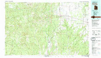
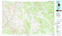
(172)- 1980 Map of Hanksville, 1987 Print
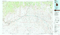
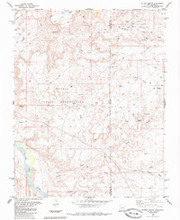
 1980 Hanksville1987 Print · USGSHanksville and the surrounding high desert are captured in the early 1980s, showcasing a landscape of dramatic topography and isolated outposts. Researchers can trace the rugged drainage of the Dirty Devil River and locate landmarks like the Factory Butte Mine and Robbers Roost Flats.2 unique versions available
 - 1980 Map of Hite Crossing, 1987 Print
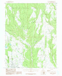
 1980 Hite Crossing1987 Print · USGSSouthern Utah's canyon country comes alive in the early eighties as the waters of Lake Powell reshape the landscape. Trace old mining operations like the Happy Jack Mine or the remote peaks of the Henry Mountains.
 - 1981 Map of Navajo Mountain, 1982 Print
 1981 Navajo Mountain1982 Print · USGSThe high desert border of Utah and Arizona is captured here in the early eighties, showing the sprawling waters of Lake Powell and the San Juan River. Researchers can locate the Sunwind Mine, the Navajo Mountain School, and the iconic Rainbow Bridge.
 - 1982 Map of Toh Atin Mesa East, 1983 Print
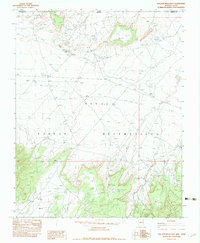 1982 Toh Atin Mesa East1983 Print · USGSThe Navajo Indian Reservation in the late seventies is shown here at the border of Arizona and Utah. Researchers can trace land use through landmarks like the Red Mesa Trading Post, the Rattlesnake Mine, and Tsilah Wash.
 - 1982 Map of Toh Atin Mesa West, 1983 Print
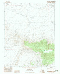 1982 Toh Atin Mesa West1983 Print · USGSThe high Arizona-Utah borderlands within the Navajo Indian Reservation are shown here as they appeared in the early eighties. Genealogists and historians can trace industrial footprints through the Red Mesa Sch, various Drill Hole sites, and a Landing Strip.
 - 1982 Map of Cow Butte, 1983 Print
 1982 Cow Butte1983 Print · USGSCrossing the Arizona-Utah border in the early eighties, this survey captures a remote stretch of the Navajo Nation and the northern foothills of the Carrizo Mountains. Trace the paths of Toh Dahstini Wash and Tsitah Wash or locate Toh Dahstini Spring and the Cow Butte landmark.
 - 1982 Map of Blanding, 1983 Print
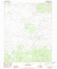
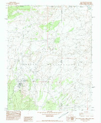
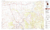
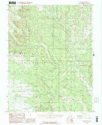
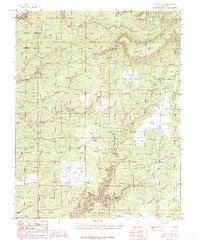
 1982 Blanding1983 Print · USGSSoutheastern Utah and the Colorado borderlands are shown here in the early eighties, capturing the high-desert settlements of San Juan County. Researchers can trace local landmarks like Nancy Patterson Lake, the ranching community of Ucolo, and the remote Lockerby.
 - 1982 Map of Teec Nos Pos, 1983 Print
 1982 Teec Nos Pos1983 Print · USGSThe Navajo Nation community of Teec Nos Pos is captured in the early 1980s at the intersection of four states. Researchers can trace tribal infrastructure and land use, from the Teec Nos Pos Boarding Sch and Rodeo Ground to the Teec Nos Pos Landing Strip.
 - 1982 Map of La Sal, 1983 Print
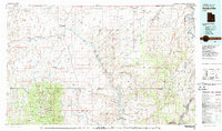
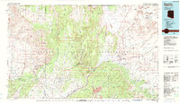
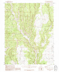
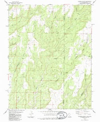
 1982 La Sal1983 Print · USGSThe high desert of southeastern Utah meets the Colorado border in the early eighties, showing a landscape defined by deep canyons and mining. Trace the industrial operations at Lisbon Mine or explore the early mapping of The Needles and Island in the Sky.2 unique versions available
 - 1983 Map of Bluff
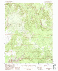
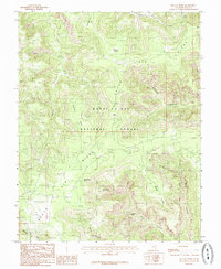
 1983 Bluff1983 Print · USGSThe San Juan River country in the early 1980s reveals a landscape of high mesas and indigenous settlements. Trace the rugged terrain of Comb Ridge, locate the Hatch Trading Post, and explore the roads connecting Bluff to Mexican Hat.2 unique versions available
 - 1983 Map of Moab
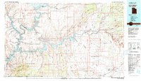
 1983 Moab1983 Print · USGSThe Colorado River corridor near Moab is captured here in the early eighties, showcasing a landscape of uranium mining and iconic parklands. Trace the Denver and Rio Grande Western RR as it passes through Cisco or locate landmarks like Delicate Arch and the Telluride Mines.3 unique versions available
 - 1984 Map of Kayenta
 1984 Kayenta1984 Print · USGSThe Navajo Nation in the mid-1980s reveals a landscape of massive sandstone mesas and ancient monuments. Researchers can trace the development of Kayenta and find landmarks like Yellow Water Mine, Goulding Well, and the Navajo National Monument.
 - 1985 Map of Woodenshoe Buttes
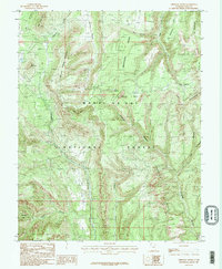
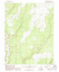
 1985 Woodenshoe Buttes1985 Print · USGSSan Juan County’s high plateaus are frozen in time during the mid-eighties as this survey details the canyonlands around Woodenshoe Buttes. Researchers can trace the drainage of Woodenshoe Canyon or locate landforms like The Heel and The Toe.
 - 1985 Map of Chippean Rocks
 1985 Chippean Rocks1985 Print · USGSThe San Juan high country in the mid-1980s is documented here as a landscape of isolated plateaus and deep canyons. Researchers can trace historic land use patterns through landmarks like Mormon Pasture, Sand Spring, and the Seven Sisters Buttes.2 unique versions available
 - 1985 Map of Black Mesa Butte
 1985 Black Mesa Butte1985 Print · USGSSan Juan County's high plateaus and deep drainage systems are documented here in the mid-eighties. Researchers can locate remote landmarks like Black Mesa Butte and Ruin Spring, or trace the winding course of Cottonwood Wash.
 - 1985 Map of Cream Pots
 1985 Cream Pots1985 Print · USGSSan Juan County in the mid-1980s reveals a backcountry defined by the deep gorges of the Manti-La Sal National Forest. Researchers can trace old routes like the Pack Trail or locate isolated landmarks such as Milk Ranch Point and the Cream Pots.2 unique versions available
 - 1985 Map of South Long Point
 1985 South Long Point1985 Print · USGSSan Juan County's high canyon country in the mid-1980s is documented here through its intricate drainage networks and named high points. You can trace early routes past Salvation Knoll, locate geological landmarks like Angel Arch, and find water sources at Posey Spring.
 - 1985 Map of Papoose Canyon
 1985 Papoose Canyon1985 Print · USGSThe high mesas of the San Juan and Dolores county borderlands are shown here in the mid-1980s, revealing a landscape of deep drainages and remote plateaus. Researchers can trace the path of the Pack Trail or locate isolated water sources like Tucker Spring and Brewer Well.
 - 1985 Map of Horsehead Point
 1985 Horsehead Point1985 Print · USGSSan Juan County in the mid-1980s is captured here as a landscape of dramatic canyons and high plateaus. Researchers can trace early resource exploration via several prospects and follow the natural drainages of Montezuma Creek and Coal Bed Canyon.
 - 1985 Map of Kane Gulch
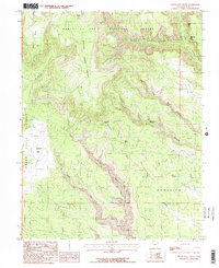
 1985 Kane Gulch1985 Print · USGSSan Juan County, Utah, is shown in the mid-1980s as a high desert landscape of deep canyons and massive plateaus. You can trace remote landmarks like Indian Park and Mormon Flat or locate the headwaters of White Canyon.2 unique versions available
 - 1985 Map of Fable Valley
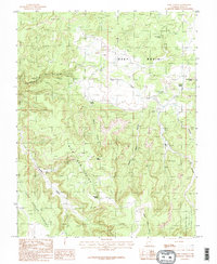 1985 Fable Valley1985 Print · USGSCanyonlands ranching and wilderness lore come alive in this mid-eighties survey of San Juan County. Trace the historic Pack Trail through Fable Valley or locate essential water sources like Wild Cow Spring and Beef Basin Spring.2 unique versions available
 - 1985 Map of Burnt Cabin Creek
 1985 Burnt Cabin Creek1985 Print · USGSThe high borderlands of Dolores County appear in the mid-1980s as a landscape of deep canyons and isolated ranching infrastructure. Genealogists and local historians can locate remote landmarks like Cedar Cem, Oak Creek, and Burnt Cabin Creek.
 - 1985 Map of Peters Nipple
 1985 Peters Nipple1985 Print · USGSThe high desert of San Juan County during the mid-eighties shows a landscape defined by tribal boundaries and energy exploration. Researchers can trace the Mail Trail, locate a remote Cem, and see the network of Oil Wells near Peters Nipple.
 - 1985 Map of Blanding North
 1985 Blanding North1985 Print · USGSBlanding and its surrounding canyons were undergoing steady growth in the mid-1980s as modern infrastructure expanded across the high plateau. Researchers can trace the rugged network of Mustang Mesa and Alkali Point alongside landmarks like Pinenut Knoll.
 - 1985 Map of Kigalia Point
 1985 Kigalia Point1985 Print · USGSHigh plateau wilderness in the mid-1980s reveals the dramatic geological breaks and hidden water sources of the San Juan backcountry. Researchers can trace remote routes past Keystone Arch or locate historic grazing sites like Babylon Pasture and Squaw Water Hole.
Showing maps 1-25 of 172
Top cities of San Juan County
- Blanding historical maps
- Oljeto (Moonlight Water) historical maps
- Monticello historical maps
- Bluff historical maps
- Mexican Hat historical maps
Frequently asked questions
- What are the different types of historical maps available for San Juan County?
- What is the oldest map of San Juan County?
- Where can I purchase historical maps of San Juan County for my home or office?
- Where can I download high-res historical maps of San Juan County?
- Are there historical topographic maps available for San Juan County?
- Is there historical aerial imagery available for San Juan County?
- Where are historical maps of San Juan County sourced from?