1990s Maps of San Juan County, Utah
Explore 21 historic maps of San Juan County from the 1990s. These maps offer a rare glimpse into what life looked like during the 1990s — showing old roads, neighborhoods, homes, and landmarks that have changed or disappeared over time.
Whether you're researching your family's past, planning a metal detecting trip, or studying how San Juan County's landscape evolved across the 1990s, these high-resolution maps are a powerful tool for exploring the history of this region.
- Focus on a specific era: All maps on this page are from the 1990s, giving you a focused view of this time period.
- See what’s changed: Compare century-old streets, trails, and buildings to today's modern landscape using overlays and satellite layers.
- Research with precision: Use these maps for genealogy, historical research, land use analysis, or educational projects.
- View, download, or print: Maps are fully viewable online in high resolution, and can be downloaded or printed for your own records.
Start exploring San Juan County's history through authentic maps from the 1990s. This is your window into the past.
San Juan County, UT maps
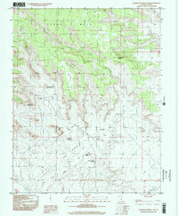
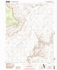
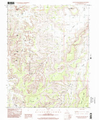
(21)- 1996 Map of Jacobs Chair, 2002 Print
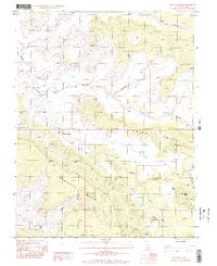 1996 Jacobs Chair2002 Print · USGSSan Juan County’s high desert landscape is documented here in the late twentieth century, showing a remote area shaped by deep canyons and mesas. Researchers can trace the layout of the Fry Canyon Trailer Park, the Landing Strip, and early exploration sites like Gravel Crossing.
 - 1996 Map of Slickhorn Canyon East, 2002 Print
 1996 Slickhorn Canyon East2002 Print · USGSSan Juan County’s high desert plateaus and river canyons are captured here in the late nineties, showcasing the intersection of tribal and federal lands. Researchers can trace the rugged shoreline of the San Juan River and locate remote landmarks like Government Rapids and Cowboy Hat.
 - 1996 Map of Indian Head Pass, 2002 Print
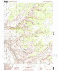
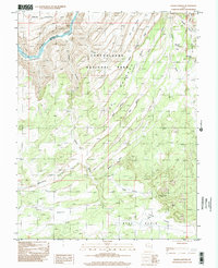
 1996 Indian Head Pass2002 Print · USGSSan Juan County's high plateaus and canyon systems are documented here in the mid-1990s as they appeared within the Glen Canyon National Recreation Area. Researchers can trace old 4WD tracks and identify isolated Prospect sites near Indian Head Pass and Dark Canyon.
 - 1996 Map of Kane Springs, 2002 Print
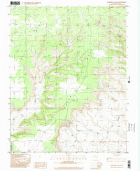
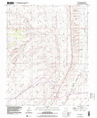
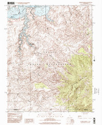
 1996 Kane Springs2002 Print · USGSSpanish Valley and the high mesas of the San Juan county line are captured here in the mid-nineties. Detail-oriented researchers can locate the Landing Strip, trace the water systems around Kens Lake, and identify numerous adits across Bridger Jack Mesa.
 - 1996 Map of Snow Flat Spring Cave, 2002 Print
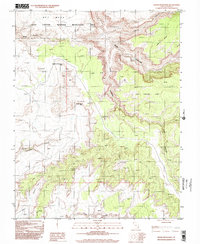
 1996 Snow Flat Spring Cave2002 Print · USGSCedar Mesa and its deep canyon networks are documented here in the late 1990s as they appeared prior to modern designations. Researchers can trace the historic Emigrant Trail or locate remote water sources like Snow Flat Spring Cave and Nevills Arch.
 - 1996 Map of Spanish Bottom, 2002 Print
 1996 Spanish Bottom2002 Print · USGSThe confluence of the Green and Colorado Rivers is captured here in the mid-1990s within Canyonlands National Park. You can trace remote trails to geological landmarks like The Doll House and the monoliths of The Maze.
 - 1996 Map of Bluff NW, 2002 Print
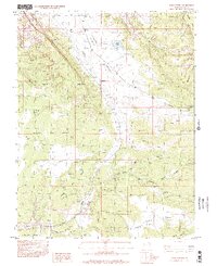
 1996 Bluff NW2002 Print · USGSSan Juan County, Utah, is shown here in the 1990s as a landscape of deep canyons and pioneer history. Trace the path of the Mormon Trail through The Twist or locate ancient habitations like Cliff Dwellings Spring and numerous Ruins.
 - 1996 Map of Moss Back Butte, 2002 Print
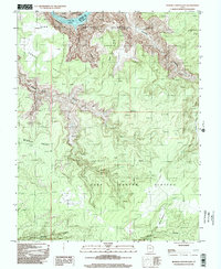
 1996 Moss Back Butte2002 Print · USGSSan Juan County, Utah, is shown in the mid-1990s as a landscape of massive stone bridges and deep canyon systems. Geologists and hikers can trace the Emigrant Trail (Pack) and locate ancient sites like the Horse Collar Ruin near White Canyon.
 - 1996 Map of Cigarette Spring Cave, 2002 Print
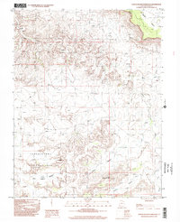
 1996 Cigarette Spring Cave2002 Print · USGSSan Juan County’s high desert and dramatic mesas are captured here as they appeared in the late nineties, before modern shifts in land management. Researchers can trace the winding path of Lime Creek or locate landmarks like Cigarette Spring Cave and Castle Butte.
 - 1996 Map of Slickhorn Canyon West, 2002 Print
 1996 Slickhorn Canyon West2002 Print · USGSThe San Juan River meets the rising waters of Lake Powell in the late nineties, cutting through the red rock of San Juan County. Researchers can trace the boundary of the Navajo Indian Reservation and locate landmarks like Shaw Arch and Slickhorn Rapids.
 - 1996 Map of Cedar Mesa South, 2002 Print
 1996 Cedar Mesa South2002 Print · USGSHigh plateau country meets the desert floor in the mid-nineties as the southern escarpment of Cedar Mesa gives way to the Valley of the Gods. Trace the steep switchbacks of the Moki Dugway and locate remote outposts like Lees Ranch.
 - 1996 Map of Bowdie Canyon East, 2002 Print
 1996 Bowdie Canyon East2002 Print · USGSThe high desert of San Juan County is captured here in the mid-nineties, showing where the river meets the vast plateau. Researchers can trace remote canyon systems like Gypsum Canyon and identify isolated infrastructure like the Landing Strip near Horse Pasture.
 - 1996 Map of Red House Spring, 2002 Print
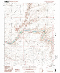
 1996 Red House Spring2002 Print · USGSThe high desert of San Juan County is mapped here in the late nineties, showing a landscape defined by deep canyons and mesas. Trace remote routes through Grand Gulch and locate vital water sources like Red House Spring and Collins Spring.2 unique versions available
 - 1997 Map of Bluff SW, 2002 Print
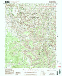
 1997 Bluff SW2002 Print · USGSSan Juan County in the late nineties is a landscape of profound archaeological depth and geologic scale. Researchers can trace the path of the Mormon Trail and locate numerous Cliff Dwellings set against Comb Ridge.
 - 1997 Map of The Loop, 2002 Print
 1997 The Loop2002 Print · USGSCanyonlands National Park at the close of the twentieth century reveals a landscape defined by the winding Colorado River and its dramatic oxbow at The Loop. Trace backcountry routes near Elephant Hill and find remote sites like Squaw Flat Campground and Cave Spring.
 - 1997 Map of North Six-shooter Peak, 2002 Print
 1997 North Six-shooter Peak2002 Print · USGSSan Juan County in the late 1990s reveals a desert landscape of high plateaus and carved drainage basins within Canyonlands National Park. Researchers can trace the winding Indian Creek or locate landmarks like North Six-shooter Peak and Bogus Pocket.
 - 1997 Map of South Six-Shooter Peak, 2002 Print
 1997 South Six-Shooter Peak2002 Print · USGSSan Juan County’s canyon country was surveyed in the late nineties, documenting a landscape of sandstone spires and ancient sites. Map collectors and hikers can trace paths to Keyhole Ruins, South Six-Shooter Peak, and the All American Man.
 - 1997 Map of Cross Canyon, 2002 Print
 1997 Cross Canyon2002 Print · USGSSan Juan County at the end of the twentieth century reveals a landscape defined by the deep incisions of the Colorado River. Researchers can trace the unique geology of The Grabens or locate remote landmarks like Bobbys Hole and Horsehoof Arch.
 - 1997 Map of Rainbow Bridge, 2002 Print
 1997 Rainbow Bridge2002 Print · USGSThe Utah-Arizona borderlands at the end of the twentieth century reveal a terrain defined by ancient geological wonders and the rising waters of Lake Powell. Researchers can trace the path to Rainbow Bridge and the high slopes of Navajo Mountain within the Navajo Indian Reservation.
 - 1997 Map of Druid Arch, 2002 Print
 1997 Druid Arch2002 Print · USGSCanyonlands National Park and the surrounding San Juan County terrain are shown here as they were documented in the 1990s. Researchers can trace remote routes and natural landmarks including Druid Arch, the expansive Beef Basin, and the hidden meadows of Chesler Park.
 - 1997 Map of Bluff, 2002 Print
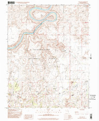
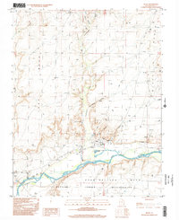 1997 Bluff2002 Print · USGSThe community of Bluff and the surrounding canyonlands appear here in the late nineties as a landscape of red-rock mesas and river-bottom mission life. Researchers can trace the San Juan River corridor, the St Christophers Mission, and landmarks like the Navajo Twins.
End of results
Showing maps 1-21 of 21
Top cities of San Juan County
- Blanding historical maps
- Oljeto (Moonlight Water) historical maps
- Monticello historical maps
- Bluff historical maps
- Mexican Hat historical maps
Frequently asked questions
- What are the different types of historical maps available for San Juan County?
- What is the oldest map of San Juan County?
- Where can I purchase historical maps of San Juan County for my home or office?
- Where can I download high-res historical maps of San Juan County?
- Are there historical topographic maps available for San Juan County?
- Is there historical aerial imagery available for San Juan County?
- Where are historical maps of San Juan County sourced from?