Old Maps of Old La Sal, Utah for Genealogy
Trace your family roots with 18 historic maps of Old La Sal. These high-res maps reveal old neighborhoods, homesites, landmarks, and streets — helping you uncover where your ancestors lived and how the area evolved over time.
- Explore historic neighborhoods: Identify where your relatives may have lived in the 1800s or 1900s.
- Compare maps over time: Trace the changes in streets, buildings, and landmarks for multi-generational research.
- Perfect for genealogy & ancestry research: Used by family historians and researchers to map out lineage and migration.
These maps are an incredible resource for exploring your personal connection to Old La Sal's past.
Old La Sal, UT maps
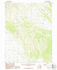
(18)- 1885 Map of La Sal
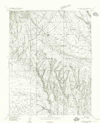
 1885 La Sal1885 Print · USGSSoutheast Utah in the mid-1880s remains a frontier of dramatic river canyons and high mountain peaks. Genealogists and historians can trace the early footprints of Moab and Plainfield or locate the high summits of Mt Peale and the path of the Green River.6 unique versions available
 - 1954 Map of Mt Peale 1 SW, 1955 Print
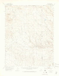
 1954 Mt Peale 1 SW1955 Print · USGSThe high plateau of San Juan County is documented here during the mid-1950s, showing the early ranching and forestry operations of the region. Researchers can trace the shift from Old La Sal to La Sal and locate landmarks like the Sawmill and La Sal Guard Station.
 - 1954 Map of La Sal, 1957 Print
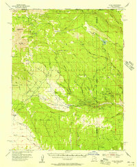 1954 La Sal1957 Print · USGSThe La Sal Mountains at the peak of the mid-century uranium boom reveal a rugged landscape of high-altitude mining and ranching. Researchers can trace numerous prospects and operations like the Vanadium Queen Mine, Uranium Girl Mine, and the early settlement at Old La Sal.6 unique versions available
 - 1956 Map of Moab, 1972 Print
 1956 Moab1972 Print · USGSThe Colorado Plateau and La Sal Mountains appear here in the mid-fifties, just as the uranium boom and energy exploration were reshaping the Four Corners. Researchers can trace the Denver and Rio Grande Western through Cisco or locate the remote outpost of Uravan and Looking Glass Rock.3 unique versions available
 - 1959 Map of Moab
 1959 Moab1959 Print · USGSSoutheast Utah and Western Colorado are mapped here in the late fifties, just as the uranium boom was transforming the remote canyon lands. Genealogists and historians can trace the foundations of Moab and Nucla, or locate mining sites and landmarks like Uravan and Dead Horse Point.
 - 1960 Map of Moab
 1960 Moab1960 Print · USGSThe canyonlands and high plateaus of the Utah-Colorado border are shown here during the mid-century uranium boom. Researchers can trace the river-and-rail corridors of the Colorado River and the Denver and Rio Grande Western near Moab and Uravan.3 unique versions available
 - 1962 Map of Moab
 1962 Moab1962 Print · USGSThe canyon country of southeastern Utah and western Colorado is captured here in the early sixties, showing the reach of the Denver and Rio Grande Western through the desert. Researchers can trace the layout of mining settlements like Uravan and old railroad stops at Cisco and Sagers Station.
 - 1964 Map of Moab
 1964 Moab1964 Print · USGSThe canyonlands of eastern Utah and western Colorado are captured here in the mid-1960s, a time when uranium mining shaped the local economy. Researchers can trace the river-and-rail network through Sinbad Valley and locate mining outposts like Uravan and Vancorum.
 - 1965 Map of Moab
 1965 Moab1965 Print · USGSSoutheast Utah and Western Colorado are mapped here in the mid-sixties, showcasing a landscape of high plateaus and deep river canyons. Genealogists and historians can trace the mining-era towns of Uravan and Paradox or locate remote landmarks like Castleton and Dead Horse Point.
 - 1974 Map of La Sal, 1975 Print
 1974 La Sal1975 Print · USGSThe high plateau and jagged peaks of the Utah-Colorado border come alive in the 1970s, showing a landscape defined by ranching and Cold War-era mining. Genealogists and historians can trace old homesteads like Pine Lodge Ranch or locate the numerous named claims including the Vanadium Queen Mine and Uranium Girl Mine.
 - 1982 Map of La Sal, 1983 Print
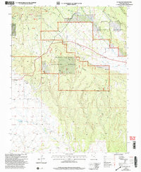
 1982 La Sal1983 Print · USGSThe high desert of southeastern Utah meets the Colorado border in the early eighties, showing a landscape defined by deep canyons and mining. Trace the industrial operations at Lisbon Mine or explore the early mapping of The Needles and Island in the Sky.2 unique versions available
 - 1987 Map of La Sal East
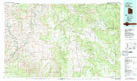
 1987 La Sal East1987 Print · USGSSan Juan County’s high country is documented here in the late 1980s, showcasing a landscape of mining and forestry. Local historians can trace mining operations at the Snowball Mine and locate the historic settlement site of Old La Sal.2 unique versions available
 - 2001 Map of La Sal East, 2004 Print
 2001 La Sal East2004 Print · USGSSan Juan County's high-country ranching and mining roots are visible in this late-century survey of the La Sal Mountains. Genealogists and historians can trace the shift from Old La Sal to the newer settlement of La Sal, while locating historic operations like the Snowball Mine and Pandora Mine.
 - 2011 Map of La Sal East, 2011 Print
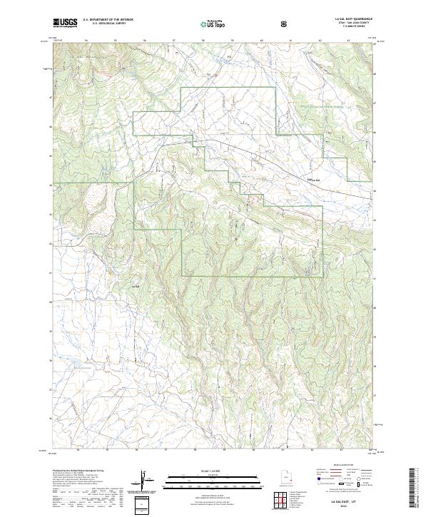
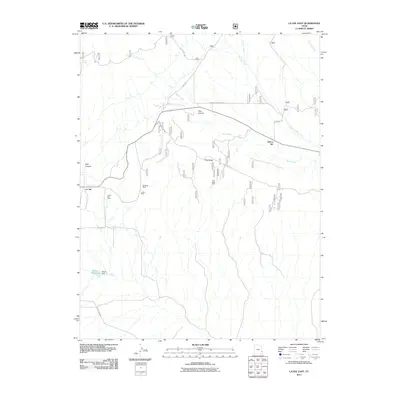 2011 La Sal East2011 Print · USGSCovers Old La Sal, including La Sal, San Juan County, and other nearby areas
 - 2014 Map of La Sal East, 2014 Print
 2014 La Sal East2014 Print · USGSCovers Old La Sal, including La Sal, San Juan County, and other nearby areas
 - 2017 Map of La Sal East, 2017 Print
 2017 La Sal East2017 Print · USGSCovers Old La Sal, including La Sal, San Juan County, and other nearby areas
 - 2020 Map of La Sal East, 2020 Print
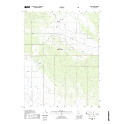 2020 La Sal East2020 Print · USGSCovers Old La Sal, including La Sal, San Juan County, and other nearby areas
 - 2023 Map of La Sal East, 2023 Print
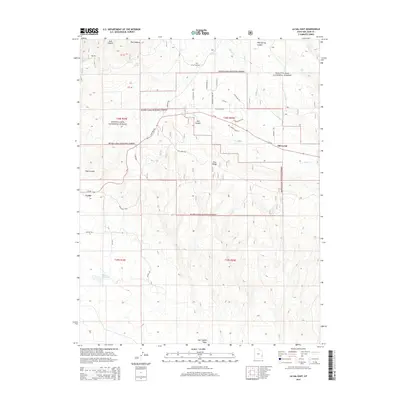
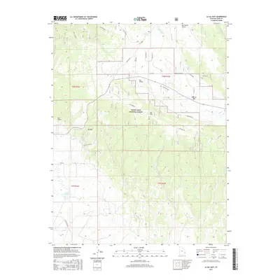
 2023 La Sal East2023 Print · USGSSoutheast Utah’s high-country terrain is captured here recently, showing the evolution of the Manti-La Sal National Forest and its surrounding communities. You can trace the shift from the original site at Old La Sal to the current La Sal settlement, while locating remote landmarks like the La Sal Guard and Wilcox Reservoir.
End of results
Showing maps 1-18 of 18
Frequently asked questions
- What are the different types of historical maps available for Old La Sal?
- What is the oldest map of Old La Sal?
- Where can I purchase historical maps of Old La Sal for my home or office?
- Where can I download high-res historical maps of Old La Sal?
- Are there historical topographic maps available for Old La Sal?
- Is there historical aerial imagery available for Old La Sal?
- Where are historical maps of Old La Sal sourced from?