Old Maps of Erda, Utah for Hiking & Exploration
Hike through history with 11 historic maps of Erda. Explore old trails, ghost towns, and forgotten backroads — perfect for outdoor adventurers and local explorers.
- Rediscover forgotten places: Map out old mining camps, roads, and footpaths that no longer exist on modern maps.
- Layer with modern tools: Combine with LiDAR or satellite views to plan hikes through historical terrain.
- Made for exploration: Popular among hikers, overlanders, and local history lovers.
Use these maps to find adventure and explore the hidden past of Erda.
Erda, UT maps
(11)- 1885 Map of Tooele Valley
 1885 Tooele Valley1885 Print · USGSThe valleys and ranges west of the Wasatch are captured here in the mid-1880s, showcasing the early mining and rail infrastructure of the region. Genealogists can trace early settlements like Grantsville, Ophir, and Stockton, or the route of the Utah and Nevada R. R.6 unique versions available
 - 1953 Map of Tooele, 1968 Print
 1953 Tooele1968 Print · USGSTooele County is shown here in the 1950s, a vast landscape transitioning between the industrial growth of the Salt Lake Valley and isolated military testing grounds. Researchers can trace the routes of the Western Pacific railroad and locate historic outposts like Iosepa Ranch and St John Station.3 unique versions available
 - 1955 Map of Tooele, 1958 Print
 1955 Tooele1958 Print · USGSTooele County and the Great Salt Lake are captured here during the mid-fifties, an era of burgeoning military testing and industrial mining. Researchers can trace the rail sidings at Salduro Station, the grounds of the Deseret Chemical Corps Depot, and the International Smelting Co facilities.3 unique versions available
 - 1955 Map of Tooele, 1960 Print
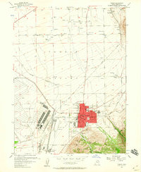 1955 Tooele1960 Print · USGSTooele was evolving into a significant military and industrial center in the mid-fifties, anchored by the massive Tooele Ordnance Depot. Local historians can trace the town's mid-century footprint, from the Drive-in Theater to the family-named Angels Grove and Warner Station.3 unique versions available
 - 1979 Map of Tooele, 1980 Print
 1979 Tooele1980 Print · USGSTooele and the eastern Oquirrh foothills appear here in the late seventies, showing a landscape defined by massive industrial works and military sites. Researchers can trace the rail corridors of the Western Pacific or locate the historic Monarch Mine and the vast Open Pit Mine near Bingham.
 - 1997 Map of Tooele, 2002 Print
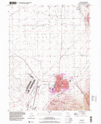 1997 Tooele2002 Print · USGSThe Tooele Valley at the close of the twentieth century shows a landscape defined by military industry and mountain-shadowed settlements. Trace local family history at the Tooele Cemetery, or locate old rail stops like Warner Station and Erda Siding.
 - 2011 Map of Tooele, 2011 Print
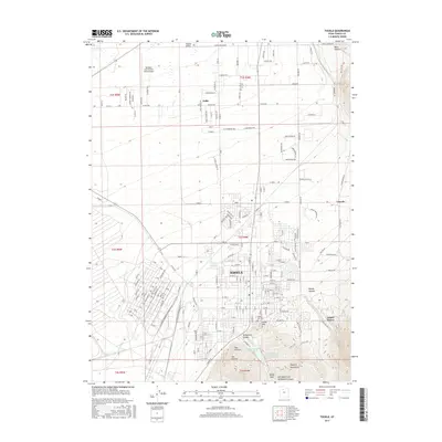
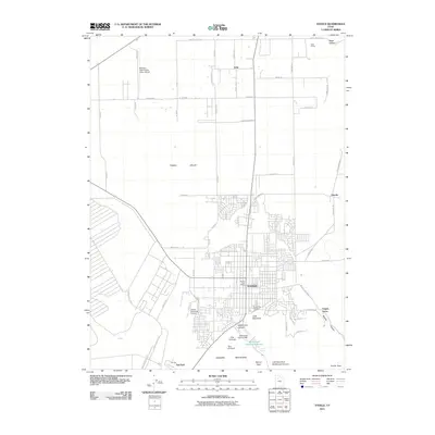 2011 Tooele2011 Print · USGSCovers Erda, including Tooele, Grantsville, and other nearby areas
 - 2014 Map of Tooele, 2014 Print
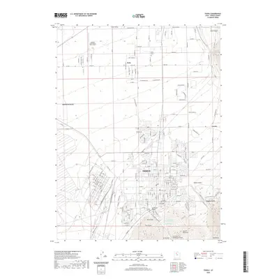
 2014 Tooele2014 Print · USGSCovers Erda, including Tooele, Grantsville, and other nearby areas
 - 2017 Map of Tooele, 2017 Print
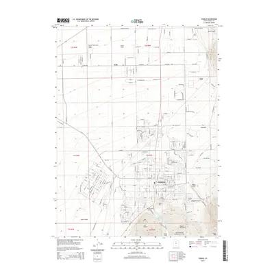
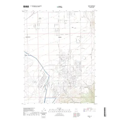
 2017 Tooele2017 Print · USGSCovers Erda, including Tooele, Grantsville, and other nearby areas
 - 2020 Map of Tooele, 2020 Print
 2020 Tooele2020 Print · USGSCovers Erda, including Tooele, Grantsville, and other nearby areas
 - 2023 Map of Tooele, 2023 Print
 2023 Tooele2023 Print · USGSThe Tooele Valley at the start of the 2020s shows a complex landscape of military history, aviation, and mountain-side settlement. Researchers can trace local roots at the Erda Pioneer Cem or study the footprint of the Tooele Army Depot.
End of results
Showing maps 1-11 of 11
Top cities near Erda
- Salt Lake City historical maps
- West Valley City historical maps
- West Jordan historical maps
- South Jordan historical maps
- Eagle Mountain historical maps
- Herriman historical maps
See more
Frequently asked questions
- What are the different types of historical maps available for Erda?
- What is the oldest map of Erda?
- Where can I purchase historical maps of Erda for my home or office?
- Where can I download high-res historical maps of Erda?
- Are there historical topographic maps available for Erda?
- Is there historical aerial imagery available for Erda?
- Where are historical maps of Erda sourced from?