1990s Maps of Pleasant Grove, Utah
Explore 8 historic maps of Pleasant Grove from the 1990s. These maps offer a rare glimpse into what life looked like during the 1990s — showing old roads, neighborhoods, homes, and landmarks that have changed or disappeared over time.
Whether you're researching your family's past, planning a metal detecting trip, or studying how Pleasant Grove's landscape evolved across the 1990s, these high-resolution maps are a powerful tool for exploring the history of this region.
- Focus on a specific era: All maps on this page are from the 1990s, giving you a focused view of this time period.
- See what’s changed: Compare century-old streets, trails, and buildings to today's modern landscape using overlays and satellite layers.
- Research with precision: Use these maps for genealogy, historical research, land use analysis, or educational projects.
- View, download, or print: Maps are fully viewable online in high resolution, and can be downloaded or printed for your own records.
Start exploring Pleasant Grove's history through authentic maps from the 1990s. This is your window into the past.
Pleasant Grove, UT maps
(8)- 1992 Map of Pelican Point
 1992 Pelican Point1992 Print · USGSThe northeastern shores of Utah Lake come into focus in the early nineties as urban development begins to press against the shoreline. Researchers can trace the expansion of American Fork, locate the Greenwood Sch, and find industrial landmarks like the Cooling Pond and Powell Slough.
 - 1993 Map of Timpanogos Cave
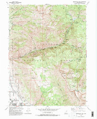 1993 Timpanogos Cave1993 Print · USGSThe foothills of the Wasatch Range come alive in the early nineties as residential growth in Pleasant Grove and Cedar Hills reaches toward the canyon mouths. Researchers can trace the path of the Salt Lake City Aqueduct or find mountain landmarks like Emerald Lake and Timpanogos Cave National Monument.2 unique versions available
 - 1994 Map of Lehi
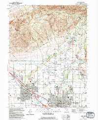 1994 Lehi1994 Print · USGSIn the mid-1990s, the northern Utah Valley was a landscape of expanding towns and complex irrigation. Genealogists and local historians can trace the foundations of Lehi and Alpine, locating landmarks like Lehi Cem and the Utah State Training School.
 - 1994 Map of Orem
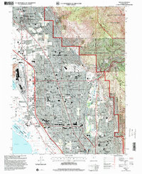
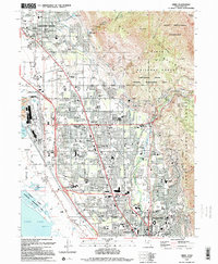 1994 Orem1994 Print · USGSThe Utah Valley landscape is shown here in the mid-1990s as suburban growth reaches the base of Mount Timpanogos. Trace the rail corridors of the Union Pacific, the vast Brigham Young University campus, and the Bunker Grain Elevators.2 unique versions available
 - 1998 Map of Lehi, 2000 Print
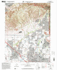 1998 Lehi2000 Print · USGSNorthern Utah Valley undergoes a period of rapid suburban growth in the late nineties as residential borders expand toward the mountains. Genealogists and local historians can trace family plots in the Lehi Cem or locate community hubs like Sego Lily Sch and the Utah State Developmental Center.
 - 1998 Map of Orem, 2000 Print
 1998 Orem2000 Print · USGSOrem and the surrounding Utah Valley suburbs are shown during a period of rapid growth in the late nineties. Researchers can trace the expansion of Brigham Young University and find landmarks like the Bunker Grain Elevators and Orem Cem.
 - 1998 Map of Timpanogos Cave, 2000 Print
 1998 Timpanogos Cave2000 Print · USGSIn the late 1990s, the northern Utah County foothills show a landscape of high-alpine wilderness meeting rapid suburban growth. Trace the wild terrain of Mount Timpanogos alongside developed landmarks like the Jordan Aqueduct and Pleasant Grove.
 - 1999 Map of Pelican Point, 2001 Print
 1999 Pelican Point2001 Print · USGSThe eastern shores of Utah Lake at the end of the century reveal a landscape of rapid suburban and industrial growth. Genealogists and historians can trace the development of American Fork and Lindon alongside landmarks like Greenwood Sch and the Slag Dump at Vineyard.
End of results
Showing maps 1-8 of 8
Top cities near Pleasant Grove
- West Jordan historical maps
- Provo historical maps
- Orem historical maps
- Sandy historical maps
- Lehi historical maps
- South Jordan historical maps
See more
Frequently asked questions
- What are the different types of historical maps available for Pleasant Grove?
- What is the oldest map of Pleasant Grove?
- Where can I purchase historical maps of Pleasant Grove for my home or office?
- Where can I download high-res historical maps of Pleasant Grove?
- Are there historical topographic maps available for Pleasant Grove?
- Is there historical aerial imagery available for Pleasant Grove?
- Where are historical maps of Pleasant Grove sourced from?