1900s (20th Century) Maps of Bennington County, Vermont
Explore 110 historic maps of Bennington County from the 1900s (20th Century). These maps offer a rare glimpse into what life looked like during the 1900s — showing old roads, neighborhoods, homes, and landmarks that have changed or disappeared over time.
Whether you're researching your family's past, planning a metal detecting trip, or studying how Bennington County's landscape evolved across the 1900s, these high-resolution maps are a powerful tool for exploring the history of this region.
- Focus on a specific era: All maps on this page are from the 1900s, giving you a focused view of this time period.
- See what’s changed: Compare century-old streets, trails, and buildings to today's modern landscape using overlays and satellite layers.
- Research with precision: Use these maps for genealogy, historical research, land use analysis, or educational projects.
- View, download, or print: Maps are fully viewable online in high resolution, and can be downloaded or printed for your own records.
Start exploring Bennington County's history through authentic maps from the 1900s. This is your window into the past.
Bennington County, VT maps
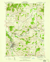
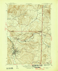
(110)- 1900 Map of Taconic
 1900 Taconic1900 Print · USGSThe tri-state border region of the Taconic Mountains thrived at the turn of the century as a hub of rail travel and valley industry. Genealogists and historians can trace the early footprints of Hoosick Falls, Bennington, and the winding path of the Rutland R.R.4 unique versions available
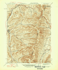
 - 1900 Map of Equinox
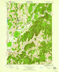
 1900 Equinox1900 Print · USGSBennington County’s valley corridor and high mountain notches are captured here in the final years of the nineteenth century. Researchers can trace the early rail-and-river network through Manchester Depot, identify old homesteads at Kelley Stand, and locate vanished landmarks like Fayville.7 unique versions available
 - 1901 Map of Fort Ann
 1901 Fort Ann1901 Print · USGSWashington County at the close of the nineteenth century was a vital corridor of New York commerce, defined by its historic canal and rail lines. You can trace the early industrial landscape through Smith Basin, find family homesteads near Slyboro, and follow the Mettawee River as it crosses the Vermont border.
 - 1901 Map of Cambridge
 1901 Cambridge1901 Print · USGSWashington County at the turn of the century is a landscape of river-powered industry and sprawling rail networks connecting New York to Vermont. Genealogists and historians can trace the paths of the Batten Kill, find old rail stops at Easton Sta., and locate vanished names like Pumpkin Hook.8 unique versions available
 - 1903 Map of Mettawee
 1903 Mettawee1903 Print · USGSThe New York and Vermont borderlands come alive in this turn-of-the-century survey of the Mettawee Valley. Genealogists can trace family footprints from Middletown Springs down to the Saratoga and Champlain Canal at Fort Ann.2 unique versions available
 - 1904 Map of Fort Ann
 1904 Fort Ann1904 Print · USGSWashington County at the turn of the century shows a landscape defined by the slate industry and early rail lines along the Vermont border. Genealogists can locate family lands near Chamberlain Mills, Smith Basin, and the crossroads of North Hebron or Slyboro.6 unique versions available
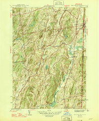
 - 1943 Map of Brattleboro
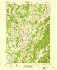
 1943 Brattleboro1943 Print · USGSSouthern Vermont and the Massachusetts border area appear in this mid-century survey as a landscape of timbered peaks and river-connected villages. Genealogists can trace family roots through markers like Arms Cem or follow the rails at Dummerston Sta and Putney Sta.
 - 1943 Map of Hoosick Falls, 1958 Print
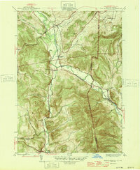
 1943 Hoosick Falls1958 Print · USGSThe New York and Vermont borderlands come alive in this mid-century survey of the Hoosic and Walloomsac valleys. Trace the busy rail junctions of the Boston and Maine and locate historic sites like Bennington Battlefield Park and Sodom.4 unique versions available
 - 1944 Map of Williamstown, 1957 Print
 1944 Williamstown1957 Print · USGSBerkshire County at the end of the war years reveals a valley shaped by the prestigious Williams College and the manufacturing centers along the Hoosic River. Genealogists and historians can locate family plots at East Lawn Cem or trace the early industrial layout of Blackinton and Braytonville.
 - 1944 Map of Shushan, 1958 Print
 1944 Shushan1958 Print · USGSThe Batten Kill valley comes alive in this mid-century record of eastern New York and the Vermont border. Researchers can trace the path of the Delaware and Hudson railroad and locate rural landmarks like Binninger Cem and Pumpkin Hook.3 unique versions available
 - 1944 Map of North Adams, 1958 Print
 1944 North Adams1958 Print · USGSBerkshire County's industrial valleys and steep mountain passes are captured here during the mid-forties. Genealogists and historians can trace rail-side neighborhoods like Zylonite, locate family plots in Miller Cem, or find the high-altitude Boston Central Shaft.
 - 1944 Map of Salem, 1958 Print
 1944 Salem1958 Print · USGSThe village of Salem and the surrounding Washington County hills are shown during the mid-1940s, highlighting the area's rail and river connections. Genealogists and researchers can locate Evergreen Cem, the Delaware and Hudson line, and rural settlements like Rexleigh.2 unique versions available
 - 1944 Map of Rowe, 1958 Print
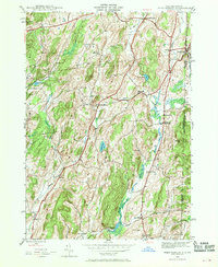
 1944 Rowe1958 Print · USGSThe Deerfield River valley and the Berkshire highlands come alive in this mid-century survey of the Massachusetts-Vermont border. Researchers can trace the path of the Hoosac Tunnel, the Mohawk Trail, and rural cemeteries like Sherman Cem and West Cem.
 - 1944 Map of West Pawlet, 1958 Print
 1944 West Pawlet1958 Print · USGSThe borderlands of New York and Vermont are captured here during the mid-forties, showing a region of quiet hamlets and well-established family farms. Genealogists and local researchers can trace early settlers through numerous sites like Taylor Hill Cem, Chamberlain Mills, and the Hebron Ch.2 unique versions available
 - 1944 Map of Berlin, 1958 Print
 1944 Berlin1958 Print · USGSRensselaer County at the close of World War II shows a high-country landscape where the Rutland railroad and the Little Hoosic River defined local life. Genealogists and hikers can trace old valley settlements like Center Berlin and Cherryplain, or find historic trails leading toward Berlin Mtn.
 - 1946 Map of Shushan
 1946 Shushan1946 Print · USGSThe borderlands of New York and Vermont are captured here just after the war, showing the rural communities of Washington and Bennington counties. Genealogists can trace family names through landmarks like Binninger Cem, Pumpkin Hook, and a system of district schools from School No 6 to School No 11.2 unique versions available
 - 1946 Map of Hoosick Falls
 1946 Hoosick Falls1946 Print · USGSRensselaer County and the Vermont border are captured here just after the war, showing a landscape shaped by river valleys and early rail lines. Researchers can trace ancestral locations from Hoosick Falls to rural spots like Sodom, School No 5, and the St Marys Cem.2 unique versions available
 - 1946 Map of West Pawlet
 1946 West Pawlet1946 Print · USGSThe borderlands between New York and Vermont are captured here during the mid-1940s as rural life centered on the Delaware and Hudson RR. Genealogists can locate family landmarks such as Taylor Hill Cem or trace the now-quiet sites of Sch No 4 (abandoned) and Chamberlain Mills.2 unique versions available
 - 1946 Map of North Pownal
 1946 North Pownal1946 Print · USGSThe Hoosic River valley at the New York and Vermont border reveals a landscape shaped by mountain railroading and upland farming in the 1940s. Researchers can trace the intersection of the Rutland and Boston and Maine railroads near Petersburg Junction or locate rural landmarks like Gardner Cem and School No 11.2 unique versions available
 - 1946 Map of Salem
 1946 Salem1946 Print · USGSWashington County at the end of the Second World War shows a rural landscape anchored by rail hubs and valley farming. Genealogists and historians can trace family locations near Salem, find burials at Evergreen Cem, or follow the Batten Kill river through Rexleigh.
 - 1946 Map of Williamstown
 1946 Williamstown1946 Print · USGSThe northern Berkshires come alive in the mid-1940s, showing the intersection of academic life and the industrial rail corridor. Genealogists and hikers can trace the original paths of the Appalachian Trail and find family-named landmarks like Theil Farm or the historic Sand Spring.
 - 1947 Map of Rowe
 1947 Rowe1947 Print · USGSFranklin County in the late 1940s reveals a mountainous landscape defined by the engineering of the Hoosac Tunnel and the Deerfield River. Genealogists and historians can locate family plots at North Cem, trace the operations at Davis Mine, and explore the rail-dependent community at Monroe Bridge.2 unique versions available
 - 1947 Map of Shushan
 1947 Shushan1947 Print · USGSThe Batten Kill valley was a network of rail-side hamlets and mountain hollows in the late 1940s. Genealogists and historians can trace the Delaware and Hudson line through Shushan and find remote landmarks like Binninger Cem and Pumpkin Hook.
 - 1947 Map of Williamstown
 1947 Williamstown1947 Print · USGSThe Berkshires of the late 1940s are captured here during a period of academic and industrial stability. Trace the grounds of Williams College, the early route of the Appalachian Trail, and family landmarks like Thiel Farm or the high slopes of Mt Greylock.2 unique versions available
 - 1948 Map of Berlin
 1948 Berlin1948 Print · USGSThe Taconic Mountains meet the New York and Massachusetts border in this post-war landscape of ridges and deep hollows. Researchers can trace the Rutland rail line through the valley or locate early landmarks like East Hollow Sch and Cherryplain.2 unique versions available
Showing maps 1-25 of 110
Top cities of Bennington County
- Bennington historical maps
- Shaftsbury historical maps
- Pownal historical maps
- Manchester historical maps
- Dorset historical maps
- Arlington historical maps
See more
Frequently asked questions
- What are the different types of historical maps available for Bennington County?
- What is the oldest map of Bennington County?
- Where can I purchase historical maps of Bennington County for my home or office?
- Where can I download high-res historical maps of Bennington County?
- Are there historical topographic maps available for Bennington County?
- Is there historical aerial imagery available for Bennington County?
- Where are historical maps of Bennington County sourced from?