1990s Maps of Bennington County, Vermont
Explore 30 historic maps of Bennington County from the 1990s. These maps offer a rare glimpse into what life looked like during the 1990s — showing old roads, neighborhoods, homes, and landmarks that have changed or disappeared over time.
Whether you're researching your family's past, planning a metal detecting trip, or studying how Bennington County's landscape evolved across the 1990s, these high-resolution maps are a powerful tool for exploring the history of this region.
- Focus on a specific era: All maps on this page are from the 1990s, giving you a focused view of this time period.
- See what’s changed: Compare century-old streets, trails, and buildings to today's modern landscape using overlays and satellite layers.
- Research with precision: Use these maps for genealogy, historical research, land use analysis, or educational projects.
- View, download, or print: Maps are fully viewable online in high resolution, and can be downloaded or printed for your own records.
Start exploring Bennington County's history through authentic maps from the 1990s. This is your window into the past.
Bennington County, VT maps
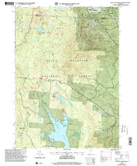
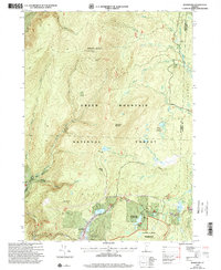
(30)- 1990 Map of Rowe
 1990 Rowe1990 Print · USGSThe Deerfield River valley of northern Franklin County comes into focus in the 1980s, balancing industrial sites with large tracts of state forest. Genealogists and local historians can locate several family cemeteries, the Davis Mine, and the iconic Hoosac Tunnel.2 unique versions available
 - 1995 Map of North Pownal, 2000 Print
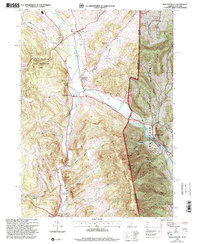 1995 North Pownal2000 Print · USGSThe borderlands of New York and Vermont come alive in the 1990s, where the Hoosic River cuts between the Taconic and Green Mountains. Trace local heritage through rural landmarks like Petersburg Junction, the Gardner Cem, and Hoosick Sch.
 - 1995 Map of West Rupert, 2000 Print
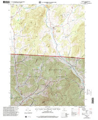
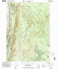
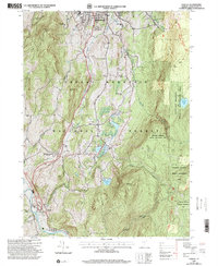
 1995 West Rupert2000 Print · USGSBennington County during the mid-1990s reveals a landscape where deep mountain hollows and high peaks dictate the limits of settlement. Genealogists and historians can trace the remote outposts of West Sandgate and Beartown or locate families near Lake Madeleine and Barber Lake.
 - 1995 Map of Pawlet, 2000 Print
 1995 Pawlet2000 Print · USGSThe Mettawee River valley in the mid-1990s reveals a Vermont landscape defined by small river-towns and timbered highlands. Genealogists and local historians can trace family locations near Mettawee Valley Cem or investigate industrial sites like the various Quarries and the Mach Airfield.
 - 1995 Map of Shushan, 2000 Print
 1995 Shushan2000 Print · USGSWashington County, New York, and the Vermont borderland are captured here in the mid-1990s, showcasing a network of historic rural settlements. Genealogists and researchers can trace family lands near Shushan, Pumpkin Hook, and the Bininger Cem, or locate the district schoolhouses that once served these valley communities.
 - 1995 Map of Salem, 2000 Print
 1995 Salem2000 Print · USGSThe rural landscape of the New York-Vermont border is captured here during the mid-1990s, centering on the valley of the Batten Kill. Researchers can trace old family names and settlements through landmarks like Evergreen Cem, Rexleigh, and the rail junction at Greenwich Junc.
 - 1995 Map of West Pawlet, 2000 Print
 1995 West Pawlet2000 Print · USGSCrossing the New York and Vermont border in the mid-1990s, this area shows a landscape of upland ridges and clustered valley hamlets. Researchers can trace rural lineages through numerous sites like Taylor Hill Cem or locate the site of Chamberlain Mills along the creek beds.2 unique versions available
 - 1995 Map of Hoosick Falls, 2000 Print
 1995 Hoosick Falls2000 Print · USGSThe Rensselaer County borderlands come alive in the mid-nineties as small settlements and rail junctions follow the winding river valleys into Vermont. Researchers can trace family sites from St Marys Ch to rural outposts like Post Corners and Center White Creek.
 - 1997 Map of Weston, 2000 Print
 1997 Weston2000 Print · USGSWeston and the Green Mountains are shown in the late nineties, capturing a landscape of deep river valleys and high forest ridges. Researchers can trace local landmarks like Weston Priory, the Wantastiquet Trout Club, and the winding Rootbeer Ridge Trail.
 - 1997 Map of Rowe, 2000 Print
 1997 Rowe2000 Print · USGSThe Berkshires of Franklin County meet the Vermont border in the 1990s, showcasing a landscape of state forests and hydroelectric engineering. Trace the legendary Hoosac Tunnel rail line and locate local landmarks like the Rowe Sch, West Cem, and the settlement of Monroe Bridge.
 - 1997 Map of Jamaica, 2000 Print
 1997 Jamaica2000 Print · USGSWindham County at the close of the twentieth century shows a landscape defined by the rugged Green Mountains and the winding West River. Researchers can trace historic settlements from Jamaica to the small community of Podunk, while locating remote landmarks like South Hill Cem and Pikes Falls.
 - 1997 Map of Manchester, 2000 Print
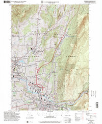
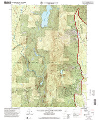
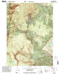
 1997 Manchester2000 Print · USGSThe Batten Kill valley of Bennington County is captured in the late 1990s, showing a landscape defined by historic rail corridors and mountain peaks. Researchers can trace family roots through the Dellwood Cem or explore institutional sites like Burr-Barton Seminary and the Manchester Ranger Station.
 - 1997 Map of Londonderry, 2000 Print
 1997 Londonderry2000 Print · USGSThe West River valley in the late nineties shows a landscape balancing its mountain heritage with a growing winter sports industry. Genealogists and historians can trace family plots at Brooks Cem and Glebe View Cem or locate the site of the former Winhall Station.
 - 1997 Map of Bennington, 2000 Print
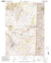
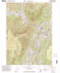
 1997 Bennington2000 Print · USGSBennington and its surrounding historic villages are captured here in the late nineties, showing the blend of collegiate life, industrial history, and forest wilderness. Researchers can trace local genealogy and landmarks through the Hinsdillville Cem, the iconic Battle Monument, and the grounds of Bennington College.
 - 1997 Map of Dorset, 2000 Print
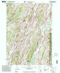
 1997 Dorset2000 Print · USGSThe Green Mountains of Vermont during the late nineties reveal a landscape of high-elevation peaks and narrow valley settlements. Genealogists and historians can trace family sites at Maple Grove Cem or locate industrial stone works at the Quarries near Freedleyville.
 - 1997 Map of Stratton Mountain, 2000 Print
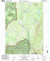
 1997 Stratton Mountain2000 Print · USGSThe Green Mountain National Forest is shown here during the late 1990s, where the Long and Appalachian Trails meet. Hikers and historians can locate the Daniel Webster Historical Monument and remote stops like Vondell Shelter or Stratton Pond.
 - 1997 Map of Sunderland, 2000 Print
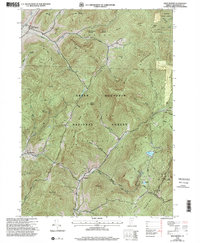
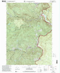
 1997 Sunderland2000 Print · USGSBennington County’s mountain interior is captured here in the late 1990s, revealing the intersection of wilderness recreation and rural outposts. Hikers and historians can trace the Long Trail past Kelley Stand or locate old settlements like Fayville and East Kansas.
 - 1997 Map of Danby, 2000 Print
 1997 Danby2000 Print · USGSThe Green Mountains of Rutland and Bennington counties are shown here in the late nineties, documenting a landscape of deep timber and high ridges. Researchers can trace the Appalachian Long Trail past historical sites like Old Job and the South End Cem.
 - 1997 Map of Mount Snow, 2000 Print
 1997 Mount Snow2000 Print · USGSThe Green Mountains of Windham County are shown here in the late nineties, showcasing a landscape of high-elevation recreation and forest management. Researchers can trace the development of the Mount Snow Ski Area, find the quiet site of Somerset, and locate the Searsburg Reservoir along the Deerfield River.
 - 1997 Map of Williamstown, 2000 Print
 1997 Williamstown2000 Print · USGSThe Berkshire highlands and the academic center of Williamstown are captured here in the late nineties. Researchers can trace the Appalachian Trail over Mt Greylock or locate Southwilliamstown Cem and Mt Hope Farm.
 - 1997 Map of Readsboro, 2000 Print
 1997 Readsboro2000 Print · USGSSouthern Vermont's river valleys and forested hills are captured here in the late 1990s, centered on the intersection of the Deerfield River and its reservoirs. Researchers can locate family cemeteries, trace the Old Stage Road, or explore the villages of Readsboro and Whitingham.
 - 1997 Map of Woodford, 2000 Print
 1997 Woodford2000 Print · USGSSouthern Vermont's high country is captured here in the late nineties as recreation and wilderness management reshaped the landscape. Trace the famous Long Trail along the ridge to the Glastenbury Mountain Lookout or locate family roots near Woodford and the Cem.
 - 1997 Map of Pownal, 2000 Print
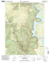
 1997 Pownal2000 Print · USGSSouth of Bennington during the late nineties, the Vermont landscape remained a mix of dense forest and small rural settlements. Genealogists and hikers can trace the Long Trail Appalachian Trail, locate the Ellis Mine, or find family names at Oak Hill Cem.
 - 1997 Map of Peru, 2000 Print
 1997 Peru2000 Print · USGSVermont's Green Mountains are captured here in the late nineties, documenting a landscape of ski resorts and historic village centers. Researchers can trace family sites at Middletown Cem, follow the Appalachian Trail, or locate the Snow Valley Ski Area and Bondville.
 - 1997 Map of Arlington, 2000 Print
 1997 Arlington2000 Print · USGSBennington County’s mountain valleys and historic river crossings are captured here in the late nineties, documenting the area's transition into a modern forest and parkland. Genealogists can trace family landmarks and school sites like Fisher Sch or the riverside hamlets of West Arlington and Chiselville.
Showing maps 1-25 of 30
Top cities of Bennington County
- Bennington historical maps
- Shaftsbury historical maps
- Pownal historical maps
- Manchester historical maps
- Dorset historical maps
- Arlington historical maps
See more
Frequently asked questions
- What are the different types of historical maps available for Bennington County?
- What is the oldest map of Bennington County?
- Where can I purchase historical maps of Bennington County for my home or office?
- Where can I download high-res historical maps of Bennington County?
- Are there historical topographic maps available for Bennington County?
- Is there historical aerial imagery available for Bennington County?
- Where are historical maps of Bennington County sourced from?