Old Maps of Sunderland, Vermont for Genealogy
Trace your family roots with 35 historic maps of Sunderland. These high-res maps reveal old neighborhoods, homesites, landmarks, and streets — helping you uncover where your ancestors lived and how the area evolved over time.
- Explore historic neighborhoods: Identify where your relatives may have lived in the 1800s or 1900s.
- Compare maps over time: Trace the changes in streets, buildings, and landmarks for multi-generational research.
- Perfect for genealogy & ancestry research: Used by family historians and researchers to map out lineage and migration.
These maps are an incredible resource for exploring your personal connection to Sunderland's past.
Sunderland, VT maps
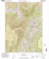
(35)- 1894 Map of Londonderry
 1894 Londonderry1894 Print · USGSSouthern Vermont in the 1890s was a land of high ridges and isolated mountain hollows. Researchers can trace the early layout of South Londonderry and find now-quiet settlements like Bucketville and Wardsboro Center.
 - 1894 Map of Equinox, 1964 Print
 1894 Equinox1964 Print · USGSBennington County's river valleys and mountain peaks are captured here in the late nineteenth century as timber and rail defined the local economy. Genealogists and historians can trace the early layouts of Arlington, Manchester, and vanished settlements like Kansas or Fayville.2 unique versions available
 - 1896 Map of Equinox
 1896 Equinox1896 Print · USGSBennington County’s mountain valleys and river corridors are captured here in the late nineteenth century during a period of robust rail expansion. Genealogists and local historians can trace family locations near Manchester Center, find remote settlements like Kelley Stand, or follow the Bennington and Rutland R. R. line.
 - 1899 Map of Londonderry
 1899 Londonderry1899 Print · USGSThe Green Mountains in the late nineteenth century were defined by the deep valleys of the West River and the Central Vermont R.R. Genealogists can locate family homes in villages like Jamaica, South Londonderry, and the vanished Bucketville.8 unique versions available
 - 1900 Map of Equinox
 1900 Equinox1900 Print · USGSBennington County’s valley corridor and high mountain notches are captured here in the final years of the nineteenth century. Researchers can trace the early rail-and-river network through Manchester Depot, identify old homesteads at Kelley Stand, and locate vanished landmarks like Fayville.7 unique versions available
 - 1903 Map of Mettawee
 1903 Mettawee1903 Print · USGSThe New York and Vermont borderlands come alive in this turn-of-the-century survey of the Mettawee Valley. Genealogists can trace family footprints from Middletown Springs down to the Saratoga and Champlain Canal at Fort Ann.2 unique versions available
 - 1950 Map of Glens Falls
 1950 Glens Falls1950 Print · USGSThe Adirondacks and the Green Mountains meet in this mid-century survey of the New York and Vermont borderlands. Researchers can trace the industrial rail corridors of the Rutland RR and Delaware & Hudson RR connecting Glens Falls, Rutland, and the shores of Lake George.
 - 1956 Map of Glens Falls, 1968 Print
 1956 Glens Falls1968 Print · USGSUpper New York and the Vermont mountains are captured here in the mid-fifties, showing the rugged rail-and-river network of the Northeast. Researchers can trace the paths of the Delaware and Hudson RR and Rutland RR as they wind through valley towns like Poultney and Whitehall.3 unique versions available
 - 1957 Map of Londonderry, 1959 Print
 1957 Londonderry1959 Print · USGSThe Green Mountains in the late fifties reveal a transition from traditional timberlands to a burgeoning ski destination. Researchers can trace the Long Trail, locate family plots at Riverside Cem, and find landmarks like the Daniel Webster Historical Monument.3 unique versions available
 - 1959 Map of Glens Falls
 1959 Glens Falls1959 Print · USGSUpper New York and Vermont are captured here during the late 1950s, a period of transition for these mountain communities. Researchers can trace the legacy of the region's river-and-rail economy through landmarks like Lake George, Saratoga Springs, and Killington Peak.2 unique versions available
 - 1964 Map of Glens Falls
 1964 Glens Falls1964 Print · USGSThe tri-state borderlands of New York, Vermont, and New Hampshire appear here in the mid-1960s. Researchers can trace the rail routes of the Rutland RR and find historic sites like Ticonderoga and Saratoga National Historical Park.
 - 1967 Map of Arlington, 1971 Print
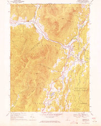 1967 Arlington1971 Print · USGSArlington and its surrounding hamlets are captured in the late sixties as the valley economy balanced river-side industry and mountain forestry. Researchers can trace the layout of small settlements like Chiselville and Kansas or locate family sites near Evergreen Cem and Fisher Sch.2 unique versions available
 - 1968 Map of Sunderland, 1972 Print
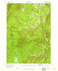
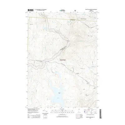
 1968 Sunderland1972 Print · USGSBennington County in the late sixties reveals a landscape where valley farming in Sunderland meets the high wilderness of the Green Mountains. Hikers and historians can trace the Appalachian Trail through remote settlements like East Kansas and Fayville.
 - 1985 Map of Claremont, 1986 Print
 1985 Claremont1986 Print · USGSUpper Valley and Green Mountain life are captured here in the mid-eighties, centered on the river-linked hubs of Claremont and Springfield. Trace old family routes and rail lines like the Boston & Maine RR, or locate properties near Lake Sunapee and Mount Ascutney State Park.2 unique versions available
 - 1986 Map of Glens Falls
 1986 Glens Falls1986 Print · USGSThe Upper Hudson Valley and Vermont borderlands come together in this mid-eighties survey of industrial river towns and mountain retreats. Genealogists and historians can trace the rail lines of the Delaware and Hudson Railway or locate landmarks like the Mount McGregor Correctional Facility and Saratoga Spa State Park.2 unique versions available
 - 1986 Map of Stratton Mtn, 1987 Print
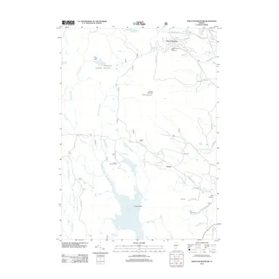
 1986 Stratton Mtn1987 Print · USGSWindham County's high ridges and glacial ponds are captured here in the mid-eighties as a vast wilderness and recreation hub. Hikers can trace the Appalachian Trail across Stratton Mountain or find old cemeteries and landmarks in Pike Hollow.3 unique versions available
 - 1989 Map of Glens Falls
 1989 Glens Falls1989 Print · USGSThe Upper Hudson Valley and the Vermont borderlands are captured here during the late eighties, showing a landscape of river-town industry and mountain recreation. Researchers can trace the Champlain Canal, the Delaware and Hudson RR, and historic sites like Saratoga National Historical Park.
 - 1997 Map of Stratton Mountain, 2000 Print
 1997 Stratton Mountain2000 Print · USGSThe Green Mountain National Forest is shown here during the late 1990s, where the Long and Appalachian Trails meet. Hikers and historians can locate the Daniel Webster Historical Monument and remote stops like Vondell Shelter or Stratton Pond.
 - 1997 Map of Sunderland, 2000 Print
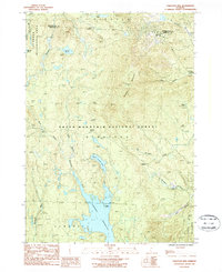
 1997 Sunderland2000 Print · USGSBennington County’s mountain interior is captured here in the late 1990s, revealing the intersection of wilderness recreation and rural outposts. Hikers and historians can trace the Long Trail past Kelley Stand or locate old settlements like Fayville and East Kansas.
 - 1997 Map of Arlington, 2000 Print
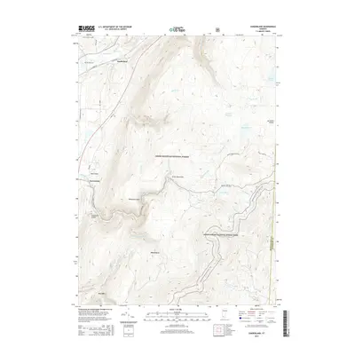
 1997 Arlington2000 Print · USGSBennington County’s mountain valleys and historic river crossings are captured here in the late nineties, documenting the area's transition into a modern forest and parkland. Genealogists can trace family landmarks and school sites like Fisher Sch or the riverside hamlets of West Arlington and Chiselville.
 - 2012 Map of Sunderland, 2012 Print
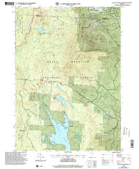
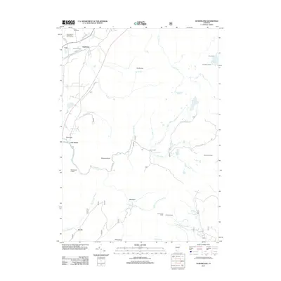 2012 Sunderland2012 Print · USGSCovers Sunderland, including Manchester, Stratton, and other nearby areas
 - 2012 Map of Arlington, 2012 Print
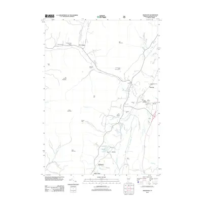 2012 Arlington2012 Print · USGSCovers Sunderland, including Shaftsbury, Manchester, and other nearby areas
 - 2012 Map of Stratton Mountain, 2012 Print
 2012 Stratton Mountain2012 Print · USGSCovers Sunderland, including Wardsboro, Stratton, and other nearby areas
 - 2015 Map of Stratton Mountain, 2015 Print
 2015 Stratton Mountain2015 Print · USGSCovers Sunderland, including Wardsboro, Stratton, and other nearby areas
 - 2015 Map of Sunderland, 2015 Print
 2015 Sunderland2015 Print · USGSCovers Sunderland, including Manchester, Stratton, and other nearby areas
Showing maps 1-25 of 35
Top cities near Sunderland
- Bennington historical maps
- Hoosick historical maps
- Manchester historical maps
- Shaftsbury historical maps
- White Creek historical maps
- Salem historical maps
See more
Top neighborhoods of Sunderland
- East Kansas historical maps
- Chiselville historical maps
- Kansas historical maps
- MacIntyre historical maps
Frequently asked questions
- What are the different types of historical maps available for Sunderland?
- What is the oldest map of Sunderland?
- Where can I purchase historical maps of Sunderland for my home or office?
- Where can I download high-res historical maps of Sunderland?
- Are there historical topographic maps available for Sunderland?
- Is there historical aerial imagery available for Sunderland?
- Where are historical maps of Sunderland sourced from?