Old Maps of Woodford, Vermont for Academic Research
Study the evolution of Woodford with 22 high-resolution historic maps. Whether you're teaching, researching, or modeling changes in land use, these maps provide essential visual documentation of urban, environmental, and geographic change.
- Analyze long-term change: Track patterns in development, transportation, and natural features.
- Ideal for environmental or urban studies: Support academic projects with primary historical map data.
- Use in the classroom or lab: Educators and researchers rely on these maps to bring historical context to life.
These maps are a powerful tool for teaching, research, and visualizing how Woodford has changed over the decades.
Woodford, VT maps
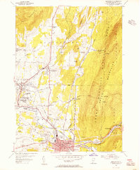
(22)- 1898 Map of Bennington
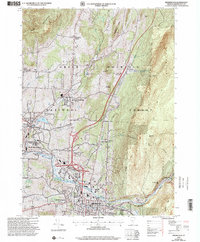
 1898 Bennington1898 Print · USGSVermont's southwestern valleys and industrial corridors are documented here in the late nineteenth century. Genealogists and historians can trace rail lines like the Rutland R R through early settlements including Papermill Village and Shaftsbury Center.10 unique versions available
 - 1900 Map of Taconic
 1900 Taconic1900 Print · USGSThe tri-state border region of the Taconic Mountains thrived at the turn of the century as a hub of rail travel and valley industry. Genealogists and historians can trace the early footprints of Hoosick Falls, Bennington, and the winding path of the Rutland R.R.4 unique versions available
 - 1948 Map of Albany, 1951 Print
 1948 Albany1951 Print · USGSThe Hudson and Connecticut River valleys are captured here in the late 1940s, showing the vital rail and water corridors of the Northeast. You can trace the Boston and Maine tracks past Mt Greylock or locate early settlements like Great Barrington and Bennington.
 - 1954 Map of Bennington, 1956 Print
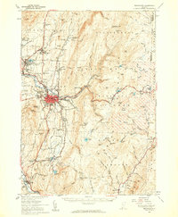
 1954 Bennington1956 Print · USGSBennington and its surrounding hollows are captured in the mid-1950s, showing the intersection of historic New England village life and post-war growth. Genealogists and historians can trace family locations near the Battle Monument, Paper Mill Village, or the Harwood Hill Sch.3 unique versions available
 - 1954 Map of Woodford, 1957 Print
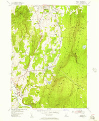
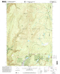
 1954 Woodford1957 Print · USGSBennington County’s high ridgelines and remote camps are frozen in time during the mid-fifties. Researchers can trace historic mountain routes like the Long Trail and locate named landmarks such as the Lookout Tower Glastenbury and Glastenbury Camp.3 unique versions available
 - 1954 Map of Pownal, 1957 Print
 1954 Pownal1957 Print · USGSSouthern Vermont's landscape is captured here in the mid-1950s, showing the intersection of mountain wilderness and valley settlements. Researchers can trace historic family burial sites like Towsley Cem or locate rural landmarks including the Barber Sch and Thendara Camp.4 unique versions available
 - 1954 Map of Stamford, 1957 Print
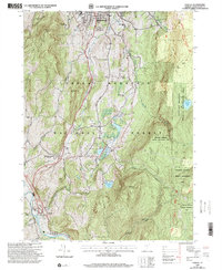
 1954 Stamford1957 Print · USGSSouthern Vermont's upland forests and small valley settlements are captured here in the mid-1950s. You can trace the winding paths of Stage Road, locate the Houghton Cem, or explore the environs of Stamford and Heartwellville.3 unique versions available
 - 1954 Map of Bennington, 1960 Print
 1954 Bennington1960 Print · USGSBennington and its surrounding uplands appear here in the mid-fifties, showing a landscape defined by manufacturing and mountain heritage. Researchers can locate family names at Waite Cem, trace the Long Trail, or explore the rail era at Paper Mill Village.4 unique versions available
 - 1956 Map of Albany, 1968 Print
 1956 Albany1968 Print · USGSThe industrial heart of the Northeast is revealed in the mid-1950s, from the Hudson Valley to the Connecticut River. Researchers can trace the legacy of the Quabbin Reservoir, locate Westover Air Force Base, or follow the Rutland RR through the Green Mountains.2 unique versions available
 - 1957 Map of Albany
 1957 Albany1957 Print · USGSThe Tri-State region and Connecticut River Valley are captured here during a period of significant postwar growth and infrastructure expansion. Genealogists and historians can trace the rail-and-river economy through landmarks like the Boston and Maine railroad, Quabbin Reservoir, and Westover Air Force Base.
 - 1959 Map of Albany
 1959 Albany1959 Print · USGSThe Hudson and Connecticut River valleys are captured here during the late fifties, showing the region's dense rail networks and massive water projects. Researchers can trace the New York State Thruway or locate local landmarks like Mt Greylock and the Quabbin Reservoir.
 - 1962 Map of Albany
 1962 Albany1962 Print · USGSThe Hudson and Connecticut River valleys meet the Green Mountains and Berkshires in this mid-century overview of the Northeast. Genealogists and historians can trace the industrial hearts of Albany and Springfield or locate features like Quabbin Reservoir and Westover Air Force Base.
 - 1986 Map of Albany
 1986 Albany1986 Print · USGSThe Capital District and the tri-state highlands come into focus during the mid-eighties as urban growth meets the edge of the Green Mountains. Researchers can trace historic industrial sites and landmarks like the Watervliet Arsenal, the Bennington Battle Monument, and the grounds of Rensselaer Polytechnic Institute.
 - 1989 Map of Albany
 1989 Albany1989 Print · USGSThe tri-state intersection of New York, Vermont, and Massachusetts comes alive in the late 1980s, centered on the historic river confluence of the Capital District. Researchers can trace the extensive rail lines of the D & H RR and explore high peaks like Mount Greylock or the reaches of the Tomhannock Reservoir.2 unique versions available
 - 1997 Map of Bennington, 2000 Print
 1997 Bennington2000 Print · USGSBennington and its surrounding historic villages are captured here in the late nineties, showing the blend of collegiate life, industrial history, and forest wilderness. Researchers can trace local genealogy and landmarks through the Hinsdillville Cem, the iconic Battle Monument, and the grounds of Bennington College.
 - 1997 Map of Woodford, 2000 Print
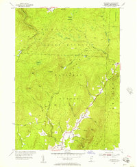
 1997 Woodford2000 Print · USGSSouthern Vermont's high country is captured here in the late nineties as recreation and wilderness management reshaped the landscape. Trace the famous Long Trail along the ridge to the Glastenbury Mountain Lookout or locate family roots near Woodford and the Cem.
 - 1997 Map of Pownal, 2000 Print
 1997 Pownal2000 Print · USGSSouth of Bennington during the late nineties, the Vermont landscape remained a mix of dense forest and small rural settlements. Genealogists and hikers can trace the Long Trail Appalachian Trail, locate the Ellis Mine, or find family names at Oak Hill Cem.
 - 1997 Map of Stamford, 2000 Print
 1997 Stamford2000 Print · USGSSouthern Vermont's high mountain terrain is captured here in the late twentieth century, showing the intersection of deep wilderness and local recreation. You can trace the Long Trail (Appalachian Trail) past Houghton Mountain and locate the Stamford Cem and the settlement of Heartwellville.
 - 2024 Map of Stamford, 2024 Print
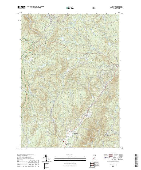 2024 Stamford2024 Print · USGSSouthern Vermont's border country is captured here in the contemporary era, showing the intersection of deep wilderness and small-town life. Researchers can trace family sites near Houghton Cem or follow the Appalachian National Scenic Trail through the George D Aiken Wilderness.
 - 2024 Map of Woodford, 2024 Print
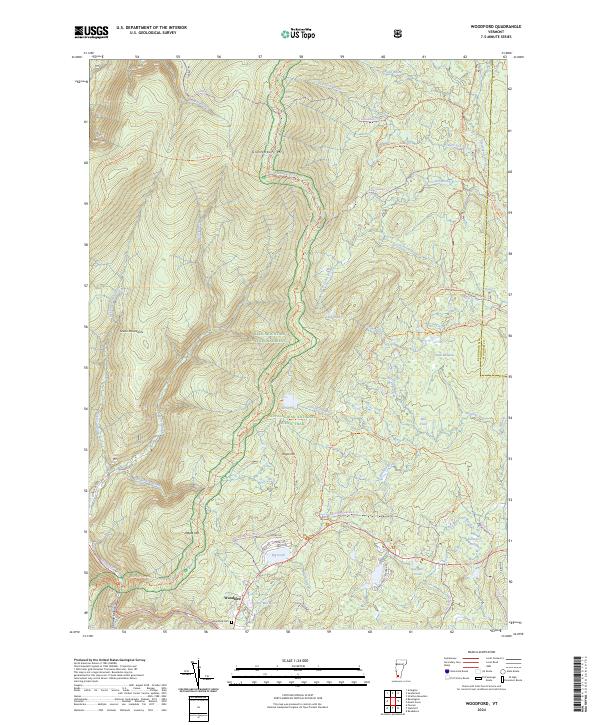 2024 Woodford2024 Print · USGSThe high Green Mountains near the Bennington and Windham county line are shown here in modern detail. Researchers can locate the Woodford Cem and trace old water-powered industry at Bugbee Mill Pond and Red Mill Pond.
 - 2024 Map of Pownal, 2024 Print
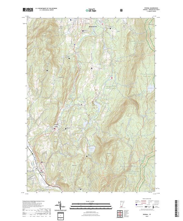 2024 Pownal2024 Print · USGSBennington County’s southwestern corner is shown in great detail in this modern survey of the Taconic Range and Green Mountains. Genealogists can locate numerous family burial grounds like Sherman Yard Cem and Towsley Cem while tracing the waters of the Hoosic River.
 - 2024 Map of Bennington, 2024 Print
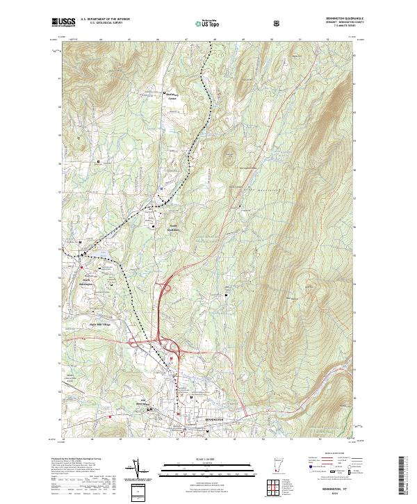 2024 Bennington2024 Print · USGSBennington and the Green Mountains come into sharp focus in this detailed survey of southwestern Vermont. Researchers can trace ancestral lines through numerous burial grounds like the Rice A Winslow Farm Cemetery or explore the historic rail lines of the Vermont Railway near South Shaftsbury.
End of results
Showing maps 1-22 of 22
Top cities near Woodford
- North Adams historical maps
- Bennington historical maps
- Adams historical maps
- Williamstown historical maps
- Hoosick historical maps
- Shaftsbury historical maps
See more
Frequently asked questions
- What are the different types of historical maps available for Woodford?
- What is the oldest map of Woodford?
- Where can I purchase historical maps of Woodford for my home or office?
- Where can I download high-res historical maps of Woodford?
- Are there historical topographic maps available for Woodford?
- Is there historical aerial imagery available for Woodford?
- Where are historical maps of Woodford sourced from?