2020s Maps of Norton, Vermont
Explore 6 historic maps of Norton from the 2020s. These maps offer a rare glimpse into what life looked like during the 2020s — showing old roads, neighborhoods, homes, and landmarks that have changed or disappeared over time.
Whether you're researching your family's past, planning a metal detecting trip, or studying how Norton's landscape evolved across the 2020s, these high-resolution maps are a powerful tool for exploring the history of this region.
- Focus on a specific era: All maps on this page are from the 2020s, giving you a focused view of this time period.
- See what’s changed: Compare century-old streets, trails, and buildings to today's modern landscape using overlays and satellite layers.
- Research with precision: Use these maps for genealogy, historical research, land use analysis, or educational projects.
- View, download, or print: Maps are fully viewable online in high resolution, and can be downloaded or printed for your own records.
Start exploring Norton's history through authentic maps from the 2020s. This is your window into the past.
Norton, VT maps
(6)- 2024 Map of Morgan Center, 2024 Print
 2024 Morgan Center2024 Print · USGSUpper Orleans County is shown here in its modern rural character, centered on the settlement at Morgan Center and the shores of Seymour Lake. Researchers can trace old family lands near Morgan Center Cem or explore the drainage of Holland Brook and The Hurricane.
 - 2024 Map of Morgan Center OE N, 2024 Print
 2024 Morgan Center OE N2024 Print · USGSThe international border between Vermont and Quebec takes center stage in this 2024 survey of the northern frontier. Researchers can trace historical water routes like Rivière Tomifobia or find family-named landmarks along Line Farm Rd and Holland Pond Rd.
 - 2024 Map of Norton Pond, 2024 Print
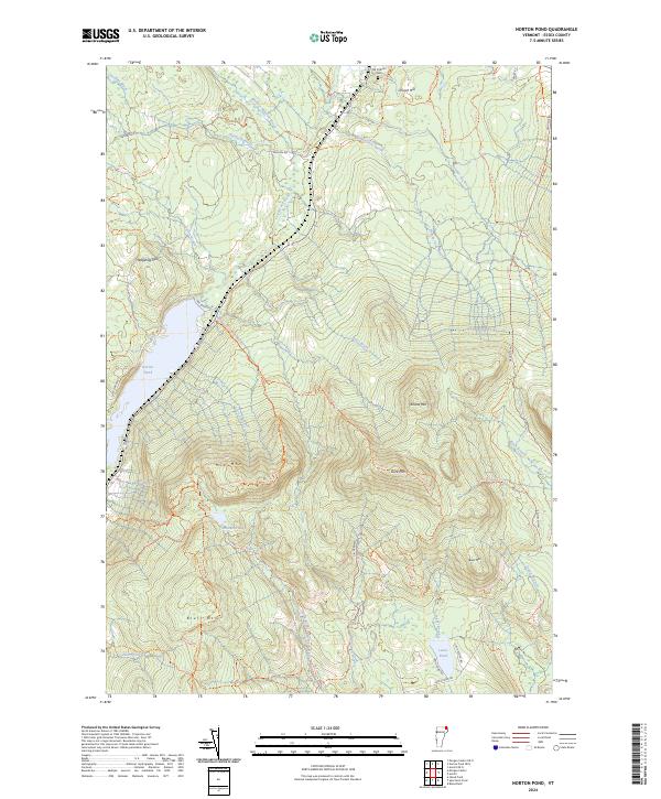 2024 Norton Pond2024 Print · USGSEssex County's high-elevation wilderness is captured in this modern survey of the Northeast Kingdom. Researchers can trace historic access via Old Catholic Cem and follow recreation paths near Norton Pond or the heights of Gore Mtn.
 - 2024 Map of Norton Pond OE N, 2024 Print
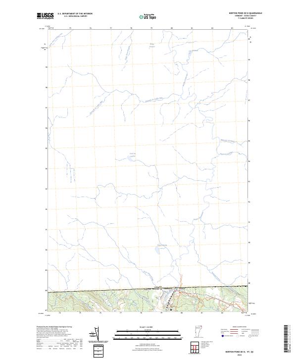 2024 Norton Pond OE N2024 Print · USGSNorthern Essex County sits right on the international line in this modern study of the borderlands. Genealogists and local historians can trace the settlement of Norton, find the Saint Bernards Cem, and follow the winding path of the Coaticook River.
 - 2024 Map of Averill OE N, 2024 Print
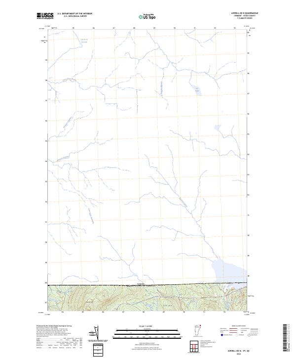 2024 Averill OE N2024 Print · USGSThe northern border of Vermont meets the Canadian frontier in this modern survey of the Essex County wilderness. Researchers can trace the rugged drainage patterns of Averill Mtn and Cole Hill or follow the waters of Lac Lippé and Black Brook.
 - 2024 Map of Averill, 2024 Print
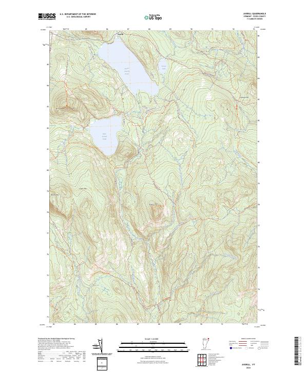 2024 Averill2024 Print · USGSVermont's Northeast Kingdom remains a landscape of deep timberlands and glacial waters in this contemporary study of the border country. Researchers can trace the remote hydrology of Great Averill Pond or follow the headwaters of the East Branch Nulhegan River.
End of results
Showing maps 1-6 of 6
Top cities near Norton
- Island Pond historical maps
- Brighton historical maps
- Stratford historical maps
- Columbia historical maps
- Morgan historical maps
- Holland historical maps
See more
Top neighborhoods of Norton
Frequently asked questions
- What are the different types of historical maps available for Norton?
- What is the oldest map of Norton?
- Where can I purchase historical maps of Norton for my home or office?
- Where can I download high-res historical maps of Norton?
- Are there historical topographic maps available for Norton?
- Is there historical aerial imagery available for Norton?
- Where are historical maps of Norton sourced from?