Old Maps of Franklin, Vermont for Metal Detecting
Plan your next treasure hunt with 33 historic maps of Franklin. Find old homesites, ghost towns, trails, and gathering spots that may be lost to time — perfect for identifying promising metal detecting locations.
- Locate forgotten sites: Uncover places like long-lost settlements, abandoned rail lines, or gathering spots.
- Plan better hunts: Use map overlays combined with LiDAR or satellite views to narrow in on historically rich areas.
- Made for detectorists: Thousands of hobbyists use these maps to discover relics, coins, and hidden history.
Use these historic maps to boost your research and find new opportunities beneath the surface of Franklin.
Franklin, VT maps
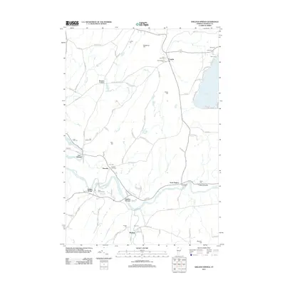
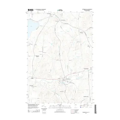
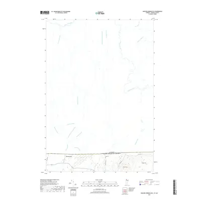
(33)- 1920 Map of Franklin Pond
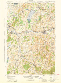
 1920 Franklin Pond1920 Print · USGSFranklin County's landscape at the Canadian border comes alive in this post-war military survey. Genealogists can trace family homesteads and local commerce through settlements like Pumpkin Village and rail stops such as Fairfield (Sta.) or the busy mills at Enosburg Falls.
 - 1922 Map of Enosburg Falls
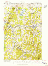
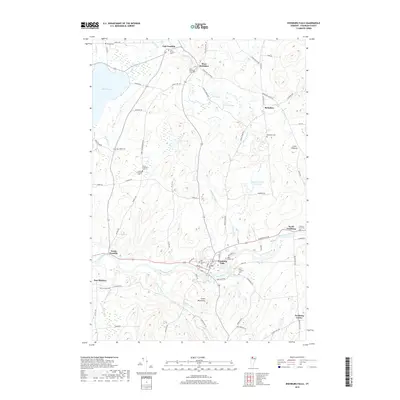
 1922 Enosburg Falls1922 Print · USGSUpper Vermont near the Canadian border thrived in the early twenties as a hub of rail commerce and rural education. Genealogists can trace family footprints across dozens of local schoolhouses like Lost Nation School or explore the industrial roots of Gilbert Tannery and Enosburg Falls.2 unique versions available
 - 1924 Map of Enosburg Falls
 1924 Enosburg Falls1924 Print · USGSNorthern Vermont's dairy and rail landscape is captured here in the 1920s, showing the borderlands along the Canadian border. Genealogists can trace family names through dozens of rural landmarks like Pomeroy School, Gilberts Tannery, and Fairfield Station.5 unique versions available
 - 1944 Map of Enosburg Falls
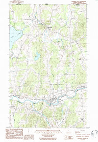
 1944 Enosburg Falls1944 Print · USGSNorthern Vermont during the mid-1940s was a landscape of river-valley rail towns and upland dairy farms centered on the Missisquoi River. Researchers can trace the path of the Central Vermont railroad and find defunct local landmarks like Gilberts Tannery or the many numbered schoolhouses like School No 5.
 - 1950 Map of Lake Champlain
 1950 Lake Champlain1950 Print · USGSThe Lake Champlain valley and its surrounding peaks are captured in detail during the late 1940s, showing the vital rail and road connections between New York and Vermont. Researchers can trace the routes of the Central Vermont Railway or locate old industrial centers like Mineville and Witherbee.2 unique versions available
 - 1953 Map of Enosburg Falls, 1955 Print
 1953 Enosburg Falls1955 Print · USGSNorthern Vermont in the early fifties shows a landscape of river-powered industry and rail-connected villages. Genealogists can trace family lines through named sites like Pumpkin Village School, Gilberts Tannery, and numerous rural cemeteries including Patten Cem.4 unique versions available
 - 1958 Map of Lake Champlain
 1958 Lake Champlain1958 Print · USGSThe Champlain Valley and surrounding high peaks are captured here in the late fifties, showcasing the cross-border region from the Adirondacks to the Green Mountains. Researchers can trace historic rail routes like the Rutland Railway or locate old valley settlements such as Keeseville and Vergennes.2 unique versions available
 - 1962 Map of Lake Champlain, 1975 Print
 1962 Lake Champlain1975 Print · USGSLake Champlain and the high peaks of the Adirondacks and Green Mountains are captured here during the mid-twentieth century. Researchers can trace the industrial legacy of the Lyon Mountain Mine and the rail corridors of the Central Vermont RR and Delaware & Hudson RR.3 unique versions available
 - 1977 Map of West Berkshire Station, 1978 Print
 1977 West Berkshire Station1978 Print · USGSThe international border at Franklin, Vermont, and southern Quebec is seen here in the late seventies. Researchers can trace land use patterns and local landmarks like Lake Carmi, West Berkshire, and the Pike River.
 - 1977 Map of Morses Line Station, 1978 Print
 1977 Morses Line Station1978 Print · USGSThe Vermont-Quebec borderlands come into focus during the late seventies, showing the rural farming landscape around Morses Line. Genealogists and local historians can trace family-named crossroads like Campbell Corners and Browns Corners near the northern shore of Lake Carmi.
 - 1986 Map of Sheldon Springs, 1987 Print
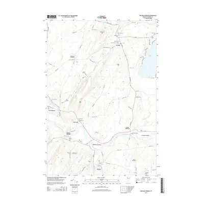
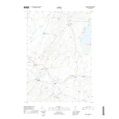
 1986 Sheldon Springs1987 Print · USGSAcross the northern Vermont borderlands in the mid-eighties, this survey reveals a landscape of river-valley hamlets and glacial hills. Genealogists and local historians can trace the foundations of Sheldon Springs, Morses Line, and the recreation areas around Lake Carmi.
 - 1986 Map of Enosburg Falls, 1987 Print
 1986 Enosburg Falls1987 Print · USGSFranklin County in the mid-eighties remains a landscape of river-valley settlements and quiet border towns. Researchers can trace the layout of Enosburg Falls, locate family plots in local Cem sites, or explore the area around Lake Carmi.
 - 1989 Map of Mount Mansfield
 1989 Mount Mansfield1989 Print · USGSNorthern Vermont in the late eighties remains a landscape of deep forests and isolated mountain villages. Genealogists and hikers can trace the old rail lines of the Canadian Pacific RR or locate family sites near Lake Willoughby and Brownington Village.
 - 2012 Map of Enosburg Falls, 2012 Print
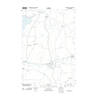 2012 Enosburg Falls2012 Print · USGSCovers Franklin, including Sheldon, Berkshire, and other nearby areas
 - 2012 Map of Sheldon Springs, 2012 Print
 2012 Sheldon Springs2012 Print · USGSCovers Franklin, including Sheldon, Fairfield, and other nearby areas
 - 2012 Map of Sheldon Springs OE N, 2012 Print
 2012 Sheldon Springs OE N2012 Print · USGSCovers Franklin, including Bedford (Ville), Bedford, and other nearby areas
 - 2012 Map of Enosburg Falls OE N, 2012 Print
 2012 Enosburg Falls OE N2012 Print · USGSCovers Franklin, including Berkshire, Frelighsburg, and other nearby areas
 - 2015 Map of Sheldon Springs, 2015 Print
 2015 Sheldon Springs2015 Print · USGSCovers Franklin, including Sheldon, Fairfield, and other nearby areas
 - 2015 Map of Enosburg Falls, 2015 Print
 2015 Enosburg Falls2015 Print · USGSCovers Franklin, including Sheldon, Berkshire, and other nearby areas
 - 2015 Map of Sheldon Springs OE N, 2015 Print
 2015 Sheldon Springs OE N2015 Print · USGSCovers Franklin, including Bedford (Ville), Bedford, and other nearby areas
 - 2015 Map of Enosburg Falls OE N, 2015 Print
 2015 Enosburg Falls OE N2015 Print · USGSCovers Franklin, including Berkshire, Frelighsburg, and other nearby areas
 - 2018 Map of Enosburg Falls OE N, 2018 Print
 2018 Enosburg Falls OE N2018 Print · USGSCovers Franklin, including Berkshire, Frelighsburg, and other nearby areas
 - 2018 Map of Sheldon Springs OE N, 2018 Print
 2018 Sheldon Springs OE N2018 Print · USGSCovers Franklin, including Bedford (Ville), Bedford, and other nearby areas
 - 2018 Map of Enosburg Falls, 2018 Print
 2018 Enosburg Falls2018 Print · USGSCovers Franklin, including Sheldon, Berkshire, and other nearby areas
 - 2018 Map of Sheldon Springs, 2018 Print
 2018 Sheldon Springs2018 Print · USGSCovers Franklin, including Sheldon, Fairfield, and other nearby areas
Showing maps 1-25 of 33
Top cities near Franklin
- Saint Albans City historical maps
- Swanton historical maps
- Fairfax historical maps
- Richford historical maps
- Sheldon historical maps
- Fairfield historical maps
See more
Top neighborhoods of Franklin
Frequently asked questions
- What are the different types of historical maps available for Franklin?
- What is the oldest map of Franklin?
- Where can I purchase historical maps of Franklin for my home or office?
- Where can I download high-res historical maps of Franklin?
- Are there historical topographic maps available for Franklin?
- Is there historical aerial imagery available for Franklin?
- Where are historical maps of Franklin sourced from?